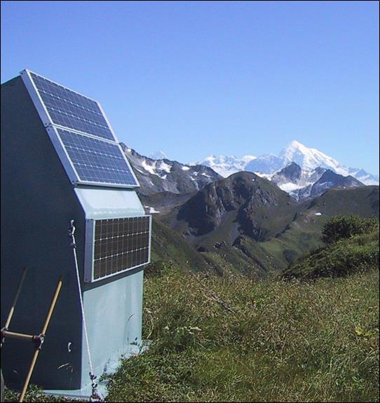
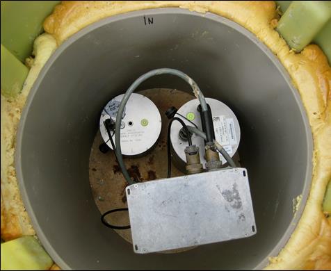
A seismic station has been monitoring earthquakes in Glacier Bay National Park and Preserve for over a decade. Are earthquakes common here?
Project Dates

Continuous monitoring since 2002.
Did You Know?
Alaska is by far the most seismically active state in the U.S. Every year about 35,000 earthquakes are recorded here. Three of the 10 largest quakes ever recorded in the world, and 10 of the 15 largest ever recorded in the U.S., occurred in Alaska. The biggest was a magnitude 9.2 that ruptured the Prince William Sound area on March 27, 1964.
Introduction

The Alaska Earthquake Information Center (AEIC) was established as a partnership among the State of Alaska, the University of Alaska Fairbanks Geophysical Institute, and the U.S. Geological Survey in 1986. AEIC’s mission is to monitor earthquake activity throughout Alaska in real time and to provide the public and government agencies with timely location and magnitude information in the event of a significant seismic event. Data from a network of more than 400 seismic stations around the state are received and processed at the AEIC.
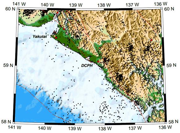
A seismic station was established in the Deception Hills (DCPH) on the outer coast of Glacier Bay National Park and Preserve in August 2002. Due to the remoteness of the area and difficult access, only a handful of seismic stations have been established in that region. DCPH is located in close proximity to the Fairweather Fault, a notable tectonic feature in Southeast Alaska. In 1958 this fault ruptured in a magnitude 7.8 earthquake that triggered a massive landslide into the ocean which in turn generated a devastating giant wave in Lituya Bay. Site DCPH provides crucial data for locating earthquakes in Southeast Alaska and for understanding local tectonics.
Methods and Findings

Learn More
On the Web: The Alaska Earthquake Information Center website is at
http://earthquake.alaska.edu/
Last updated: May 16, 2019
