Last updated: June 16, 2020
Article
#Sciencedeskdigs: Geologic Cross Section
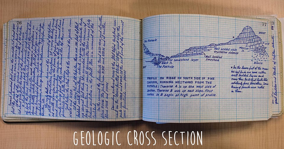
Today on #sciencedeskdigs we learn the story of how a request for an old map lead GIP guest scientist, Reba McCracken, to a trove of detailed field notes, maps, and cross sections of geologic features in national parks from the 30s and 40s.
What is it?
This is a hand-drawn geologic cross section and field notes from the collection of Philip Burke King (P.B. King), a field geologist from the 1930s. The first geologists to survey our National Parks often did so on foot or horseback. When P.B. King first described the geology of the Guadalupe Mountains, even cameras were cumbersome, and he often ended up drawing what he saw by hand. He drew countless geologic cross sections, maps, and panoramas. In his notebooks, he described the different geologic units he found in neat calligraphy, filling hundreds of pages with details that modern NPS geologists still reference.
His field notes are safeguarded in the USGS archives in Lakewood, CO, and spend most of their time in storage, but I got to dust them off to save them digitally. Going through these notebooks gave me a feel for how geoscience has evolved over the past 80 years. Modern geologists now use computer-based analysis and fieldwork today often involves GPS units, digital cameras, and other kinds of technology but P.B King had such painstaking attention to detail that his work is still relevant today. I would love to take his maps and panoramas back to the sites where he drew them to see how they have changed.
Describe your workspace in one word:
Collaborative