These large braided rivers may look like sterile, inhospitable environments, but there is, in fact, a complexity of habitats with high biodiversity. Alexander Milner Institute of Arctic Biology

Jill Crossman
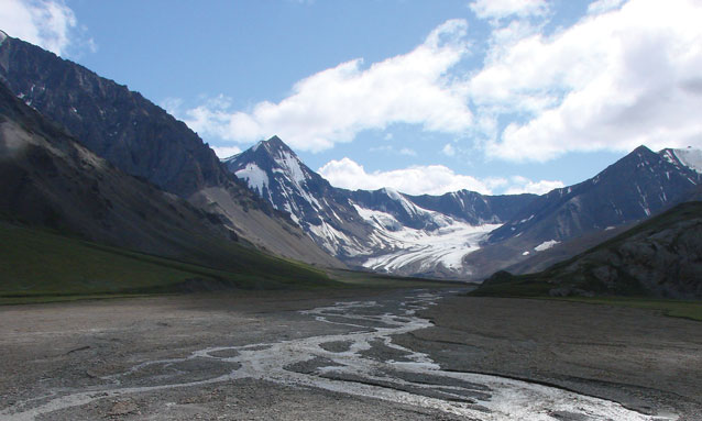
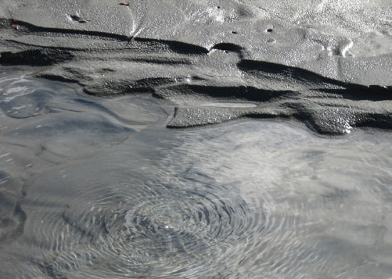
Springs of water bubble to the surface in small channels of the Toklat River, upriver from the park road. These upwelling channels occur where the braided channel of the main river flows through low terraces at the side of the wide outwash plain. The fact that these upwelling channels and their surrounding vegetation are very different from the large braided channel of the main river has intrigued Dr. Alexander Milner for years.
The upwelling channels run clear, not turbid with glacial silt as the main channel often does. The upwelling channel areas support more willows and woody vegetation than the gravel bars adjacent to the main Toklat. If they are like upwelling channels elsewhere, they are “hotspots” of biodiversity.
Sources of Water Flow in the Toklat
Water in the Toklat River is a result of three flow sources, each with different physical and chemical properties: (1) glacial melt (ice and snow) at the head of the valley, (2) run-off of precipitation from valley sides, and (3) groundwater upwellings.
The Toklat has seasonal periods of high and low flow typical of large glacial rivers. The braided main channel has maximum flow and turbid waters during warm summer days when glacial melt is maximum. When snow- and ice-melt are reduced, the braided flow is likewise reduced. In winter, the river is a single channel with clear water.

Jill Crossman
Research Objectives
By quantifying and comparing the upwelling channels and the main glacial channel in terms of water temperature and chemistry, rates of water flow, and plant and animal composition, these three researchers can determine how the flowpaths influence the biological diversity of the upwelling channels.
Specifically, they are collecting data to determine (1) whether the combined water flow in the upper Toklat River basin has spatial and temporal patterns that reflect the three contributing water-flow pathways (glacial melt, runoff, upwellings), (2) whether the temperature regime in the upwelling channels is less variable than that in the main glacial channel, (3) whether the chemical properties of the upwelling channels are different from those of the main glacial channel, (4) how the richness and abundance of the biotic communities in the upwelling channels compare to those in the main glacial channel, and (5) whether riparian (stream bank) vegetation associated with upwelling channels differs significantly from other areas of the Toklat.
Research Methods
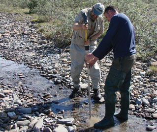
To measure water levels in the upwelling channels, in 2007, the field crew installed nested piezometers (small pipes inserted side by side into the river at depths of about 6 in and 12 in (15 and 30 cm). Water level was also monitored in a braid of the main glacial channel of the Toklat River. From July to September 2007, field staff checked water levels in each piezometer two or three times daily to detect fluctuations in flow and to create flow nets (diagrams of water flow).
Water samples taken from the stream surface and below the surface were analyzed for water chemistry (nutrients and ions), pH (acidity), and conductivity. Researchers collected macroinvertebrates every two weeks from surface channels using a Surber sampler (a net that funnels water into a collecting vial) and every week from water pumped out of the piezometers.

Patterns of Water Flow
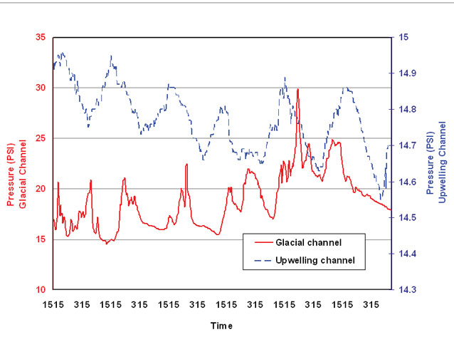
During a 24-hour period, the pattern of rises and falls in stage (water level) of the main glacial channel, due to variation in glacial melt with time of day, was also mirrored in the upwelling channels (see graph at right). However, there was a time lag of about 20 hours. This pattern suggests that the upwellings are being fed predominantly by the main glacial channel, with the time lag due to the time it takes the water to seep through as groundwater.
After a heavy rainfall, there is an increase in stage of the main glacial channel and of the upwelling channels suggesting that additions by rainwater from valley sides may also play a role. Chemical analysis of the water samples will provide more clues about the water flow. The glacial water may flow within the terrace and then emerge where the terrace slopes to the level of the subsurface water table.
Biodiversity Hotspots
Because the upwelling channels have a stable flow and are likely to be enriched by nutrients, they provide more suitable habitat for biota than the main glacial channel. Compared to the glacial channel, the upwelling channels had higher chlorophyll levels and both higher abundance (25 times higher) and higher diversity of macroinvertebrates.

NPS Photo / Lucy Tyrrrell
Biodiversity in Upwelling Channels
If the Toklat water flow is similar to upwelling systems studied elsewhere, the turbidity and channel instability of the main braided channel typically translate to poor habitat for biotic communities. In contrast, the more stable upwelling channels provide productive habitat for algae, macroinvertebrates, and fish.
They also support woody plant growth (e.g., willow and birch) that is important for many animals, including moose and bears. The upwelling areas may also be important as summer habitat for species that feed on fish or macroinvertebrates (e.g., wading birds), and as overwintering habitat for fish.
Last updated: April 22, 2016
