Last updated: August 16, 2021
Article
Permafrost Landscapes
NPS Photo
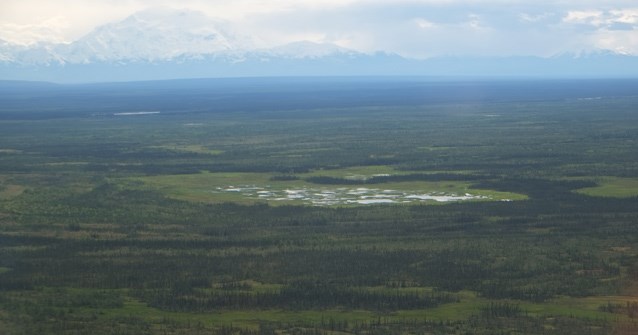
Permafrost has a strong influence on ecosystems in Denali National Park and Preserve because thermal characteristics of the ground directly control or indirectly influence the local hydrology, patterns of vegetation, and wildlife communities.
Characteristics of Permafrost
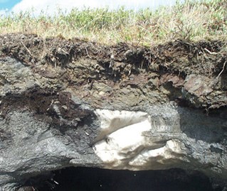
Depth to permafrost differs widely from place to place. Ice content varies from small ice crystals, lenses, and seams in the soil to massive ice features several meters thick. Some permafrost ground is “ice-rich,” with more than 50 percent frozen water in the soil, while other areas are “ice-poor,” where the soil is colder than 0 ºC, but contains little frozen water.
One hallmark of permafrost landscapes is the abundance of summer bogs, ponds, and lakes, even in areas of limited rainfall, because the permafrost beneath does not let summer meltwaters drain. A clue to the melting of permafrost beneath, or frost heaves in the active layer, is the tilting of spruce trees in different directions, known as “drunken forest.”
NPS Photo
Factors Influencing Permafrost
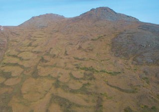
In general, Denali’s northern latitude and the relatively cool mean annual air temperatures prevent well-insulated soils from thawing in summer. Other factors, such as soil type, vegetation cover, snow cover, fire history, and hydrology, also influence patterns of permafrost.
Soil grain size affects drainage and is important in the formation of permafrost. Fine clays and silts, which are extensive north of the Alaska Range, retain moisture more readily than coarse grains. Thus permafrost develops extensively in loamy-textured soils with silt and organic matter and only occasionally in gravelly soils.
Plants in the active layer provide an organic cover that insulates permafrost from warm summer temperatures. Snow insulates soils from the extreme cold temperatures that would facilitate permafrost development. Areas of Denali dominated by permafrost tend to be areas where snowfall is limited or is blown away by the wind, so soils are exposed to deep winter cold. After wildland fires in permafrost terrain (northwest park), the ground warms and the active layer thickens until the plant cover grows back.
NPS Photo
Extent of Permafrost in Denali
Soil scientists have classified Denali’s soils based on the percentage of soils in a soil unit that are underlain by permafrost. Permafrost is either continuous (i.e., permafrost exists in more than 80 percent of the soils), discontinuous (20 to 80 percent of the soils), or sporadic (5 to 20 percent). Nearly 45 percent of the park (more than one million hectares) has continuous (21%) or discontinuous (22%) permafrost. The remainder has no permafrost (10%) or sporadic permafrost (14%). The Alaska Range and environs were not classified (32%). Permafrost currently dominates the Toklat River basin and the stunted spruce and spruce woodlands in the northwestern part of Denali.
Permafrost in Peril — A Changing Landscape
Climatic changes of the last century (warming temperatures since the late 1800s) and especially the last few decades (typically 1 to 2 ºC warmer since 1977), and predictions of warming by 2 to 5 ºC in the 21st century are cause for concern. Increased mean annual air temperatures result in warming of permafrost.
Permafrost is considered fragile if it is within a couple degrees of thawing. Denali contains some of the southernmost continuous permafrost in Alaska. Recent measurements in a permafrost bore hole near the park infer that the local permafrost is within less than 1 ºC (1.8 ºF) of thawing. Thus, Denali’s permafrost soils are very susceptible to climate change, and significant landscape change is likely to occur with continued climate warming.
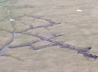
When ice-rich permafrost thaws, the ice changes to a mud slurry, and the ground sinks as much as several yards or meters. Landslides can occur, and thermokarst terrain often develops.
Modeling and Monitoring Permafrost
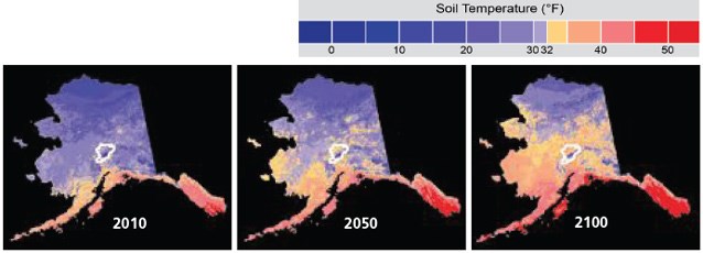
Dr. Santosh Panda and two other researchers at the Geophysical Institute of the University of Alaska Fairbanks created models for future soil temperatures and geographic extent of permafrost in Alaska and specifically in Denali. They based their models on two scenarios of climate warming, and on park maps or data about ecotypes, precipitation (snow), and soil types.
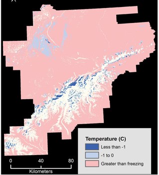
The models predict that, in the next century, the region of permafrost in Alaska increasingly will be restricted to more northern latitudes in the next century (see maps below). In Denali, areas that now are underlain with permafrost would lose permafrost in the next half century, limiting the area of the park in permafrost to 6 percent (see map above) by 2060 and 0.3 percent by 2100.
Because permafrost is important to park ecosystems, it is one of the “vital signs” for monitoring ecosystem health in Denali as part of the Central Alaska Network’s Inventory and Monitoring Program.
