NPS Photo / Brad Ebel
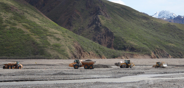
The Denali Gravel Acquisition Plan authorizes gravel to be removed from the Toklat River floodplain in alternate years to support maintenance needs of the Denali Park Road. Beginning in 2004, and continuing in every even year, approximately 22,200 cubic yards of gravel are excavated from the river using methods designed to mimic natural processes. Inherit to the park’s dedication to adaptive management is a motivation to understand and minimize impacts to natural systems. This requires an understanding of how sediment moved through this reach prior to gravel extraction and whether a balance between aggradation (deposition) and degradation (incision) has since been altered.
Colorado State University has partnered with DENA to investigate the response of the section of floodplain experiencing gravel extraction using temporally and spatially nested data. These data consist of detailed topographic monitoring in areas of interest using precision GPS, continuation of valley-spanning cross-sectional data, Terrestrial LiDAR, airborne LiDAR and potential incorporation of a new airborne photogrammetric technique. The data acquired will be used to create surfaces (see Figure 1) to locate areas of aggradation or degradation and alterations to channel form across varying temporal and spatial scales, and to identify areas to avoid or target with gravel excavation. This will contribute to an ongoing analysis of the severity of disturbance to the health of this river and its implications for Park infrastructure and management. Quantification of the effects of gravel mining on this river has implications for the National Park Service’s management policies, gravel-extraction techniques applied by other land management organizations, and similar instances of river resource extraction worldwide.

Last updated: April 28, 2016
