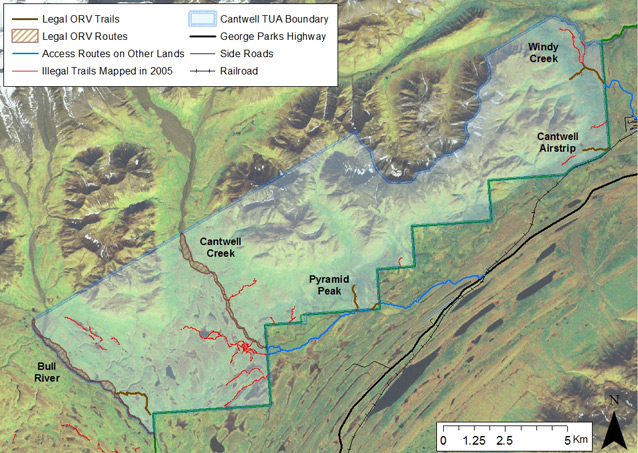
The Cantwell Traditional Use Area, a segment of specially managed Park lands near the town of Cantwell, allows qualified subsistence users to operate off-road vehicles (ORV) for subsistence purposes on established routes (Figure 1). Totaling approximately 11km, the Windy Creek Trail, Pyramid Peak Trail, and Cantwell Creek Floodplain Route allow subsistence users to maintain a pattern of ORV use considered traditional prior to Park management of those lands. To ensure that excess resource damage does not occur because of this allowance, beginning in 2008, botany program staff has conducted annual monitoring to document trail use, extent, and condition - including any impacts or incursions beyond established trails.
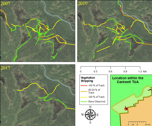
Overall, trail use remains stable across the area and it appears likely that the same users are using the trails in the same way each year to fulfill their subsistence hunting needs. Trail conditions vary among the different trails, but in general marking of routes and boundaries in 2009 appears to have concentrated ORV impacts to smaller areas. Additionally, areas of ORV incursion into sensitive wetlands that occurred prior to monitoring began are showing signs of recovery (Figure 2), indicating that further incursions in those areas have been avoided.

2015-2016 Update
In 2015, we mapped trail conditions, assessed recovery of vegetation at repeat photo points, and documented ORV use from late July through late September via trail counters. Compliance of ORV users with trail regulations was high and we found no notable incursions. Vegetation recovery continues at sites of previous incursion, but damages remain visible (Figure 3). In 2016, we plan to continue monitoring as above, as well as conduct an aerial search for possible new incursions.

Last updated: April 20, 2017
