Last updated: October 7, 2022
Article
Research Brief: Coastal spruce-fir forests in the face of sea-level rise and salt marsh migration

C. Schmitt/Schoodic Institute
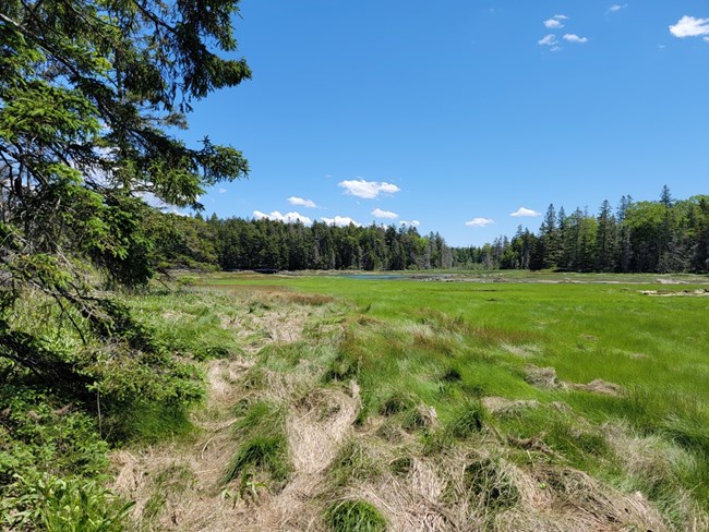
Caitlin Littlefield, Lead Scientist with Conservation Science Partners and 2021 Second Century Stewardship Fellow is researching the narrow zone where Acadia’s spruce-fir forest borders salt marsh.
Park managers generally want to allow salt marshes to migrate inland as sea levels rise, because marshes filter water and provide important habitat, among many other functions. And yet, the inland migration of salt marshes may encroach on coastal forests, leaving “ghost forests” of standing dead trees. Lowland spruce-fir forests are at the southern edge of their range in Acadia, and the park’s future climate is expected to become too warm for these boreal trees in the coming decades, This presents a dilemma for park staff and neighboring communities: do they let the marshes expand inland at the expense of forests, or try to protect the vulnerable coastal forest?
In this project, Littlefield plans to examine the shifting boundary between marsh and woods: how salt marshes may be expanding inland, displacing spruce-fir forest. She will evaluate tree health, mortality, and the emergence of seedlings at increasing distances from the salt marsh interface.
Working with colleagues at University of Vermont (Dr. Jane Foster) and Schoodic Institute (Dr. Peter Nelson), Dr. Littlefield will use satellite imagery to determine if patterns observed in the field have been unfolding for years and if the patterns are widespread. This information will inform the creation of predictive maps of salt marsh migration and spruce-fir forest dieback.
Spring 2022 update
In early May, Littlefield visited several marshes to ground-truth the satellite data. Preliminary computer analysis had showed a loss of “green-ness” over the last decade, suggestive of dying trees. Immediately upon arrival at Bass Harbor Marsh, she saw scattered dead spruce trees, weathered gray without any needles, at the edge of the marsh. The trees were evidence that the remotely-sensed data were telling a true story.
She continued on into the marsh to set up transects running from marsh into the woods, documenting plant cover, whether trees were alive or dead, and if new seedlings were emerging. From the pools of water on the still-brown marsh surface rose a ringing chorus of toads, while shorebirds and ducks fed in the creeks and flats. Azure butterflies and migrating songbirds flittered along the edge of the woods. In some places, bog plants like leatherleaf and sweetgale, already in flower, mixed in with the salt-tolerant cordgrasses. At other transects, the marsh grass was growing on the shaded ground beneath the trees. It was clearly a dynamic zone with no firm boundary between salt marsh and woods.
Littlefield is currently analyzing her data, to determine if the story suggested by the satellite record – forest loss – aligns with what’s actually happening on the ground at Bass Harbor Marsh and other marshes in Acadia
