Last updated: April 30, 2018
Article
Climate Corner, April 2018
State of California Sea-Level Rise Guidance Now Available
This recently released document provides guidance to state agencies for how to incorporate sea-level rise projections into planning, design, permitting, construction, investment, and other decisions, including:
- a synthesis of the best available science on sea-level rise projections and rates for California;
- a stepwise approach for state agencies and local governments to evaluate those projections and related hazard information in decision-making; and
- preferred coastal adaptation approaches.
This guidance is based on the scientific findings found in the 2017 “Rising Seas in California: An Update on Sea-Level Rise,” which reflects recent advances in ice loss science and sea-level rise projections.
California Multivariate Ocean Climate Index Updated Through March

Farallon Institute
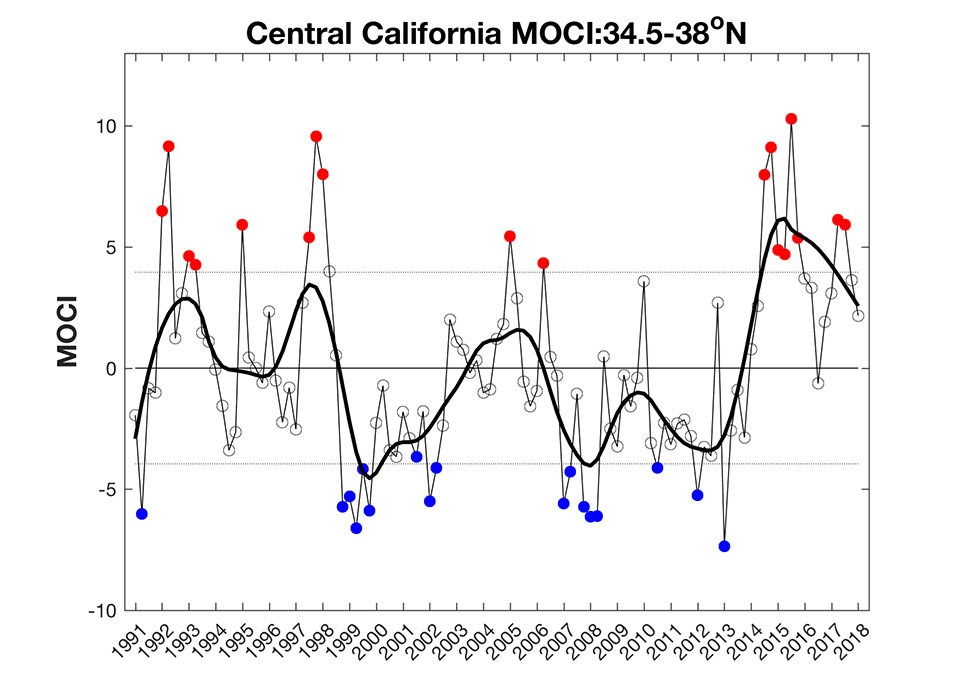
Each season, the Farallon Institute averages numerous kinds of California ocean and climate data, from sea surface and air temperatures to upwelling and Pacific Decadal Oscillation indices, and synthesizes them into a single indicator of the state of the coastal ocean. Known as the Multivariate Ocean Climate Index (MOCI), this indicator captures the timing and intensity of ocean and climate phenomena such as "The Blob" on multiple time scales, and accross regions of the California Coast. MOCI is also a potentially useful predictor of a variety of marine ecosystem dynamics, as it has been correlated in various ways with the success of species from all corners of the food web.
MOCI calculations are now available from January 1991 through March 2018. Values are returning to normal range over the past couple of seasons, though they remain on the "warm/unproductive" side in Central and Southern Caliornia. Visit the Farallon Institute website to learn more about MOCI, and to access the latest data and graphs.
