Last updated: November 13, 2020
Article
Springs Monitoring at Carlsbad Caverns National Park
NPS
Springs, Seeps, and Tinajas
Springs, seeps, and tinajas are relatively rare but ecologically important natural resources in the American Southwest. A place where water naturally flows from the ground is called a spring. Seeps are small springs where groundwater slowly leaks out. Tinajas, sometimes called potholes, are bedrock depressions where water collects from springs or rainfall.
Despite their small size, springs, seeps, and tinajas (or springs for short) tend to be hot spots of biodiversity in arid lands, supporting a large number of aquatic, riparian (springside/streamside), and terrestrial species. They are sparsely distributed across the landscape and aquatic organisms, riparian vegetation, and associated wildlife vary greatly from spring to spring. Arid-land springs often have endemic species (species unique to that spring or area) due to their isolation and persistence.
Common stressors to plants and animals in and around springs include reduced water availability due to drying and water temperature extremes (such as freezing), reduced light penetration (due to turbid water), and biochemical conditions outside of normal for a site. Climate change is an emerging stressor on springs in the American Southwest. Changes in amounts and quality of water can disrupt ecosystem functions and processes and lead to lower species diversity. The Chihuahuan Desert Network monitors springs at Carlsbad Caverns National Park to detect broad-scale changes in aquatic and riparian ecological condition that could pose a threat to these important resources.
NPS
What Do We Monitor?
We monitor six sentinel springs at Carlsbad Caverns National Park: Iron Pipe Seep, Oak Spring, Slaughter Pothole, Upper East Grammer Seep, Upper Lechuguilla Spring, and Upper Lowe Ranch Spring. Sentinel springs are chosen as representative systems that act as indicators of ecological change.
Site Characterization
Once every five years at each spring, the spring type, location, site diagram, site description, and vegetation community characteristics are reassessed to determine any major changes to the spring type.
Site Condition
Each year, we evaluate site condition, which includes taking photo points, characterizing natural and anthropogenic (man-caused) disturbances (on a scale of 1–4 where 1 = undisturbed), and surveying for invasive, non-native plants and animals. We also survey for obligate wetland plants (plants that almost always occur only in wetlands) and facultative wetland plants (plants that usually occur in wetlands, but also occur in other habitats).
NPS
Water Quantity
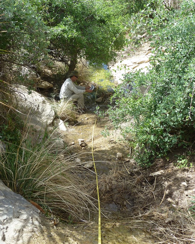
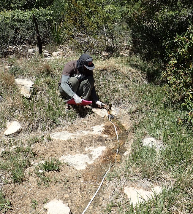
Each year we characterize water quantity by measuring the persistence of springs (determined by examining the variance in spring water temperatures) and wetted extent (the length, width, and depth of surface water). We also estimate spring discharge (flow).
Water Quality
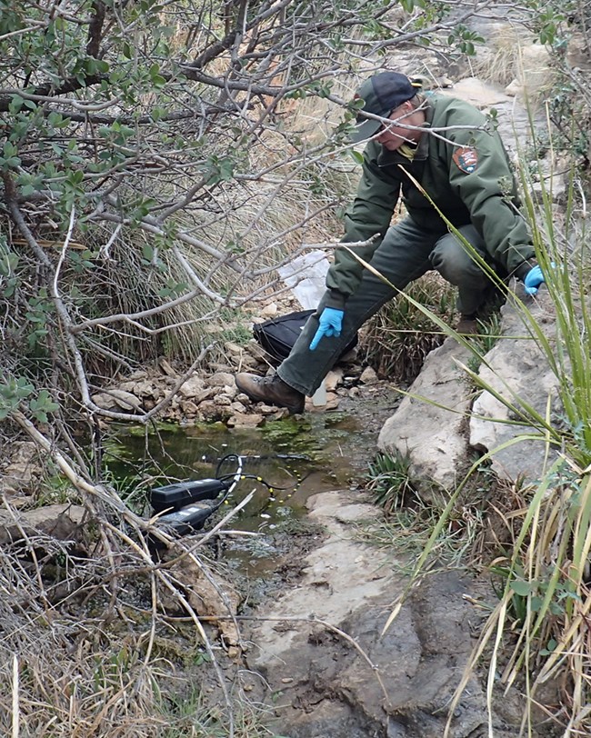
Water chemistry and core water quality parameters are monitored every year, including water temperature, pH (how acidic or alkaline the water is), specific conductivity (a measure of dissolved compounds and contaminants), dissolved oxygen (how much oxygen is present in the water), and total dissolved solids (another indicator of potentially undesirable compounds).
Each spring has a unique water source and geology, and both can affect water chemistry. We are currently collecting baseline data and report raw data for each spring below. With more data in future years, we will develop assessment points for each spring to better understand spring water quality conditions and trends.
Park Springs in Water Year 2018
(October 2017–September 2018)
Data provided here are provisional and will be subject to additional analysis and interpretation in the future. We will update this page as new information becomes available.
NPS
Iron Pipe Seep
Iron Pipe Seep is located near the top of a ridge in a small north-facing drainage overlooking Slaughter Canyon. The area drained by this seep is relatively small (about 28 acres). The amount and timing of rain have a large impact on the stream due to the geography of the seep and the area around it. It is likely that most of the water this spring produces starts as rain that follows the cracks and fissures in the limestone to flow out the orifice. A spring box was installed long ago and was eventually buried. It collects and directs an unknown amount of the spring flow through a one-foot-diameter iron pipe.
We classified Iron Pipe Seep as a rheocrene spring when we visited in April 2018. Rheocrene springs are springs that emerges into a flowing stream. Water flowed as a small trickle from the iron pipe into a short spring brook with several pools. The water flowing from the pipe was cool and clear, the pools were stagnant, and the larger pool downslope was dry. The channel and pools appear to frequently dry out.
Site Disturbance
The spring had minimal disturbance, but the site was highly disturbed by trampling and bedding of animals that were most likely introduced, exotic Barbary sheep (mean disturbance value of 1 = undisturbed).
Obligate and Facultative Wetland Plants
1 species: sedge (Carex sp.)
Invasive, Non-native Species
Barbary sheep: while we don't monitor for Barbary sheep, we saw evidence of their presence here.
Water Quantity
The spring was mostly dry from April through September 2018. Discharge ranged from 6.7 to 10.4 liters/minute (1.8 to 2.8 gallons/minute) at the different orifices—openings where the water emerges. The stream channel length was 6.6 m (21.7 ft) with an average width of 41.7 cm (16.4 in) and average depth of 1.2 cm (0.5 in). This could be a very good site for studying the impact and mitigation techniques of climate change on hydrology and ecology in this ecosystem if we can determine how effective the spring box is at collecting discharge.
Water Quality and Chemistry
Water quality and chemistry are typical for a site with this geography, geology, and short flow path (the distance and time it takes water that has fallen as rain to flow through the ground and then out of the spring). Baseline results are shown in the tables below.
| Sampling Location (Orifice) | Sample Time (24 hr) |
Temperature (°C) | Dissolved Oxygen (mg/L) | pH | Specific Conductivity (µS/cm) | Total Dissolved Solids (mg/L) | Exposure |
|---|---|---|---|---|---|---|---|
| 1 (A) | 10:42 | 19.6 | 4.14 | 6.92 | 422.2 | 455.0 | Sun |
| Sampling Location (Orifice) |
Alkalinity | Calcium | Chloride | Magnesium | Potassium | Sulfate |
|---|---|---|---|---|---|---|
| 1 (A) | 320 | 50 | 5 | 48 | 0.3 | 7 |
NPS
Oak Spring
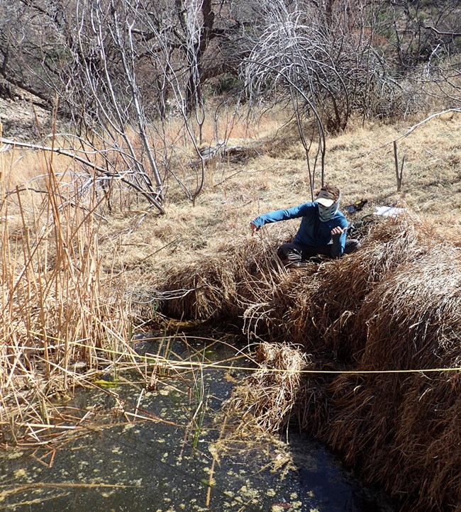
This spring was classified as a complex rheocrene system (multiple spring orifices/openings at the head of a small drainage) when we sampled in March 2018. There is evidence of historical manipulation of the spring site (multiple large concrete dams—one dam is 1-meter thick— and possibly the remains of depressions and berms). The remains of these structures still direct and collect water flowing from the various orifices.
The spring emerged from a series of complex contacts, strikes, and fissures in the steep limestone slopes of the surrounding canyon. Water also emerged from the bottom of the canyon in and along a channel. After flowing through a main channel and a crescent-shaped pool, the water disappeared into a mat of compacted soil and Bermudagrass (Cynodon dactylon). Downstream, water flowed under a mat of large sedges (Carex sp.) into two small but distinct channels that become a large plunge pool filled with cattails before disappearing into the gravel. Flows from all of the orifices were cool and clear and there was algae and litter in the pools.
Site Disturbance
The spring had minimal disturbance (mean disturbance value of 1 = undisturbed). Tracks and game trails were observed near the spring causing only slight disturbance. In 2018, we noted a shorter intermittent channel, burned snags, and resprouts, indicating slight disturbance from fire and drying.
Obligate and Facultative Wetland Plants
3 species: sedge (Carex sp.), maidenhair fern (Adiantum sp.), and cattail (Typhaceae family)
Invasive, Non-native Species
2 plant species: Bermudagrass (Cynodon dactylon) and horehound (Marrubium vulgare)
Water Quantity
The spring was wet during most of the sampling period from March to October 2018. Discharge from the main orifice was 0.6 liters/minute (0.16 gallons/minute). Stream channel length was 43.7 m (143.4 ft) with an average width of about 1 m (3.3 ft) and a 1-cm (0.4 in) average depth.
Water Quality and Chemistry
Water quality and chemistry are in the expected range for this spring. Baseline results are shown in the tables below. Dissolved oxygen is not reported because the instrument did not pass the post-calibration check.
| Sampling Location (Orifice) |
Sample Time (24 hr) |
Temperature (°C) |
pH | Specific Conductivity (µS/cm) |
Total Dissolved Solids (mg/L) |
Exposure |
|---|---|---|---|---|---|---|
| 1(A) | 12:58 | 15.8 | 8.12 | 594.8 | 386.8 | Sun |
| 2(B) | 13:06 | 11.3 | 7.74 | 570.3 | 370.5 | Shade |
| 3(C) | 13:34 | 21.3 | 8.12 | 631.0 | 409.5 | Sun |
| 5(A,B) | 13:50 | 13.1 | 7.88 | 586.0 | 380.9 | Sun |
| Sampling Location (Orifice) |
Alkalinity | Calcium | Chloride | Magnesium | Potassium | Sulfate |
|---|---|---|---|---|---|---|
| 1(A) | 265 | 58 | 10 | 28 | 0.5 | 21 |
| 2(B) | 280 | 58 | 14 | 40 | 0.4 | 34 |
| 3(C) | 300 | 62 | bdl | 31 | 0.1 | 24 |
| 5(E) | 295 | 68 | 5 | 33 | 1.5 | 2 |
NPS
Slaughter Pothole
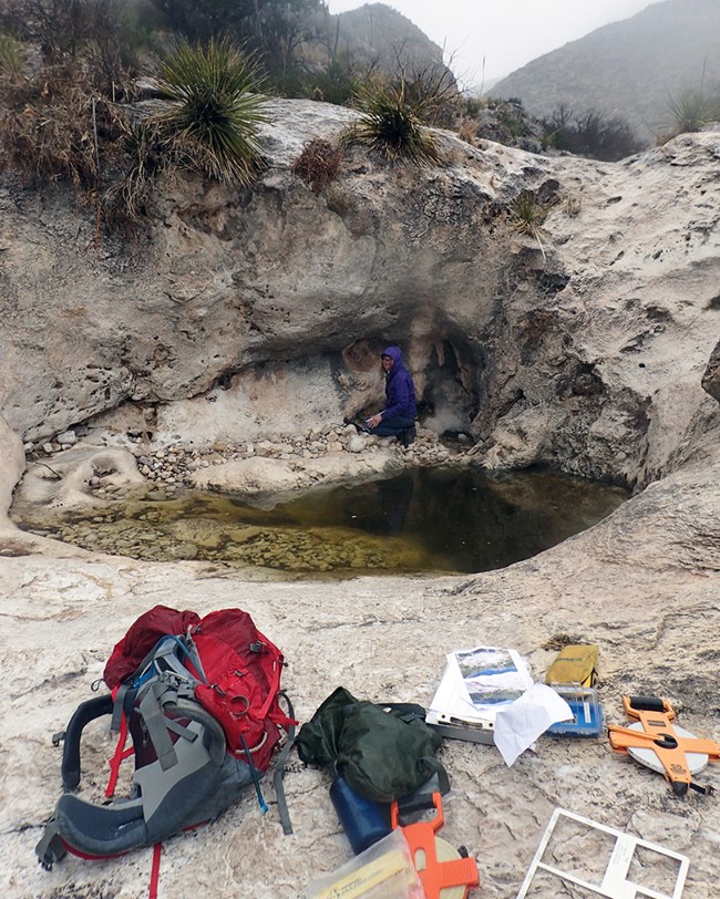
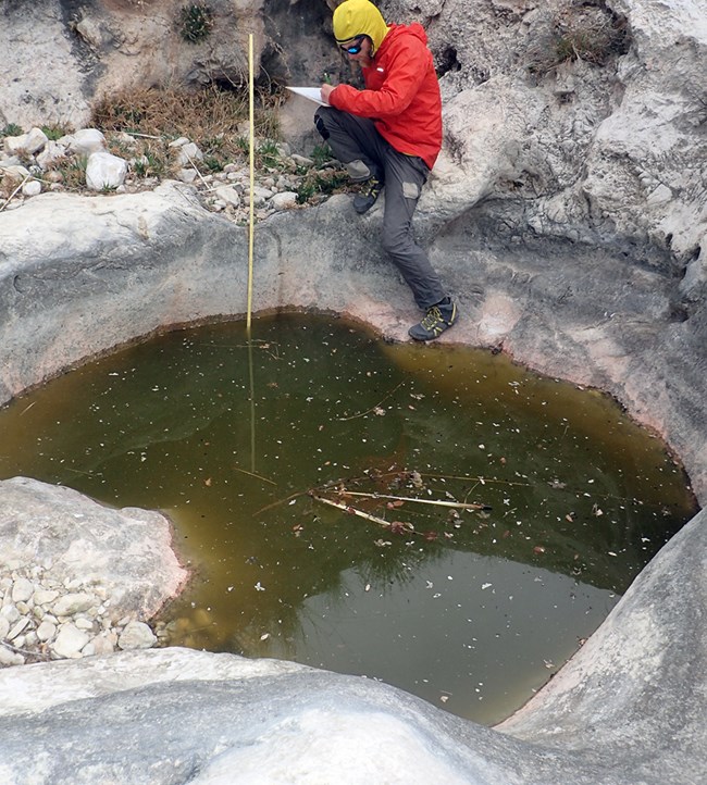
Entrapped on all sides by bedrock, Slaughter Pothole is a 6.5 x 6.5-ft tinaja that is about 2-ft deep. It is located in the upper elevations of the Slaughter Canyon drainage, with very steep bedrock upstream and a large bedrock slab downstream giving way to a dry gravel and sand channel. When we visited in March 2018, there was little vegetation near the tinaja because of the dominant bedrock, but some gravel and soil deposits on the northeast edge of the pool provided habitat for some small forbs and grasses.
Site Disturbance
There was minimal disturbance, but it is likely used by wildlife and visited by humans as there is a hiking trail near the tinaja (mean disturbance value of 1 = undisturbed). However, the bedrock surface makes disturbance hard to estimate.
Obligate and Facultative Wetland Plants
None detected
Invasive, Non-native Species
1 plant species: mullein (Verbascum thapsus) - only a few plants
Water Quantity
The spring was wet for the entire sampling period from March 26 through June 6, 2018 (the temperature stopped recording data on June 6). The pool at orifice A was assessed as a limnocrene system—a type of spring that emerges as a pool. The pool had an average length of 2.1 m (6.9 ft), an average wetted width of about 1.8 m (~5.8 ft), and average depth of 71.2 cm (2.3 ft).
Water Quality and Chemistry
The water that collects in the tinaja appears to be mostly from surface water, but the water chemistry and persistence data indicate that there may be a small amount of groundwater input that keeps water in the depression year-round. Baseline water quality and chemistry data are shown in the tables below.
| Sampling Location (Orifice) |
Sample Time (24 hr) |
Temperature (°C) |
Dissolved Oxygen (mg/L) |
pH | Specific Conductivity (µS/cm) |
Total Dissolved Solids (mg/L) |
Exposure |
|---|---|---|---|---|---|---|---|
| 1(A) | 10:26 | 15.9 | 10.32 | 9 | 271.1 | 467.1 | Shade |
| Sampling Location (Orifice) |
Alkalinity | Calcium | Chloride | Magnesium | Potassium | Sulfate |
|---|---|---|---|---|---|---|
| 1(A) | 135 | 28 | bdl | 6 | 4.5 | 0 |
NPS
Upper East Grammer Seep
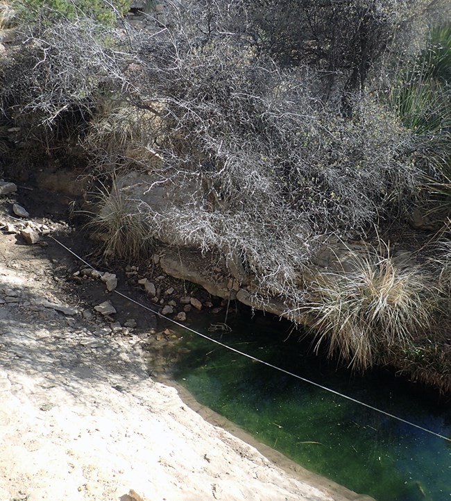
The Upper East Grammer Seep site is in a steep limestone drainage. In the upstream portion, there are sections of exposed limestone bedrock. When we visited the site in March 2018, a small amount of water seeped from a horizontal seam in the limestone at the spring origin. This location was at a transition point between a steep bedrock channel and a less steep section where sediment accumulated as the slope decreased.
Water flowed for several meters across the bedrock surface in a thin sheet until it spilled into the cobble and boulder filled channel section forming several shallow pools. The first pool had clear water and significant algae and the second pool was created by a gravel dam and clumps of muhly grass (Muhlenbergia sp.). Flow continued underground from there, down a steep slide, and into a litter-covered small pool of water.
Site Disturbance
The spring had minimal disturbance (median disturbance value of 1 = undisturbed), but there was evidence of substantial animal use at the site. Game trails, tracks, and animal dugout beds were present, but it was unclear if these were from feral Barbary sheep or native wildlife, though deer were observed near the site. Recent flooding has caused slight disturbance, with gravel deposition at the base of the downstream pool .
Obligate and Facultative Wetland Plants
3 species: sedge (Carex sp.), andropogon grass (Andropogon sp.), and maidenhair fern (Adiantum sp.)
Invasive, Non-native Species
2 plant species: Bermudagrass (Cynodon dactylon)
Barbary sheep: while we don't monitor for Barbary sheep, they may be present here.
Water Quantity
Temperature sensors in one of the pools indicated that the spring was wet from March to October 2018. Discharge from the spring origin was 0.9 liters/minute (0.24 gallons/minute). The length of the stream channel was 42.2 m (138.5 ft), the average width was 1.5 m (4.9 ft), and the average depth was 4.1 cm (1.6 in).
Water Quality and Chemistry
The water chemistry was typical for the geology and geography of the site. Baseline results are shown in the tables below.
| Sampling Location (Orifice) |
Sample Time (24 hr) |
Temperature (°C) |
Dissolved Oxygen (mg/L) |
pH | Specific Conductivity (µS/cm) |
Total Dissolved Solids (mg/L) |
Exposure |
|---|---|---|---|---|---|---|---|
| 1(A) | 09:02 | 11.7 | 7.21 | 7.85 | 601.0 | 390.7 | Shade |
| Sampling Location (Orifice) |
Alkalinity | Calcium | Chloride | Magnesium | Potassium | Sulfate |
|---|---|---|---|---|---|---|
| 1(A) | 285 | 42 | 70 | bdl | 1.3 | 38 |
NPS
Upper Lechuguilla Spring
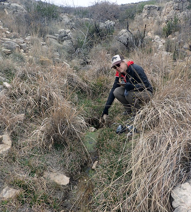
This spring emerges in a higher elevation, east-facing stretch of the West Lechuguilla canyon drainage. In March 2018, we classified it as a rheocrene spring—a type of spring that emerges as a flowing stream. The water emerged in a drainage as a small algae-covered pool (0.5 x 0.5 x 0.1 m) that flowed very slowly for about 1 m (3.3 ft) before disappearing as underground flow. Downstream, there was dampness and wetland vegetation leading to a wide bedrock area with pools and algae. The water then flowed off a short drop and ended.
The spring has not produced much flow in the last few years and the spring brook and pools are likely ephemeral—dependent on rain for significant surface flow. There is a small community of wetland plants, and much of the sediment is saturated with water. This indicates that there is perennial (year-round) water flowing through this system below the soil surface.
Site Disturbance
The spring had very little disturbance (median disturbance value of 1 = undisturbed). The only disturbance detected was wildlife tracks in the muddy area downslope of the channel.
Obligate and Facultative Wetland Plants
3 species: sedge (Carex sp.), spikerush (Eleocharis sp.), and rush (Juncaceae family)
Invasive, Non-native Species
None detected
Water Quantity
Temperature sensors at the spring orifice (opening) showed that the spring was intermittently wet from March to October 2018. Discharge from the spring was 0.05 liters/minute (0.01 gallons/minute). The length of the stream channel was 12.8 m (42 ft), the average width was 48.0 cm (18.9 in), and the average depth was 1.4 cm (0.6 in).
Water Quality and Chemistry
Water quality and chemistry are typical for this type of site. Baseline results are shown in the tables below.
| Sampling Location (Orifice) |
Sample Time (24 hr) |
Temperature (°C) |
Dissolved Oxygen (mg/L) |
pH | Specific Conductivity (µS/cm) |
Total Dissolved Solids (mg/L) |
Exposure |
|---|---|---|---|---|---|---|---|
| 1(A) | 11:27 | 10.9 | 15.22 | 7.89 | 612.3 | 398.5 | Shade |
| Sampling Location (Orifice) |
Alkalinity | Calcium | Chloride | Magnesium | Potassium | Sulfate |
|---|---|---|---|---|---|---|
| 1(A) | 270 | 56 | 6 | 35 | 1.2 | 40 |
NPS
Upper Lowe Ranch Spring
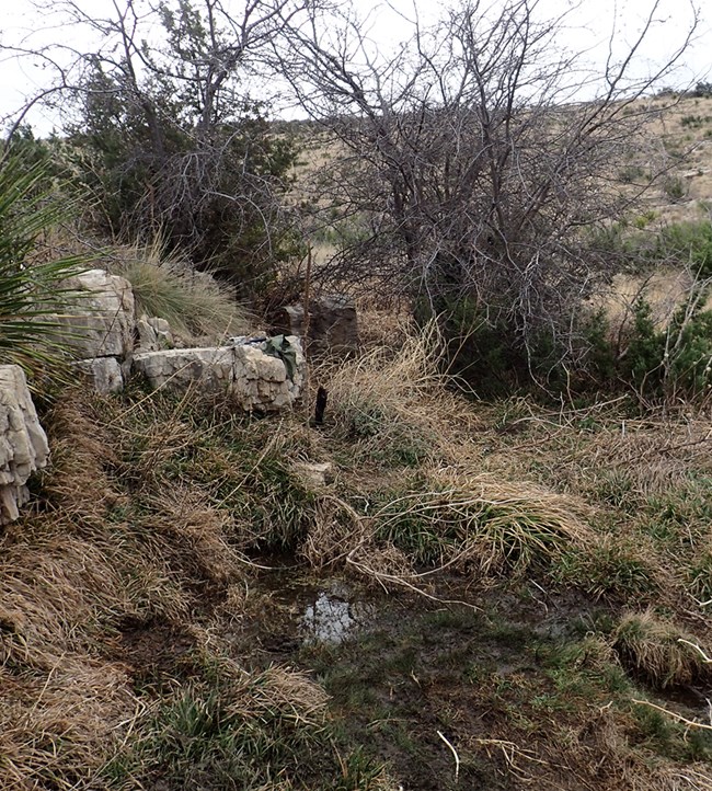
Upper Lowe Ranch Spring emerges along the base of a limestone bedrock shelf. In March 2018, we classified it as a rheocrene spring—a spring that emerges as a flowing stream. The water emerged as a 6 to 7-m long (19.7 to 23 ft) seep along a bedrock shelf. Where it emerged is likely a contact—a seam between the material of the shelf and another lower bedrock material. The water seeped down the contact, mostly through saturated sediment and vegetation, and collected in a series of pools. Flow continued slowly downslope towards the main drainage and then spread out over a flattened area.
Site Disturbance
The spring had very little disturbance (median disturbance value of 1 = undisturbed). There was slight disturbance from historical human use. A very distinct trail led to the site, indicating moderate feral animal use (likely from Barbary sheep) and slight native wildlife use. The 2011 Loop Fire burned much of the vegetation in the area (rated moderately disturbed) and drying has caused marshy areas of thick riparian vegetation to desiccate (slight disturbance).
Obligate and Facultative Wetland Plants
2 species: spikerush (Eleocharis sp.) and sedge (Cyperaceae family).
Invasive, Non-native Species
4 plant species: mullein (Verbascum thapsus), Johnsongrass (Sorghum halepense), Bermudagrass (Cynodon dactylon), and horehound (Marrubium vulgare) in scattered patches
Barbary sheep: while we don't monitor for Barbary sheep, they may be present here.
Water Quantity
Temperature sensors in the small pool indicated that it was wet throughout most of the period between March and October 2018. Flow of the spring could not be measured because it seeped from the rock. Spring channel length was 11.3 m (37.1 ft), average width was 73.3 cm (28.9 in), and average depth was 2.2 cm (0.9 in).
Water Quality and Chemistry
Water quality and chemistry were generally typical for the site. Baseline results are shown in the tables below. Dissolved oxygen is not reported because the instrument did not pass the post-sampling calibration check.
| Sampling Location (Orifice) |
Sample Time (24 hr) |
Temperature (°C) |
Dissolved Oxygen (mg/L) |
pH | Specific Conductivity (µS/cm) |
Total Dissolved Solids (mg/L) |
Exposure |
|---|---|---|---|---|---|---|---|
| 1(A) | 08:17 | 13.0 | not available | 7.59 | 563.5 | 366.0 | Shade |
| Sampling Location (Orifice) |
Alkalinity | Calcium | Chloride | Magnesium | Potassium | Sulfate |
|---|---|---|---|---|---|---|
| 1(A) | 270 | 52 | 6 | 37 | 0.0 | 2 |
