Last updated: August 20, 2018
Article
Artificial Horizon: Navigation for the Lewis and Clark Expedition

Smithsonian Institution
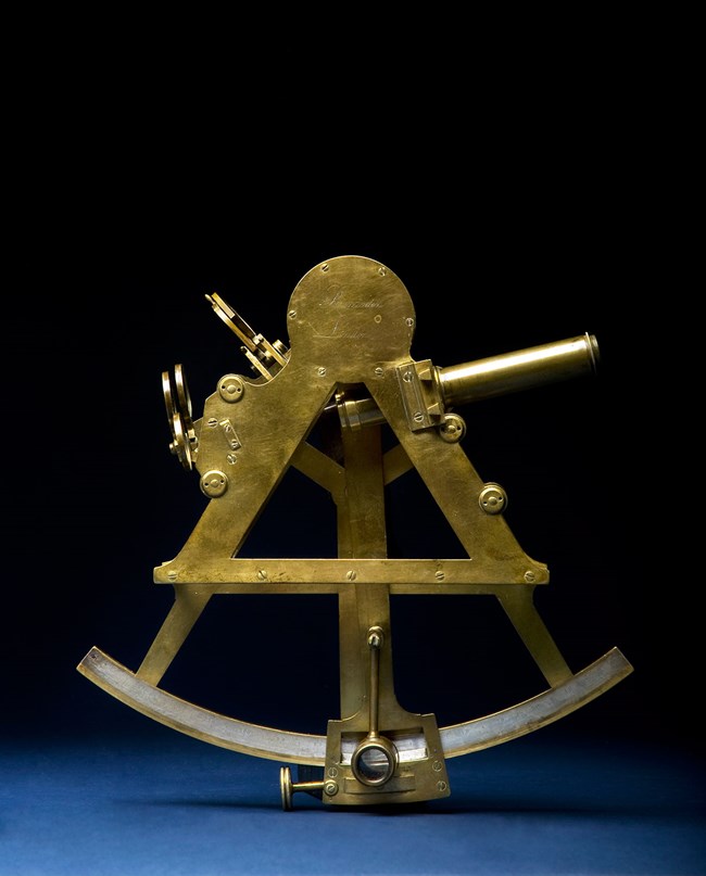
To determine latitude, the distance north of the equator, all they had to do was measure the height of the sun above the horizon at noon. Since Lewis came prepared with the latest technical instruments (the octant and sextant), this measurement should have been easy. But in real life, it wasn’t so simple since the biggest obstacle was actually seeing the horizon. That’s not a problem on the open seas. But on land, trees and hills often obscure it.
To solve this problem, Lewis also brought a device called an artificial horizon – typically just a tray of water with a sheet of reflective mica on the surface. Measuring the angle between the sun and its reflection in the mica provided exactly twice the angle between the sun and the horizon.
However, even with the measurement, the Captains had to correct for things that threw it off: the tilt of the Earth (which varies due to season), the refraction of the sun’s rays by the atmosphere, and the height of the observer. Despite all these complications, Lewis’s latitude readings were often correct to within a fraction of a degree.
This sextant may be very similar to one used by Meriwether Lewis. It’s a part of the collection of the Air and Space Museum at the Smithsonian Institution.
