Last updated: July 20, 2020
Article
Archeology at Hopewell Culture National Historical Park

Early Observations
E.G. Squier and E.H. Davis first described the Hopeton Earthworks in their monumental survey of mounds and earthworks in the Mississippi Valley, published in 1848. Located just four miles north of their hometown of Chillicothe, they described the earthworks as a rectangle with an attached circle. The rectangle measured 900 feet by 950 feet, and the diameter of the circle was 1,050 feet.
The walls of the earthworks included twelve breaks or gateways. Two smaller circles adjacent to the rectangle on the east side of the earthworks measured 250 and 200 feet in diameter, respectively. Parallel walls, placed 150 feet apart, extended southwest from the northwest corner of the rectangle for 2,400 feet to the edge of the terrace. In 1848 the walls of the rectangle were 12 feet high and 50 feet wide at their base, and the walls of the great circle were 5 feet high. Squier and Davis did not observe ditches around any of the earthworks.
An Endangered Resource
Hopeton Earthworks was officially designated as a national historical landmark in July 1964, yet it took much longer to preserve the site. In December 1980 Congress authorized the National Park Service to purchase 150 acres of the Hopeton Earthworks. Unfortunately, it took another ten years to get funds to make the purchase. During this decade the site was cultivated annually.
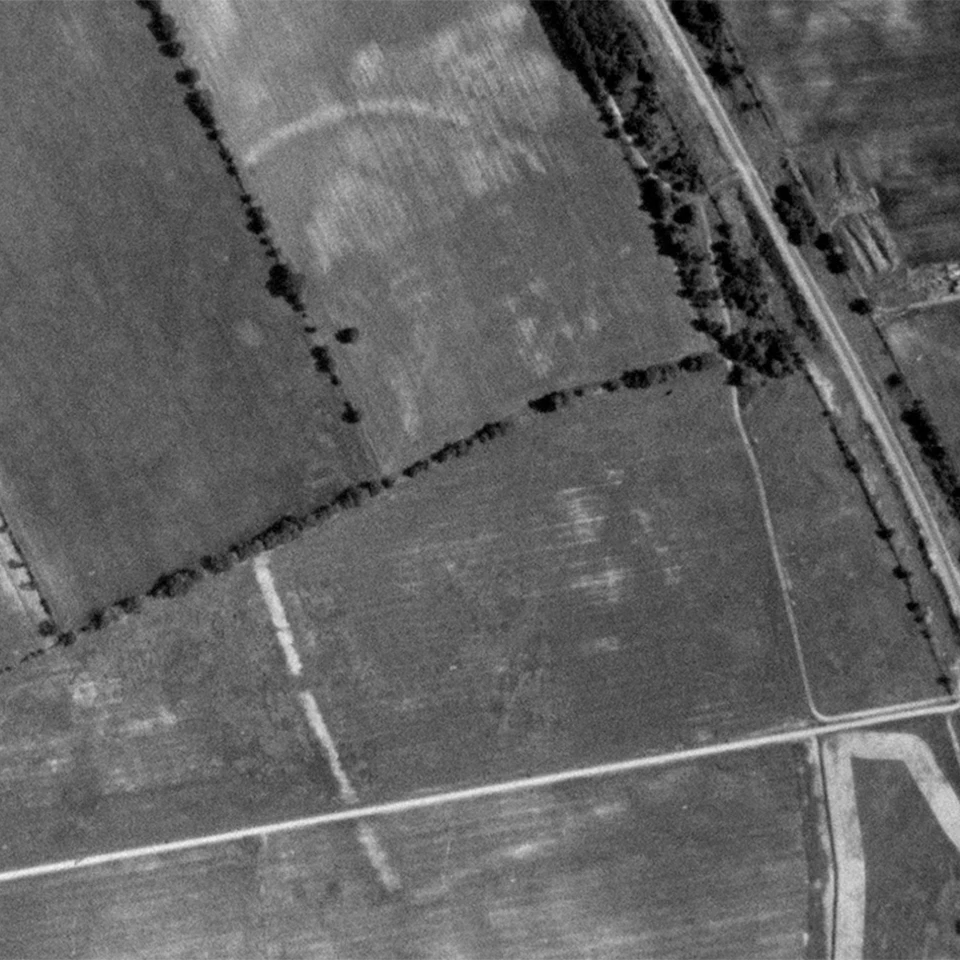
Damage to the earthworks was significant. In a study of aerial photographs of the site, John Blank found that with the introduction of high-powered tractors in the late 1950s, the earthworks were being reduced at a rate of about 1.2 inches per year and widened at a rate of one foot per year. An aerial photograph of the site in 1938 shows that many of the features Squier and Davis recorded were still visible. However, by 1966 all of the minor earthwork features and mounds had disappeared.
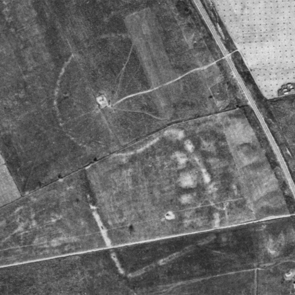
Left image
1938 aerial photo of Hopeton Earthworks before modern industrial agriculture.
Right image
1966 aerial photo of Hopeton Earthworks after the advent of modern agriculture.
Additional damage to the earthworks occurred when commercial gravel quarry operations began along the western edge of the terrace in 1984 and were expanded in 1990.
In 1992, Public Law 102-294 renamed the park Hopewell Culture National Historical Park and authorized the expansion of the park to include further lands at Hopeton plus the Hopewell, High Bank, and Seip Earthworks. This legislation provided the National Park Service with the authority to purchase the remaining lands within the National Historic Landmark boundaries that had not been impacted by gravel quarry operations.
Ongoing Research
Ongoing work at Hopeton represents the cooperative efforts of many individuals and several different institutions. This long-term study has a number of goals, including understanding the timeline, structure, and function of the earthworks. Participants incorporate several approaches to investigating Hopeton. Geophysical surveys provide a first look of possible features underground and earthwork wall structure. Excavations follow, based on the results of these surveys. Topographic mapping has also provided another perspective of the site and can be compared with other data sets.

Geophysical surveys also identified several potential archeological features for excavators to test. One of these turned out to be a large, deeply buried pit just outside a gateway in the southern wall. It was filled with broken ceramics and mica and appears to be associated with the production of ritual objects.
These investigations have just opened the door to understanding how the Hopeton Earthworks was used. Analyses of the recovered materials and additional work will tell us more!