Article

Archeology & Adaptation to Climate Change in Yellowstone

Photo - ©D. MacDonald
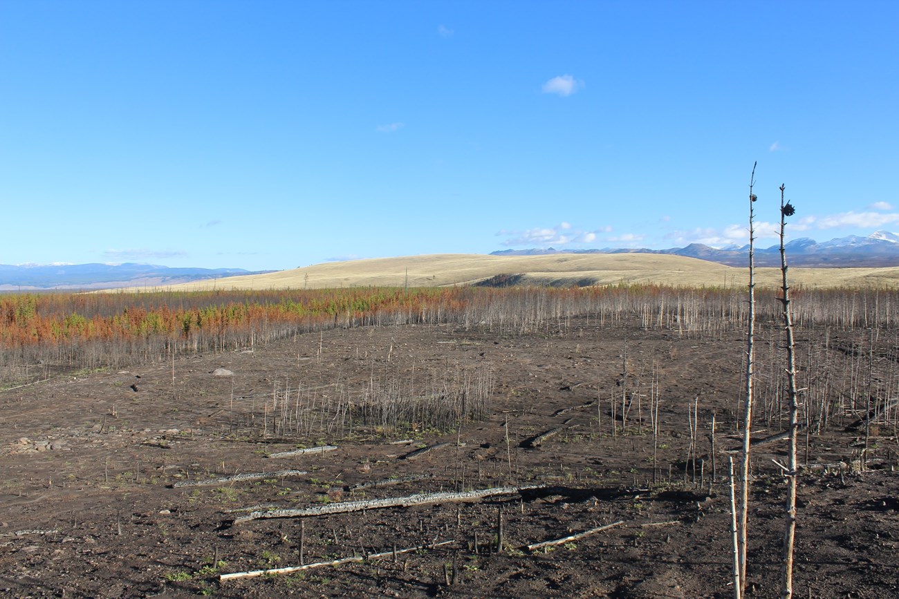
Figure 1. Surfaces denuded by wildland fire can rapidly erode, threatening archeological resources. Photo - ©D. MacDonald

Photo - ©D. MacDonald

Archeology & Adaptation to Climate Change in Yellowstone
by Staffan Peterson


The effects of climate change may pose the greatest threat to the integrity of natural and cultural resources that Yellowstone National Park (YNP) has ever experienced (NPS 2010). Protection and preservation of these resources requires park managers to understand potential threats using the best available research, and that they act in the long-term public interest. The causes and consequences of climate change, including how climate affects ecosystems and how humans have adapted to climate change, are critical research areas. This article focuses on how probable climate-driven changes in land cover and disturbance regimes may be impacting archeological resources in YNP, and how park managers use science to respond and adapt to emerging challenges.

YNP encompasses over 2.2 million acres in northwest Wyoming, southern Montana, and eastern Idaho, between 5,000 and 11,000 ft. above sea level. The surface geology is primarily volcanic plateaus of Quaternary rhyolitic rock surrounded by Eocene mountains. The park’s highly variable ecosystem is home to diverse flora, fauna, and microorganisms, some of which are uniquely found in Yellowstone (Despain 1990). The climate in the Greater Yellowstone Ecosystem (GYE) includes long cold winters, short cool summers, with precipitation of 10-70 in. annually. Summer droughts help sustain the normal fire regime. Because climate is a determining factor for the presence and distribution of all life, understanding climate change can explain how past peoples adapted to life in Yellowstone over several millennia.

Today, we are faced with a paradox. Evidence of adaptation to past climate change can explain different aspects of past lifeways, but current and future climate change can threaten or erase that very evidence. It is a critical part of the mission of the NPS to protect, preserve, and interpret this record for this and future generations. Given the agency mission of resource preservation, we have to understand and anticipate critical vulnerabilities to meet our preservation mandate, including new threats from a changing environment.
Potential Climate Change in the GYE

The truism that the climate has been changing since the end of the Ice Age does not speak to the fact that the climate has changed significantly faster in just the last few decades than over the prior 12,000 years. Globally, an increase of 6°F-13°F may occur over the next 80 years, or within the lifetime of today’s preschoolers (Collins et al. 2013). These changes can have cascading effects on ecosystems and park resources. For example, a 2°F increase in average annual temperature may result in a 600% increase in area burned each year (Peterson and Littell 2014). Snowpack may decrease by 3-4 in. per year (Chang and Hansen 2015), while spring rains may increase. Effects of climate change can also impact park infrastructure, visitation patterns, and visitor experiences in the park and its resources in unpredictable ways. Parks across the United States are responding to these challenges by developing mitigation and adaptation strategies, including increased monitoring of ongoing impacts, predictive modeling of climate change scenarios (e.g., sea level rise, increased storm surges, flooding, wildfires, and drought), and modeling predicted impacts to vulnerable cultural resources.

In the western U.S., most climate change scenarios suggest higher summer temperatures and earlier spring snowmelt, creating conditions for increased wildland fire frequency and intensity (Flannigan 2006,Littell et al. 2011, Gross 2016,Halofsky et al. 2017). Burned acreage has increased significantly over the past 20 years, and is projected to double by 2040 and triple by 2080. Drought and hotter temperatures also weaken trees, making them more susceptible to infestation by mountain pine beetle, Engelmann spruce beetle, and western spruce budworm. Insect-killed trees provide fuels that further increase the risk of wildland fire. Federal and academic researchers have linked these trends to climate change (e.g., Littell et al. 2016, Loehman 2017).

Climate change studies in the GYE have been published in dozens of articles and books, including a recent issue of this journal (NPS 2015). The study of modern climate change in YNP began in 1992, when Romme and Turner (1992) explored the logical consequences of rising global greenhouse gas emissions on Yellowstone’s ecosystem. They predicted that high elevations would experience upward shifts in the elevations of upper and lower tree lines, and fire regimes would become more severe (Romme and Turner 1992, 2015). Paleontological studies of pollen provide a model for how forest composition and treelines in the GYE changed with climate changes over the last 12 millennia (Whitlock 1993). Thirty years have passed since these early forecasts, and current data support the 1992 study in its broad outlines. Present conditions and near-term projections include changes in temperature, precipitation, humidity, wind speed, sunshine duration, and evaporation (Hartmann et al. 2013), resulting in earlier snow melts, warmer summers, and longer growing and fire seasons (Romme and Turner 2015, Tercek 2015). In YNP, average temperatures over the last three decades are 3°F warmer than in the preceding three decades (Tercek et al. 2015).

Shifts in the type and location of land cover, hydrology, and fire disturbance regimes will likely impact cultural resources in destructive and irreversible ways. Distinct and serious threats to the record of our collective past exist in the form of climate driven drought, desertification, erosion, flooding, and other environmental impacts (Curry 2009). High elevation ice is being lost at significant rates globally. Ice cores from Mt. Kilimanjaro show that these ice fields are on the verge of disappearing entirely (Thompson et al. 2009). Glacier National Park is projected to lose many of its iconic glaciers within 12 years (Hall and Fagre 2003, USGS 2017). Similar changes are occurring or are projected for high elevations from Alaska to the Andes. Impacts to coastal wetlands are highly vulnerable to climate change in the form of sea-level rise and coastal subsidence.

Climate change impacts may mean changes to many aspects of the resources of Yellowstone. Federal agencies have in recent years begun efforts to anticipate and prepare for new impacts to the cultural and natural resources they are charged with protecting (Melnick 2015; NPS 2010, 2016). These efforts broadly seek to understand climate variability, analyze and quantify resource vulnerabilities, develop and implement adaptation plans, and measure and communicate success. Current research can serve as a tool for identifying a range of management options available for anticipating and mitigating impacts to these critical resources.

Evidence of the Human Past in Yellowstone
Cultural resources, broadly conceived, are things that help us remember the human past and help shape our current identities. They include tangible items such as buildings, historic districts, archeological sites, and artifacts, and intangibles such as ceremonial and traditional observances and values. This article focuses on archeological resources—a subset of Yellowstone’s cultural resources. Over 1,900 archeological sites have been documented in the park, an astounding number given that less than 3% of the park has yet been surveyed. Archeological resources in the GYE represent almost 11,000 years of continuous human presence. Sites from all periods have been recorded, in all kinds of physiographic settings. Native American tribes historically connected to YNP include the Arapaho, Assiniboine, Bannock, Blackfeet, Cheyenne, Chippewa, Comanche, Crow, Flathead, Kiowa, Lakota, Nez Perce, Salish, Sioux, and Shoshone (Nabokov and Loendorf 2002). Artifacts and sites from the prehistoric and historic periods have been documented in diverse settings, including along rivers and lakeshores, on islands, in hydrothermal areas, and on mountain tops.

The European American presence in Yellowstone began in the early 1800s, with fur trappers and prospectors and by the mid-1800s, with military and scientific expeditions. The park was established in 1872, adding to the continuously evolving record of the human imprint on the land. Historic period sites dating from the earliest days of the western expansion of the United States to the modern era include wagon roads, camps, military facilities, trails, and all manner of infrastructure related to the creation and continuous use of the park. Detailed information on the archeology of Yellowstone is available in various books and journals (Reynolds and Johnson 2003, Johnson 2010, Livers 2012, MacDonald and Hale 2012, MacDonald 2018).

Hundreds of archeological studies in YNP have provided insight on this vast history. These studies are primarily undertaken in order to meet legal mandates to preserve park resources ahead of infrastructure projects that support the needs of four million visitors each year. Others are tied to assessing potential or actual effects of natural processes on archeological sites, such as wildfire or erosion. For example, due to long-term upwelling in the Yellowstone magma reservoir, Yellowstone Lake is experiencing changes in wave action that can erode shorelines where sites are located. In order to assess that impact, the park undertook a four-year total survey of the shoreline, documenting numerous sites, some of which are being actively impacted by erosion.

Still other work is conducted for research purposes by university partners, most recently by the University of Montana and the University of Wyoming. For example, an ongoing study of sites related to the Nez Perce Flight of 1877 in Yellowstone discovered numerous sites connected to that event and yielded fascinating insights on some aspects of the war (Horton and Eakin, this issue). Research on prehistoric bear hunting (Ciani 2014), obsidian use (Park 2010, Doss and Bleichroth 2012), game drives and sheep traps (Eakin 2009), wickiups (Eakin 2009, White and White 2012), tipi rings (Livers 2012), 19th century wagon roads, mining, and tourist developments (Corbin and Russell 2010, Flather 2003) all incorporate archeological information and have greatly enriched our understanding of how people have used YNP.

As native peoples used this land for nearly 11,000 years, the vast majority of archeological sites documented are from the prehistoric period. These Native American sites include short-term or seasonal camps, trails, tipi rings, obsidian and chert quarries, vision quest sites, wikiups, game drives, and other places where people worshipped, hunted, gathered plants, made tools, fished, traveled, or otherwise conducted a myriad of day-to-day tasks.

Archeology is not the sole source of information on human use of the park. Native American traditional knowledge and historical documents are rich sources of information. The best narratives of the past are based on many types of information, each leveraging the strengths of the others. However, the further back we look, the less there is to go on. For the majority of the prehistoric and historic periods, archeology is a primary source of information on the park’s complex human presence.

Climate Impacts Life
While the climate has always been changing, how climate change affects people and their ways of life is less well understood. Researchers in paleoclimatology, paleontology, geomorphology, demography, and archeology have collaborated to develop a broad outline of ways in which people have interacted with changing climates. The findings indicate complex interactions between climate and lifeways, operating at different spatial and temporal scales.

Around 13,000 years ago, glaciers up to one mile thick began to melt off of mountains in the GYE. Within 1,500 years, people began to enter YNP, evidenced by distinctive large spear points made of obsidian from YNP’s Obsidian Cliff found in the environs of YNP. Excavations at sites in the GYE show hunters in this period had a diverse subsistence base, with a focus on bison. Between 8,000 and 5,000 years ago, the climate became drier and hotter. Analysis of ancient pollen recovered from lake beds in the southern part of Yellowstone indicate peak dryness, much dryer than today, occurred around 7,000 years ago (Whitlock 1993). Stone tools from this period are much more abundant than those from the preceding period, however, archeological features dating from this period, such as hearths; are rarer and more ephemeral, suggesting long-term use of the area decreased. Animal bones recovered from this period point to a relative decrease in bison hunting. The drier, hotter climate may have led to poorer forage, resulting in smaller bison herds.

Beginning about 5,000 years ago, the climate cooled and became wetter. Changes in the human use of the area are correlated with this climatic shift. For example, increases in the number of artifacts and features indicate substantially increased use of Yellowstone between 3,000 and 1,500 years ago, and continue to increase all the way up to the 19th century. Thus, the long-term perspective that only archeological evidence can provide, points to a strong relationship between climate change and human ways of life. Evidence also points to how major changes in future climate patterns could impact modern people.

Climate Change Impacts on Archeological Resources
Modern scientific archeology investigates not just artifacts, but the environmental context in which they are found. Climate change can impact the environment in which these resources exist, and through which we understand and manage these resources in complex and often poorly understood ways. It is as much a fallacy to assume we can preserve these resources but not the environments where they exist, as it is to assume we can manage wildlife, but not wildlife habitat. Two major sources of climate change driven threats— wildland fire and the melting of ancient ice—are explored below.

Wildland Fire
The area impacted by wildfire is predicted to increase in the GYE with global warming. Empirical statistical models and process-based simulations agree almost universally. The relationship most subject to change is between drought and fire, and this effect is being recorded at multiple scales.

Over 80% of YNP is now forested (Despain 1990). Fire evolved as a critical part of the forest ecology of YNP and continues to be so today. The normal fire season begins after deadfall dries out after the spring melt and summer rains decrease. By July, humidity drops and increasing “dry” lightning strikes create fire starts that can grow rapidly in the dry air. High temperature wind-driven fires burn both the forest understory and crown vegetation during this time (NPS 2015). As temperatures decrease and precipitation increases in September, the wildfire season ends (Marcus et al. 2012). The longer, warmer summers predicted by some models would alter the normal fire regime by creating bigger, hotter fires. Wildland fires are characterized as surface fires that burn surface vegetation, ground fires that burn buried fuels like forest duff, and crown fires that burn up into the forest canopy (Fuller 1991). All three create risk to archeological resources in distinct ways (figure 1).

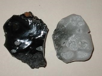
Wildland fires can impact archeological resources both directly and indirectly. Through post-fire observation and field experiments, archeologists learned how fire impacts diverse types of artifacts (Winthrop 2015). At more than 572°F, obsidian artifacts will bubble, crack, or even melt. A more subtle impact is heat alteration of the artifact surface such that it cannot be dated using the obsidian hydration method. Above 662°F, chert artifacts can fracture, develop fine cracks, shatter, and change in color. Sandstone, bone, or shell artifacts can undergo a range of effects from breaking apart to complete destruction (Winthrop 2015). In Yellowstone, the massive 1988 fires burned over much of the Obsidian Cliff National Historic Landmark with intensely hot crown fires. Post-fire observations by archeologists detected probable fresh fracturing, oxidation, and disintegration of materials at nearly all of the 59 archeological features associated with the cliff (Davis et al. 1995).

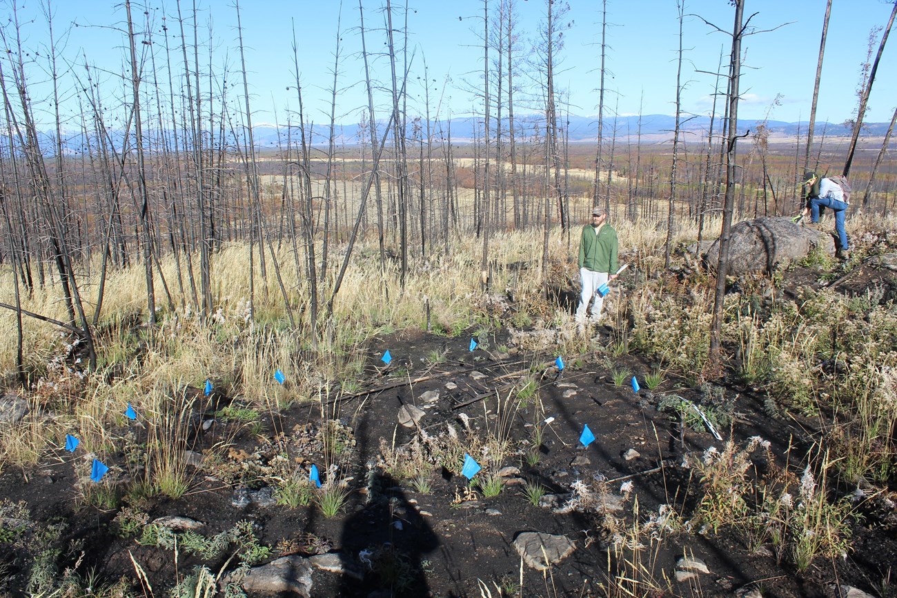
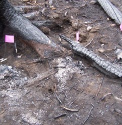
The most susceptible artifacts are those on or near the surface (figure 2 and 3). While most fires have minimal impacts below 5.9 in., organic remains such as pollen can be affected. More destructive impacts are the tipping of crown fire burned trees, completely disturbing soil over a large area, or when burning roots carry fire below the surface. When rains or winds follow, sheet or gully erosion can move or bury artifacts, altering their original context; and hearths or midden layers can be destroyed. An indirect effect is the exposure of sites previously concealed by vegetation, creating risk for illegal collecting of artifacts (figure 4).

A little known class of features present in the GYE are Native American wooden structures. Wikiups, or conical timber lodges, and their remnants have been recorded in dozens of locations in the GYE. These small, tipi-like log structures are of varying ages, with some probably being prehistoric. Some may be simple expedient shelters, while others may be associated with ceremonial activities (White and White 2012). Game drives, or sheep traps consisting of rock and brush arranged in fence-like lines up to 200 yards long, were designed to control the movement of sheep or other ungulates across the landscape to areas where they could be easily hunted (Eakin 2009, Lee and Puseman 2017). These rare feature types, documented in the Absaroka Mountains in the eastern part of the park, are highly vulnerable to destruction by wildland fire (figure 5).

Finally, fire fighting itself can impact archeological resources. The heroic efforts of wildland firefighters are often followed up by a little known but critical effort to assess and repair both direct effects of the fire and impacts from the firefighting response. Natural and cultural resource specialists survey burned areas to document the severity and extent of any damage from the fire or firefighting efforts on park resources. In YNP, burned areas are typically left to restore on their own, but tracks from firefighting vehicles or fire lines dug into the ground are typically repaired. Damage to archeological resources is documented and at-risk sites are recommended for follow-up investigations, including surface collection of artifacts or targeted excavations. Federal wildland fire policy is to deploy specially trained resource advisors alongside fire fighting crews with the goal of minimizing impacts to sensitive areas from fire lines and fire fighting vehicles, and to assess the condition of resources after the fire is over. Often that can involve documenting impacts and recommending ways to mitigate damages, such as recovering at-risk artifacts for long-term curation or restoring soil cover in affected areas.
When assessing any new site impacts, it is important to note that many sites may have already experienced impacts from human or natural causes. To better understand old versus new impacts, YNP archeologists monitor the condition of sites on a recurring basis, providing baseline data useful in identifying new impacts.
Photo -  ©A. Knapp
Figure 2. Fire damage to stone artifacts (adapted from Knapp 2006).

Photo -  ©A. Knapp

Figure 3. Left, unburned obsidian artifact, right, burned.

NPS Photo -  A. Steffen.

Figure 4. Prehistoric obsidian quarry exposed by wildland fire. Photo - ©D. MacDonald
Figure 4. Prehistoric obsidian quarry exposed by wildland fire.

Photo - ©D. MacDonald

Figure 5. Centuries-old sheep skulls near a prehistoric sheep trap were destroyed by a recent fire (from Eakin 2009). Photo - ©D. Eakin.
Figure 5. Centuries-old sheep skulls near a prehistoric sheep trap were destroyed by a recent fire (from Eakin 2009).

Photo - ©D. Eakin

Modeling Potential Wildland Fire Effects in a Changing Climate
Global climate models provide anticipated trajectories in temperature and precipitation change. At the park level, this information can be used to model how those changes will be manifested, for example as near-, medium-, or long-term changes to ecosystem processes and land cover. Models of potential impact can then be used for scenario planning to understand whether under a given scenario resources would become vulnerable to harm (NPS 2016). In this case, vulnerability expresses the sensitivity plus the exposure to new effects. The ability to adapt to the impact would mitigate the resource vulnerability. Because cultural resources, as static “time capsules,” cannot adapt to changing environmental conditions, managers are responsible for finding ways to increase their resilience to impacts.

Wildland Fire Models
Using a suite of fire behavior analysis systems that incorporate fire behavior models and geographic information, resource managers can model the spread of wildfires and burn probabilities across a given landscape under a specified set of terrain, fuels, and weather conditions.

In recent years, YNP began modeling archeological resource vulnerability under a potential climate change model (Cannon 2015). Locational modeling of how and where destructive fires could occur in YNP was used in tandem with modeling of where prehistoric archeological sites are most likely to be found. These models specified 1) changes in fire season temperatures and precipitation to understand change in the likelihood of destructive crown fires under historic and altered climate change scenario and 2) the likelihood of any location to be suitable for archeological sites in terms of proximity to perennial water and the slope of the landform.

One climate change model compared fire risk under historic weather conditions (using park fire season data for 1941-2015) to fire risk under projected weather conditions to measure change in the risk of wildland fire. Fire risk is a function of weather conditions (temperature, precipitation), topography (slope, aspect), and land cover (fuel loads), all of which can vary substantially across Yellowstone. The model considered elevation, slope, aspect, a wildland fire fuel model, canopy cover, canopy height, crown base height, and crown bulk density (Scott and Burgan 2005). Historical and projected weather data for the study area were obtained from ClimateAnalyzer.org (Tercek 2015). Thus, the risk factor was modeled pixel by pixel across the park, creating a parkwide map of fire risk, as low, medium, high risk. The historic model and the projected model (figure 6) were compared, showing where risk can change (Cannon 2015).

Archeological Site Location Probability Modeling
Archeologists are eager to understand past climate change as one factor that can explain the human past. Understanding future climate change is also of interest as a new risk to specific archeological resources. We need to know where those resources lie with respect to the fire risk map. The author created a site location favorability map that models the likelihood for prehistoric sites to occupy specific landform type. For example, the model indicates the most suitable site locations are within 400 yards of perennial water and where the slope is less than 10%. With this information in-hand, the altered fire risk for each class of site suitability (low, medium, high) was modeled. The results indicate that in areas under the climate change model conditions, fire risk in low suitability areas will remain unchanged, moderate risk areas will slightly decrease, and areas of high fire risk will increase by approximately 45%. This increase should be a red flag for managers concerned about at-risk resources should the model conditions become reality.

Ice Patch Archeology
In certain high altitude settings all over the world, conditions have promoted the formation and preservation of small but persistent patches of ice, some several thousand years old. As these ice patches are too small to flow downhill like glaciers, they can cryogenically preserve elements from their immediate locale for hundreds or thousands of years. Ice patches can preserve organic material such as pollen, seeds, plants, trees, bone, hair, entire animals, insects, dung, etc., and can also encapsulate human-made items. These materials are typically only preserved in dry caves, arid sites, bogs, and perennially frozen environments. Without preserved organic artifacts, archeologists in Yellowstone must infer lifeways using an extremely limited part of the total suite of objects past peoples created and used—typically only stone artifacts and charred organic remains.

At ice patches in the GYE, archeologists have recovered projectile points and shafts, basketry, wooden tools, butchered animal remains, and other artifacts from 200-10,000-years-old (Lee et al. 2014, Reckin 2014). Native American traditional knowledge suggests high altitude ice patches were important places for hunting, gathering, and ritual practices since ancient times. A key part of the story of human ice patch use is their role as favored hunting areas. Ice patches attract herbivores, such as sheep, that move upland in search of summer pastures, running water, and relief from biting insects. Ancient hunters understood this pattern, stalking and killing prey resting on the ice patches. Aerial images show active game trails near melting ice patches in Yellowstone (Lee 2014). Weapons and tools of wood, fiber, or stone would be lost or discarded in the act of hunting and processing game, eventually being encased in growing ice patches (figure 7). With the warming climate, these cryogenically preserved artifacts are slowly emerging.

A Greater Yellowstone Coordinating Committee-supported study has identified over 450 prospective ancient ice fields in the GYE that could contain archeological and paleobiological resources (Lee et al. 2014). While ice fields are inherently dynamic – being influenced by topography, accumulation rates, ice dynamics, and melt and evaporation rates – diverse and mutually reinforcing datasets show that across the Rockies and beyond, both ice patches and glaciers are in recent years retreating at an alarming rate. An analysis of stereophotography of glaciers in the Absaroka and Beartooth ranges in Montana has shown melt back rates of 1-8 ft. per year between 1952 and 2003 (Seifert et al. 2009).

Most ice patches in YNP are found on peaks in the Absaroka Range in the east and southeast parts of the park, above 8,000 ft. in elevation. They range in size from one half to hundreds of acres, found singly or in groups. Ice patches that are most likely to contain cultural material are near mountain passes, are not on steep slopes that would limit how animals could use them, and have minimal exposure to melt-inducing sunshine. Most ice patches contain preserved biological material accumulated over decades or centuries. A few in the GYE contain the remains of mature Engelmann and whitebark pine stands that grew during a brief warm period about 8,800 years ago when tree lines were significantly higher than today, then died and were encased in ice when the climate cooled. Spear points and arrowheads, bows, dart and arrow shafts, and remains of prey species such as bighorn sheep have been recovered in the Absaroka Range. Some of these artifacts have radiocarbon dates that range from 210-9,200-years-old (Lee et al. 2014, Lee and Puseman 2017).

Retrieving organic artifacts from these critically endangered ice patches is bedeviled by their remote locations. In most cases, accessing the areas requires days of hiking in and out of remote areas that are difficult to camp in and lack water or shelter from high winds. Missions must be timed to occur after newer snow cover has melted off, as exposed organic artifacts can crumble to pieces soon after exposure. The extreme perishability of many recently exposed artifacts is particularly troubling. Exposure also increases the risk of illegal collecting. In 2017, an individual was convicted of felony illegal collection of several artifacts from ice patches on public land, destroying much of their scientific value and their ability to be enjoyed by the public. Ideally one would continually monitor the ice patches for newly emerging materials, but doing so would be nearly impossible given the location of most ice patches. At best, archeologists get to the areas they can given the challenges and hope for a timely arrival.

Conclusions
If current climate change projections are correct, the observations and projections presented suggest an increased level of concern for irreplaceable resources. The climate threat forces a sobering reality, but also affords us new and powerful ways to conceive of park resources. Rather than considering our preservation mandate of park resources as minimizing threats to individual artifacts or sites, we now can think more broadly to how we can preserve the significant landscapes that contain these resources.

Future work should, of course, include strengthening the science needed to better understand future events and ways to respond to them. At present we do not have the tools needed to choose the most appropriate management action when new impacts are likely. What do we need to know in order to choose the right management strategy? Are triage methods appropriate, such as choosing among survey, salvage, hardening, or is doing nothing at all the correct course of action? Work on these tasks is now within our grasp if we choose.
All resource management decisions are made within a complex matrix of federal law and regulations, funding realities, agency policies, and the multitude of potential impacts resulting from agency action or inaction. The mandate of preservation of the nation’s treasures means we owe it to this and future generations to devise ways to do the best we can to preserve the resources we are charged with protecting.

Acknowledgments
Laura Cannon made significant contributions to this research presented as an NPS Young Leaders in Climate Change intern. Thanks to Dr. Craig Lee of INSTAAR, Dan Eakin, Dr. Douglas MacDonald of the University of Montana, and to the Yellowstone Center for Resources for continued support of this work.
Figure 6. Risk category change under historic and projected climate scenarios (acres).

Literature Cited

Cannon, L. 2015. Understanding climate change impacts to archaeological resources in Yellowstone National Park. Manuscript. Yellowstone Center for Resources. Mammoth, Wyoming, USA.

Chang, T., and A. Hansen. 2015. Historic and projected climate change in the Greater Yellowstone Ecosystem. Yellowstone Science 23:14-19.

Ciani, M.D. 2014 The bear in the footprint: using ethnography to interpret archaeological evidence of bear hunting and bear veneration in the Northern Rockies. Thesis. University of Montana, Missoula, Montana, USA.

Corbin, A., and M.A. Russell. 2010. Historical archeology of tourism in Yellowstone National Park. Springer Publications, New York, New York, USA.

Collins, M., R. Knutti, J. Arblaster, J.L. Dufresne, T. Fichefet, P. Friedlingstein, X. Gao, et al. 2013. Long-term climate change: projections, commitments and irreversibility. Pages 1029-1136 in T.F. Stocker, D. Qin, G.K. Plattner, M. Tignor, S.K. Allen, J. Doschung, A. Nauels, Y. Xia, V. Bex, and P.M. Midgley, editors. Climate change 2013: the physical science basis. Contribution of Working Group I to the Fifth Assessment Report of the Intergovernmental Panel on Climate Change. Cambridge University Press. Cambridge, Massachusetts, USA.

Curry, A. 2009. Climate change: sites in peril. Archaeology 62:32-35.

Davis, L.B., and A.M. Johnson. 1993. The 1989 Obsidian Cliff Plateau reconnaissance, Yellowstone National Park, Wyoming and the National Historic Landmark Nomination. National Park Service, Washington, D.C., USA.

Davis, L.B., S. Aaberg, J. G. Schmitt, A.M. Johnson. 1995. The Obsidian Cliff Plateau prehistoric lithic source, Yellowstone National Park, Wyoming. Selections from the Division of Cultural Resources No. 6. Yellowstone Center for Resources, Mammoth, Wyoming, USA.

Despain, D.G. 1990. Yellowstone vegetation: consequences of environment and history in a natural setting. Roberts Rinehart Publishers, Boulder, Colorado, USA.

Doss, P.K., and A. Bleichroth. 2012. Following the path of stone: obsidian artifacts from Indiana sourced to Yellowstone Plateau. Yellowstone Science 20(2):12-14.

Eakin, D. 2008. Evidence for Shoshonean mountain sheep trapping and early historic occupation in the Absaroka Mountains of northwest Wyoming. Manuscript. Office of the Wyoming State Archaeologist, Laramie, Wyoming, USA.

Eakin, D. 2009. Perishable Native American structures and related sites in the GYE of northwest Wyoming. Page 131 in R.E. Masters, K.E. Galley, and D.G. Despain, editors. The ’88 fires: Yellowstone and beyond conference proceedings. Tall Timbers Research Station, Tallahassee, Florida, USA.

Flannigan, M.D., K.A. Logan, B. D. Amiro, B. J. Stocks, and B.M. Wotton. 2006. Forest fires and climate change in the 21st century. Mitigation and Adaptation Strategies for Global Change 11(847–859).

Flather, R. 2003. Red Sowash and the Round Prairie Saloon. Yellowstone Science 11(4):14-16.

Fuller, M. 1991. Forest fires: an introduction to wildland fire behavior, management, firefighting, and prevention. Wiley Nature Editions, New York, New York, USA.

Hall, M.P., and D.B. Fagre. 2003. Modeled climate-induced glacier change in Glacier National Park, 1850 - 2100. BioScience 53: 131-140.

Gross J.E., M. Tercek, K. Guay, M. Talbert, T. Chang, A. Rodman, D. Thoma, P. Jantz, and J.T. Morisette. 2016. Analyses of historical and projected climates to support climate adaptation in the Northern Rocky mountains. Pages 55-77 in A.J. Hansen, W.B. Monahan, S.T. Olliff, and D.M. Theobald, editors. Climate change in wildlands. Island Press, Washington, D.C., USA.

Halofsky, J.E., D.L. Peterson, S.K. Dante-Wood, L. Hoang, J.J. Ho, L.A. Joyce. 2017. Climate change vulnerability and adaptation in the Northern Rocky Mountains. General Technical Report. U.S. Department of Agriculture, Forest Service, Fort Collins, Colorado, USA.

Hartmann, D.L., A.M.G. Klein Tank, M. Rusticucci, L.V. Alexander, S. Brönnimann, Y. Charabi, F.J. Dentener, et al. 2013. Observations: atmosphere and surface. Pages 159-254 in T.F. Stocker, D. Qin, G.K. Plattner, M. Tignor, S.K. Allen, J. Boschung, A. Nauels, et al., editors. Climate change 2013: the physical science basis. Contribution of Working Group I to the Fifth Assessment Report of the Intergovernmental Panel on Climate Change. Cambridge University Press, Cambridge, Massachusetts, USA.

Johnson, A.M. 2010. An overview of precontact archeology in Yellowstone. Yellowstone Science 18(1):24-28.

Johnson, A.M., and B.O.K. Reeves. 2013. Summer on Yellowstone Lake 9,300 years ago: the Osprey Beach Site. Plains Anthropologist 58.

Knapp, A. 2006. Archaeology under fire: the impacts of forest fire on archaeological inquiry. Poster presentation. 64th Plains Anthropological Conference, Topeka, Kansas, USA.

Lee, C.M. 2014. Archaeological survey of perennial ice patches on Table Mountain, Yellowstone National Park and the Trident Plateau, Yellowstone National Park and Bridger-Teton National Forest: results of the 2013 field season. Technical Report. Institute of Arctic and Alpine Research, Boulder, Colorado, USA.

Lee, C.M., R.L. Kelly, R. Reckin, I.L. Matt, and P.L. Yu. 2014. Ice patch archaeology in western North America. SAA Archaeological Record 14:15-19.

Lee, C.M., and K. Puseman. 2017. Ice patch hunting in the Greater Yellowstone Area, Rocky Mountains, USA: wood shafts, chipped stone projectile points, and bighorn sheep (Ovis Canadensis). American Antiquity 82:223-243.

Littell, J.S., M.M. Elsner, G. Mauger, et al. 2011. Regional climate and hydrologic change in the northern US Rockies and Pacific Northwest: internally consistent projections of future climate for resource management. Climate Impacts Group, University of Washington College of the Environment, Seattle, Washington, USA.

Littell, J, D.L. Peterson, K. Riley, Y. Liu, and C. Luce. 2016. A review of the relationships between drought and forest fire in the United States. Global Change Biology. 22(7):2353-69.

Livers, M. 2012. Stone circles in Yellowstone. Yellowstone Science 20(2):5-11.

Loehman, R.A., R.E. Keane, L.M. Holsinger, and Z. Wu. 2017. Interactions of landscape disturbances and climate change dictate ecological pattern and process: spatial modeling of wildfire, insect, and disease dynamics under future climates. Landscape Ecology 32(7):1447-1459.

MacDonald. D. 2018. Before Yellowstone: Native American archaeology in the national park. University of Washington Press, Seattle, Washington, USA.

MacDonald, E.H. 2012 Yellowstone archaeology: Southern Yellowstone. University of Montana Contributions to Anthropology Volume 13(2). University of Montana Office of Printing and Graphics, Missoula, Montana, USA.

Marcus, W.A., J.E. Meacham, A. Rodman, and A.Y. Steingisser. 2012. Atlas of Yellowstone. University of California Press, Berkeley, California, USA.

Melnick, R.Z., O. Burry-Trice, and V. Malinay. 2015. Climate change and cultural landscapes: research, planning, and stewardship. National Park Service, National Center for Preservation Technology and Training. University of Oregon, Eugene, Oregon, USA.

Nabokov, P., and L. Loendorf. 2002. American Indians and Yellowstone National Park: a documentary overview. Yellowstone National Park, Yellowstone Center for Resources, Mammoth, Wyoming, USA.

National Park Service (NPS). 2010. National Park Service climate change response strategy. National Park Service, Climate Change Response Program, Fort Collins, Colorado, USA.

National Park Service (NPS). 2015. Special issue: ecological implications of climate change on the Greater Yellowstone Ecosystem. Yellowstone Science 22:1-88.

National Park Service (NPS). 2016. Cultural resources climate change strategy. National Park Service, Cultural Resources, Partnerships, and Science and Climate Change Response Program, Washington, D.C., USA.

Park, R. 2010. A culture of convenience? Obsidian source selection in Yellowstone National Park. Thesis. Department of Archaeology and Anthropology University of Saskatchewan, Saskatoon, Saskatchewan, Canada.

Peterson, D.L., and J.S. Littell. 2014. Risk assessment for wildfire in the western United States. Pages 232-235 in D.L. Peterson, J.M. Vose, and T. Patel-Weynand, editors. Climate change and United States forests. Springer, New York, New York, USA.

Reckin, R. 2013. Ice patch archaeology in global perspective: archaeological discoveries from alpine ice patches worldwide and their relationship with paleoclimates. Journal of World Prehistory 26:323-385.

Reynolds, J.R, and A.M. Johnson. 2003. A volunteer’s perspective, and archeology 101. Yellowstone Science 11(3):10-13.

Romme, W.H,. and M.G. Turner. 1992. Global climate change in the Greater Yellowstone Ecosystem. Yellowstone Science 1(1):2-5.

Romme, W.H. and M.G. Turner. 2015. Ecological implications of climate change in Yellowstone: moving into uncharted territory? Yellowstone Science 23:6-11.

Scott, J.H., and R.E. Burgan. 2005. Standard fire behavior fuel models: a comprehensive set for use with Rothermel’s surface fire spread model. RMRS-GTR-153. U.S. Department of Agriculture, Forest Service, Rocky Mountain Research Station, Fort Collins, Colorado, USA.

Seifert, D., E. Chatelain, C. Lee, Z. Seligman, D. Evans, H. Fisk, and P. Maus. 2009. Monitoring alpine climate change in the Beartooth Mountains of the Custer National Forest. RSAC-0115-RPT1. U.S. Department of Agriculture, Forest Service, Remote Sensing Applications Center, Salt Lake City, Utah, USA.

Tercek, M. 2015 A seemingly small change in average temperature can have big effects. Yellowstone Science 23:70-71.

Tercek, M., A. Rodman, and D. Thomas. 2015. Trends in Yellowstone’s snowpack. Yellowstone Science 23: 20-27.

Thompson, L.G., H.H. Brecher, E. Mosley-Thompson, D.R. Hardy, and B.G. Mark. 2009. Glacier loss on Kilimanjaro continues unabated. Proceedings of the National Academy of Science. 106 (47):19770-19775.

U.S. Geological Survey. 2017. Retreat of glaciers in Glacier National Park. https://www.usgs.gov/centers/norock/science/retreat-glaciers-glacier-national-park

Winthrop, K. 2015. Bare bones guide to fire effects on cultural resources for cultural resource specialists. U.S. Department of the Interior, Bureau of Land Management. https://www.ncptt.nps.gov/articles/disasters/wildland-structural-fire/fire-and-cultural-resource-management-fire-preparedness-3/bare-bones-guide-to-fire-effects-on-cultural-resources-for-cultural-resource-specialists/

White, D.R.M., and K.L. White. 2012. Wikiups of the Greater Yellowstone Ecosystem: conical timber lodges within Bridger-Teton National Forest, Grand Teton National Park, Shoshone National Forest, and Yellowstone National Park. National Park Service, Yellowstone National Park, Yellowstone Center for Resources, Mammoth, Wyoming, USA.

Whitlock, C. 1993. Postglacial vegetation and climate of Grand Teton and southern Yellowstone National Parks. Ecological Monographs 63(2):173-198.
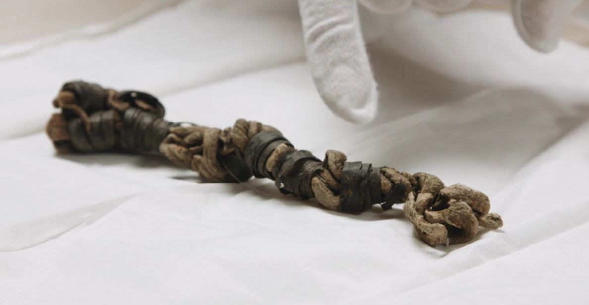
Figure 7. This  artifact may represent one of the first ice patch artifacts recovered in the Greater Yellowstone Area.

Photo - ©C. Lee

Figure 7. This artifact may represent one of the first ice patch artifacts recovered in the Greater Yellowstone Area. The artifact is composed primarily of plaited or twisted (not braided) leather partially covered with a coiled, blackish wrapping of organic material that may be bark from a chokecherry tree (Prunus virginiana). The artifact was collected on “melting snow” in the vicinity of a glacier that has been analyzed with repeat aerial photography. It appears the permanent snow and ice features in the area where this was found have undergone a significant decrease in snow and ice since the 1950s. The artifact was radiocarbon-dated to 1,495 ± 20, which makes it about 1,370-years-old (AD 558-578).

Part of a series of articles titled Yellowstone Science - Volume 26 Issue 1: Archeology in Yellowstone.

Yellowstone National Park

Last updated: July 20, 2022