Introduction

Diana Rapper
By Cathy L. Connor, Clay Good, Riley Woodford, and Michael L. Hekkers
The Gulf of Alaska’s rugged Pacific seacoast is characterized by extreme topographic relief that has been sculpted by glacier erosion in a rapidly uplifting landscape. Along this tectonically deforming plate margin, Alaska’s changing climate, powered by solar energy, drives the intense geochemical and mechanical weathering that disintegrates the rapidly uplifting bedrock. Deep geothermally-driven crustal dynamics along the Juan de Fuca spreading ridge far to the south ultimately results in extreme deformation along the shorelines of Glacier Bay National Park and Preserve. Over geologic timescales these tectonic forces deliver fresh rock to the surface, where it has been elevated into extreme topography like the 15,325’ (4,671 m) Mt. Fairweather located only 12 mi (20 km) from the sea. Training young Alaskans to observe as well as to understand how these earth processes have left their record in local landscapes, can inspire lifelong learning interests in the sciences (Whitmeyer et al. 2009).
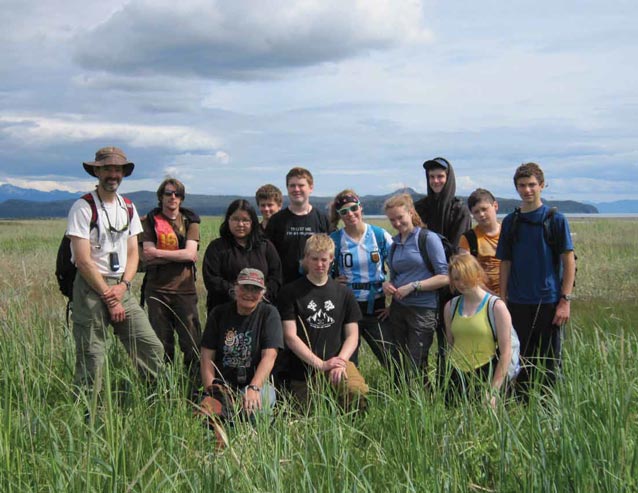
For four summers, between 2008 and 2011, the Alaska Summer Research Academy (ASRA) at University Alaska Fairbanks and the Design Discover Research (DDR) program at University Alaska Southeast provided authentic field experiences in Glacier Bay National Park in northern Southeast Alaska for homegrown high school students.
Getting Students to the Landscapes - Logistics

Marc Choquette
Glacier Bay National Park and Preserve lies on the mainland of the generally roadless Alexander Archipelago that is northern southeast Alaska. Inter-island and island-to-mainland access is made possible by the Alaska Marine Highway System (AMHS) ferries, private marine vessels, and small planes. Prior to 2011, access to this park from the state capital in Juneau only 80 miles away, was limited to expensive private boats, airplanes, or a challenging and time consuming kayak crossing of the wide fjords of Lynn Canal or Icy Strait.
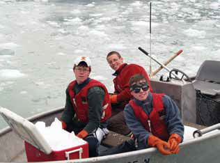
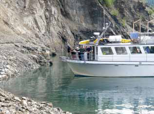
Beginning in 2008, University of Alaska faculty teamed with science educators linked through a grant to the Juneau Economic Development Council’s Springboard Program to create unique field science opportunities in Glacier Bay National Park for Alaska High school students (Connor et al. 2011). Initially the 60 ft (18 m) MV Glacier Seal served as our research vessel and floating field camp, transporting students from Juneau into Glacier Bay and back.
With the initiation of AMHS ferry service from Juneau to Gustavus in 2011, students brought bicycles onto the ferry and pedaled and hiked around on the large glacier outwash plain of Gustavus, just south of the National Park. They also traveled north over the Little Ice Age terminal moraine to GBNP headquarters in Bartlett Cove and accessed the upper bay by sea kayaks and tour boat shuttles. Students visited the bay’s active tidewater glaciers in the Reid Inlet, Johns Hopkins Fjord, and the Tarr Inlet area of the West Arm of the bay as well as the deglaciated landscapes of Muir and Adams Inlet on the eastern side of the park.
Over the 4 years of these summer science field experiences our Alaskan students hailed from all over the state including Kotzebue, Chuathbaluk, Fairbanks, Seward, Soldotna, Palmer, Wasilla, Anchorage, Petersburg, and Juneau. A few out-of-state students travelled to Alaska from Massachusetts, Minnesota, Illinois, Colorado, Texas, and California to participate.
Landscape Change

Melissa Skan
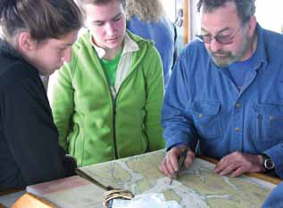
The authors served as a multi-disciplinary cadre of instructors who provided academic content, field support, and onsite mentoring for the students each summer to unpack the complicated glacial story of this national park. The National Park Service provided us with an excellent naturalist who accompanied us and provided local insight. The students were introduced to the scientific disciplines of glaciology, glacial geology, plate tectonics, plant succession, wildlife biology, ornithology, and disturbance ecology as well as the social sciences, specifically anthropology and its subdiscipline of ethnohistory. During onboard seminars and on-the-ground immersion into the park’s landscapes, students deployed marine instruments, surveyed plant and animal populations, and assessed the stratigraphic record. The faculty helped them assemble and interpret the key bits of information that they collected from each disciplinary area into a composite view of this region and to understand the longer time scale natural history of a changing landscape through cycles of glacier advance and calving retreat. The climatic impacts to the lives of sixteenth century HUNA Tlingit teenagers, who were forced by rapidly advancing glaciers to flee their homeland and to seek refuge across Icy Strait in Hoonah, were recanted to our 21st century teenagers through readings of published oral histories (Dauenhauer and Dauenhauer 1987).
Glacier Bay--The HUNA Tlingit Homeland

Riley Woodford
The indigenous people of northern southeast Alaska, the HUNA Tlingit, named their Glacier Bay Area homeland S’é Shuyee, “area at the end of the glacial silt” (HIA 2007). They identified their homeland as glacio-fluvial in nature, down to the grain size of the sediment. One of their important village sites was called L’eiwshaa Shakee Ann, “town on top of the sand mountain (dune)” and it existed between Point Gustavus and the Bear Track Mountains (HIA 2006), an area now inundated by the sea (Connor et al. 2009, Figure 6).
This very large terrestrial glacier outwash plain or glacier forefield was the existing landscape during this Neoglacial through Little Ice Age (LIA) period (5,000 years ago to ~1740 AD) of their residence time. The tall dunes or moraines could have provided leeward-side protection from the northerly katabatic winds blowing off the glacier, said to be far up the valley (Susie James in: Dauenauer and Dauenauer 1987). On the west side of the valley, in the present Berg Bay, the Chookanheeni clan members describe a meadow-lined river with clan houses of upstream and downstream family groups (Lily White personal communication with Wayne Howell NPS 2003).
Between 1724-1794, the up-valley glacier ice had advanced to the south over all of the Tlingit habitations in the lower-valley, and their surrounding outwash plain forests. This forced a mass human evacuation to Hoonah (Glacier Bay Story Susie James, in Dauenhauer and Dauenhauer 1987) across Icy Strait. The ice advance also erased the physical archeological record in the lower bay region, leaving oral histories an important source of data for landscape reconstruction (Figure 7).
By the time of arrival of the English explorer George Vancouver in 1794 with his cartographers, naturalists and scientists, the glacier, which had earlier extended beyond the present bay entrance, had begun a calving retreat. Master of the HMS Discovery, Joseph Whidbey, recounted grappling with a mass of ice bergs in Icy Strait and near the then glacier terminus at the newly exhumed Bartlett Cove, present site of Park Headquarter (Lamb 1984). When John Muir arrived 85 years later in 1879, the ice terminus positions had retreated to Tlingit Point (~24 mi (38km) NW of Bartlett Cove), and the glacier had retreated and separated into its tributary branches spanning the West Arm and Muir Inlet, opening up lower central Glacier Bay to marine waters (Burroughs and Muir 1899, Figure 8).
Since that time, the once coalesced ice mass has retreat 60 mi (100 km) up the bay, subdividing into even more glacier tributaries (Molnia 2006). The post-LIA landscape has uplifted 20’ (6 m) over the past ~200 years relative to sea level, with some sites pulsing upward at rates of 10” (25 cm)/yr (Larsen et al. 2005). Gustavus resident, Morgan DeBoer owns land north of the ferry dock, settled by his family 50 years ago when it was flooded by daily tides. Since then, his emergent nine hole golf course has the 21st century potential for further expansion with continued uplift of the shoreline along Icy Strait (Figure 9).
Observing Landscape Change over Century Timescales
The Little Ice Age terminal moraine separates Park Headquarters in Bartlett Cove from the broad outwash plain that underlies Gustavus and its airport. Hikes along Dude Creek (Figure 17), the Good and Salmon Rivers, and Glen’s Ditch Road and the Nature Conservancy’s Nagoonberry Trail east of the airport, enabled students to observe incision points into emergent subtidal sediments (Figure 12). Creek channels featured uplifted intertidal and subtidal marine sediments overlain by young stream deposits. These glacier forefield sites also provided excellent access to areas of active plant succession, and provided opportunities to observe the habitat and behavior of wolves, cranes, moose, bears, and marine waterfowl in this dynamic seacoast habitat along Icy Strait. Students conducted beach surveys to measure gradients (Figure 11, 18, 19, 21, and 25) and cored young spruce trees growing on glacial moraines and uplifting shorelines to obtain ages and calculate local uplift rates (Motyka 1998).
Glaciers and Oceanography-Comparing Seawater Salinity and Temperature Gradients near
Location of the salinity gradient or halocline near the ice termini of active tidewater glaciers helped students to identify the extent of the fresh glacier meltwater lens at the surface, overlying the denser saline marine waters. These data could be contrasted with the entirely glacier free and marine-dominated system in Blue Mouse Cove midway up the bay.
The tidewater Margerie and Johns Hopkins Glaciers showed a near-surface (-10’ (3m)) temperature inversion created by iceberg calving and submarine glacial meltwater rising to the surface. This contrasts with much warmer temperatures in nonglacial Blue Mouse Cove. The halocline or abrupt change in salinity was measured at Margerie and Johns Hopkins Glaciers by students to occur at 16’ to 23’ (5 to 7 m) below the surface over different summers. This contrasts with much warmer temperatures and deeper halocline (38’ (-11.5 m)) in Blue Mouse Cove.
During two of the summers students brought their own self-built, remotely operated vehicles (ROVS, Figure 26) which they deployed with underwater cameras to view the bay’s submarine environment. The ships hydrophone allowed us to listen for marine mammal communications and cruiseship noise in the underwater portions of Glacier Bay and Icy Strait.
Wildlife Ecology
Terrestrial surveys of older (two centuries) and newly deglaciated landscapes in the park enabled students to observe variation in marine invertebrate populations in the intertidal zones (Figures 25 and 27), ongoing plant succession, and large mammal population and bird densities in different regions in the park. Plaster casts were made of mammal tracks of interest (Figure 16) and birds identified during our traverses of the areas’ shorelines. Sea lions hauled out on Marble Island were sometimes identified by the numbers with which they had been branded and later reported to Alaska Department of Fish and Game researchers. Seabird colonies at Marble Island and adjacent to Margerie Glacier were excellent ornithology training sites for our students.
The Value of Field Science Experiences for High School Students
Students participated in all of the disciplinary activities during the field camp. About halfway through they selected areas of interest and were tasked with taking the lead on the collection and management of their data sets, pertinent to selected disciplines. Upon our return to campus, students analyzed their data and prepared presentation slides to share at a public forum attended by campus faculty, the local community and their family members.
Preparing for oral presentations required that they take seriously our faculty admonitions to organize and catalogue their massive quantities of digital photos and movie clips, as well as to think critically about the meaning of the spatial and temporal connections linking their specific data sets with their student colleagues and the change they had observed representing over two centuries in the upper and lower parts of the Glacier Bay. The students ended their experience much changed and more thoughtful about the place they call home, with a more visceral and personal understanding about the impacts of glacial ice to this very special national park.
Acknowledgements
Special thanks to former Juneau Economic Development Council Director, Dr. Lance Miller, and to Mary Hakala, former leader of the JEDC’S Springboard Science Education program. Both have shown unusual expertise at finding funds for and making possible authentic science experiences for Alaska’s youth. Thanks also to Steve Schaller and all the naturalists who helped us to make this a singular experience for Alaskan students.
Part of a series of articles titled Alaska Park Science - Volume 12 Issue 2: Climate Change in Alaska's National Parks.
Last updated: August 7, 2015
