Photograph by Ann Harding, Alaska Volcano Observatory, USGS
The National Natural Landmarks (NNL) Program was established in 1962 by the Secretary of the Interior under the authority of the Historic Sites Act of 1935
(16 U.S.C. 461 et seq.). Managed by the National Park Service, the primary goals of the program are to recognize and encourage the preservation of the best remaining examples of the major biotic communities and geologic features in the nation’s natural landscape. There are currently 591 sites designated in 48 states, 3 territories, and the Commonwealth of Puerto Rico.
Sites considered for possible NNL designation are identified primarily through inventory studies, such as the Works of Volcanism (Rose 1977), which identified many volcanic sites in Alaska as potential NNLs. Six of these sites have received NNL designation as outstanding examples of a variety of different volcanic structures. Stretching down the Alaska Peninsula, these volcanoes are important and dynamic landscape features that continue to affect human life and activities. Three are within National Park Service units and three in units of the National Wildlife Refuge System.
National Natural Landmarks Photo Contest. Photograph courtesy of Helena Buurman.
Aniakchak Crater
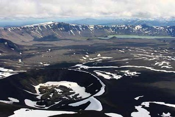
Aniakchak Crater, located 24 miles (39 km) southeast of Port Heiden on the Alaska Peninsula, is one of the world’s largest explosive craters, averaging 6 miles (10 km) wide and 2,000 feet (610 m) deep. Contained in the caldera is Surprise Lake, which is the headwaters of the Aniakchak River, the largest river flowing into the Pacific Ocean from the Alaska Peninsula. The interior of the caldera provides textbook examples of many volcanic features such as lava flows, cinder cones and explosion pits. The volcano’s most recent eruption occurred in 1931, when it hurled 15.4 cubic miles (64 km3) of debris out of its core, scattering it for 20 miles (32 km) over the surround-ing landscape. The topography and setting of the caldera make it climatologically unique in that it is able to generate its own weather. The caldera and its surroundings are in a pristine natural condition and visitation is infrequent.
Bogoslof Island
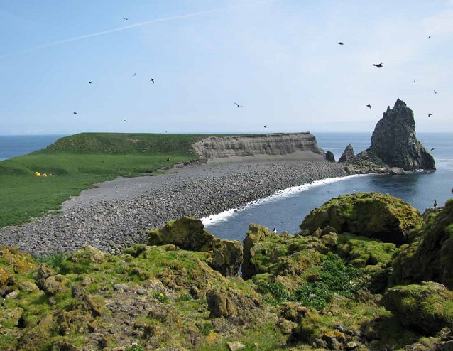
Bogoslof Island is a historic geologic feature 25 miles (40 km) north of Umnak Island in the Aleutian Archipelago. It is the summit of a largely submarine stratovolcano, and at least six volcanic island masses rose here in the past 130 years. Remnants of the last three erup-tions, the most recent in 1992, form the present island. Its major significance as a landmark is attached to the community of Steller sea lions that haul out on the island. Over 50,000 sea birds including puffins, murres, and rare red-legged kittiwakes use the island as a nesting ground. The swarming mass of sea lions and fur seals together with the sea birds on a relatively small island presents a biological spectacle. The colonizing plant communities that occupy a narrow band just above high tide line are of extreme value in botanical succession studies.
National Natural Landmarks Photo Contest. Photograph courtesy of Carol P Murdock.
Iliamna Volcano
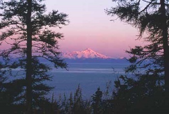
Iliamna Volcano, located 135 miles (217 km) southwest of Anchorage, is a typical cone-shaped volcano rising some 5,000 to 6,000 feet above the mountains of the Aleutian Range. It rises to a summit height of 10,016 feet (3,053 m) and is a typical stratovolcano composed of a sequence of lava flows and pyroclastic rocks. Iliamna Volcano is not a simple symmetrical cone, but is the northern-most and highest of four peaks within the landmark, which form a 3-mile (5 km) long ridge. Most of the volcano and its flanks are covered by snow and ice, and at least ten glaciers radiate from its summit. Little of the original constructional surface remains, as the volcano has been deeply dissected by erosional processes. The volcano has a relatively minor recorded history of volcanic activity. Present activity appears to be confined to two small sulfur vents located at about 9,000 feet (2,740 m) near the summit on the eastern face.
National Natural Landmarks Photo Contest. Photograph courtesy of Helena Buurman.
Mount Veniaminof
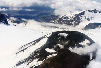
Mount Veniaminof is a unique active volcano of uncommon size. The caldera is almost six miles across, and contains a cupped ice field of 25 square miles (65 km2), the most extensive crater-glacier in the nation. Located on the Alaska Peninsula, Mt. Veniaminof is 20 miles (32 km) northeast of Port Moller on the Bering Sea and 20 miles northwest of Chignik on the north Pacific Ocean. It is the only known glacier on the continent with an active volcano vent in its center. Volcanic activity at the mountain has been recorded since 1830; major explosive eruptions occurred in 1838 and 1892. Often shrouded in clouds, Mt. Veniaminof has had numerous small eruptions in modern times, the last of which was in 2008. All recent eruptions have taken place from a cinder cone that pokes up through the ice in the caldera.
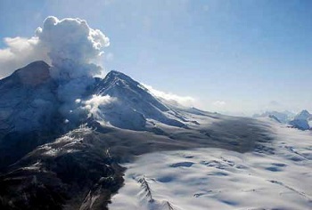
National Natural Landmarks Photo Contest. Photograph courtesy of Kate Bull.
Redoubt Volcano
Redoubt Volcano is an excellent example of a classic symmetrical stratovolcano. The volcano is a broad cone-shaped mountain about six miles in diameter at its base, and at a summit elevation of 10,197 feet (3,108 m), it towers some 5,000 to 6,000 feet above the surrounding rugged peaks of the Aleutian Range. The volcano is composed of layers of pyroclastic material, mud flows, and lava flows, and it rests on Mesozoic granitic rocks. Extensive glaciers and ice fields cover much of the volcano. It has a history of recorded volcanic activity dating back to 1778. The most recent eruptive period occurred in March 2009. The eruption was characterized by powerful ash explosions with resulting plumes between 30,000 to 60,000 feet (9,100 to 18,200 m) above sea level. The Alaska Volcano Observatory observed 11 major explosive events during the first week, and a total of 19 events over the 14-day eruptive period in March and early April. Redoubt is located 110 air miles (180 km) southwest of Anchorage.
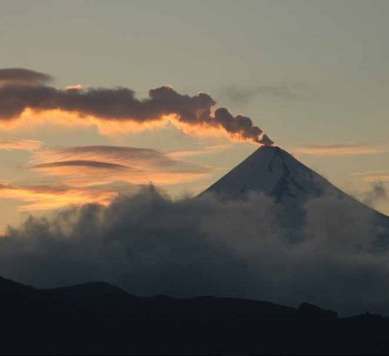
Photograph by Cyrus Read, Alaska Volcano Observatory, USGS
Shishaldin Volcano
Shishaldin Volcano is the tallest of 11 known volcanoes on Unimak Island. Eruptions have been recorded from the volcano since 1775, with major eruptions occurring in 1824 and 1830. It is active today and completely unpredictable, making extensive on-site study difficult. Located 50 miles (80 km) west of Cold Bay in the Aleutian Archipelago, the scenic aspects of this tall, symmetrical volcano are magnificent and make it readily identifiable. It was last active in 2008, but emits a steady plume of steam from a small summit crater.
References
Rose, R.H. 1977. The works of volcanism: sites recommended as potential natural landmarks. National Park Service. U.S. Department of the Interior.
Part of a series of articles titled Alaska Park Science - Volume 11 Issue 1: Volcanoes of Katmai and the Alaska Peninsula.
Last updated: October 26, 2021
