Part of a series of articles titled Alaska Park Science, Volume 18, Issue 1, Understanding and Preparing for Alaska's Geohazards.
Article
Geohazard Risk Reduction along the Denali National Park Road
Denny Capps, Denali National Park and Preserve
Douglas A. Anderson, Federal Highways Administration
Molly McKinley, Denali National Park and Preserve
Douglas A. Anderson, Federal Highways Administration
Molly McKinley, Denali National Park and Preserve

NPS/Denny Capps
Geohazards, are geologic processes that pose a risk to humans and infra-structure. Geohazards are: (1) generally forecastable events through scientific evaluation; (2) amenable to risk analysis based on probabilities; (3) subject to linkages between different geohazards and the physical environment (e.g., earthquakes and heavy rains can cause landslides); (4) causing increased impacts because of expansion of infrastructure; and (5) manageable through minimization of their consequences (Keller and Blodgett 2006). While managing geohazards is challenging, new programmatic tools are making it easier for park managers to improve safety and resiliency. This article provides an overview of Denali National Park and Preserve’s (hereafter “Denali”) geohazard risk reduction program.
Denali’s Geohazards
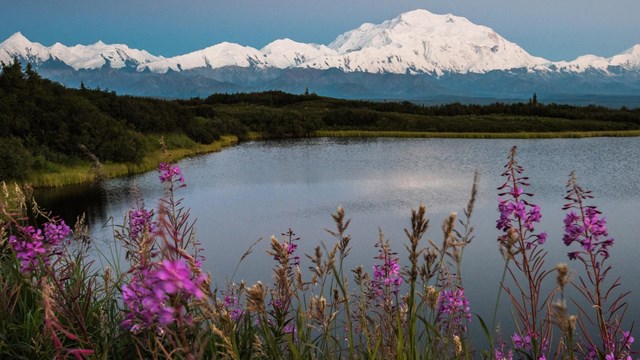
Denali is a prime location for the study of geohazards, with over 20,000 feet (6,000 m) of topographic relief, 1,400 square miles (3,700 km2) of glaciers (Loso et al. 2014), active tectonics, and widespread permafrost. A focus on geohazards is most relevant for the 92-mile (148-km) road that visitors and staff use to access the park. In 2017, Denali had approximately 600,000 visitors, resulting in $632 million in visitor spending, 8,150 jobs, and $924 million in general economic output (Denali National Park and Preserve 2018). As a result, Denali and the road represent a major economic engine for the region.

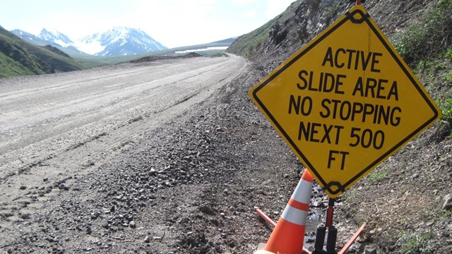
In Denali, geohazards include earthquakes, landslides, rockfall, debris (mud) flows, glacier outburst floods, ice and snow avalanches, river erosion/deposition, and others (Capps et al. 2017). While ice and snow avalanches have killed at least 49 mountaineers since 1976 and injured many others (Wright and Chenoweth 2012), landslides, rockfalls, and debris flows are the source of greatest concern because they have repeatedly blocked and damaged the Denali Park Road (hereafter “road,” Figure 1) and threatened the safety of visitors and staff. For example, the Igloo landslide has blocked the road numerous times, once for four days (Figure 2). Thankfully, these events have occurred in September and October, after Denali’s busy summer season. However, the 2016 Eagle’s Nest landslide occurred in July during the park’s busy season. This landslide blocked the road completely for four days and limited traffic for six more (Figure 3).


Risk management associated with geohazards varies depending on location. In the backcountry, particularly for mountaineers, individuals and teams generally must mitigate their own risks. Much of the allure of mountaineering is to combat and survive the often harsh and challenging environment. By contrast, in developed areas, there is an expectation that parks maintain a safe environment for visitors and staff. This is accomplished by managing visitor access and through education.
The Denali road is a front-country environment. The Alaska Road Commission (ARC) constructed the road between 1922 and 1938 to provide access for park visitors and staff and as a haul road for mining activities. Because of this dual purpose, the ARC had to adapt their methods from creating a series of tangents to the aesthetic design standards of the National Park Service (NPS). NPS standards required blending the road into the natural landscape so that the act of driving would be more interesting (Mathews et al. 2019). The State of Alaska and the NPS have nominated the current road alignment for listing in the National Register of Historic Places. Traffic on the road is restricted, with most visitors traveling in buses driven by highly trained staff. All other drivers are required to watch a Denali-specific training video that provides information about how to travel the road safely.
Influential Processes
Tectonics and climate greatly influence Denali’s geohazards. Plate tectonics motion creates the high topographic relief of the Central Alaska Range. High relief, in turn, creates slopes conducive to landslides, debris flows, and rockfall. Earthquakes occur daily in Denali, but most are too small for people to notice. Several are felt each year, particularly in the Kantishna area. More rarely, a large event occurs. For example, a M 7.9 earthquake struck 19 miles (30 km ) east of the park on November 2, 2002 (Alaska Earthquake Center 2016). This earthquake released more energy than all earthquakes in the lower-48 states over the previous 30 years combined (M. West, personal communication, June 15, 2015). The Alaska Earthquake Center, the U. S. Geological Survey (USGS), and various academic institutions lead research efforts on earthquakes and an extensive body of information is available on this topic. Earthquakes are particularly important because they can trigger landslides, debris flows, rockfall, and other associated hazards.
While they present challenges, these processes create many of the landscapes that we enshrine in national parks. For example, without earthquakes, there would be no mountains. Without mountains, there would be no Dall’s sheep (important for Denali’s foundation) or world-class scenery. Without sheep and scenery there would be no Denali. As Robert Sterling Yard (who cofounded the National Parks Conservation Association with Stephen Mather) stated, “Geology is the anatomy of scenery.” Denali’s geologic backbone draws many people to seek solace and test their outdoor skills in a rugged landscape.
Climate also substantially influences Denali’s geohazards. Recent climate records indicate that the mean annual temperatures are considerably warmer than the 1981-2010 30-year normal (+1.0°C in 2014 and 1.3°C in 2015; Sousanes 2016). Climate forecasts through the end of the century indicate that Denali is likely to experience increasing warming (~4.0°C) and heightened variability in seasonal precipitation (Gonzalez et al. 2018, Rupp and Loya 2009).
This anticipated warming will cause permafrost thaw, which can destabilize slopes. Subsurface temperature measurements indicate significant warming in Alaska since the 1980s. Greater permafrost warming has occurred on the North Slope (<4.0°C) with less (<1.0°C) occurring in the Denali region. Latent heat effects partially explain the lesser change in Denali as temperatures near 0°C (Osterkamp 2007, Romanovsky et al. 2010). Models indicate that approximately 75% of Denali was underlain by shallow permafrost during the 1950s and was reduced 50% during the 2000s. According to the model’s projections, shallow permafrost will only cover 6% of the park by the 2050s and 1% by the end of the century (Panda et al. 2014). Permafrost thaw and degradation is already influencing landslide activity in the park and modeling predicts even more activity. Rapid permafrost thaw increases landslide susceptibility by altering physical and hydrologic properties of hillslope materials, including reduced cohesion of the soils and increased hydraulic connectivity (Patton et al. 2019). These properties contribute to the occurrence of landslides on slopes as shallow as a few degrees.
Impacts
Geohazards physically threaten the safety of our visitors, staff, and resources. Therefore, our first and foremost goal is to use research to improve safety. The 1916 NPS Organic Act declares that we shall “conserve the scenery and the natural and historic objects and the wild life therein and to provide for the enjoyment of the same in such manner and by such means as will leave them unimpaired for the enjoyment of future generations.” The mandate to provide access as well as protect park resources implies a responsibility for visitor safety. Because Denali is very large (over six million acres) and remote, we focus attention on locations where visitors spend the most time. Here, the concept of exposure (i.e., whether or not people and assets are in areas prone to slope failures) is critical. To frame the idea, a geohazard affecting an occasionally used trail will have a lower exposure level than if it was threatening a busy road or housing area (Stock and Collins 2014). We must also be vigilant with the safety of our own staff, whose relative numbers may be low, but who often work for long periods in high-risk areas. Maintenance staff often work for hours, days, or sometimes even weeks at sites with known geohazards. These staff feel a sense of pride in keeping park infrastructure functioning, yet may not be fully cognizant of the risks they face in areas prone to geohazards.
Geohazards may also subject the government to tort claims, a civil process of seeking compensation for damages or harm. In common law jurisdictions such as a national park, individuals who suffer loss or harm may expect the government or government employees to hold legal liability for their safety. The information gathered from geohazards research also helps protect the government from successful tort claims by developing knowledge of the risk and expending funding where there will be a maximum benefit-to-cost ratio, such as rehabilitating deteriorating infrastructure in high-risk areas. Both federal (Merando v. United States 2008) and state (Helm v. State of Washington 2015) legal precedents demonstrate the effectiveness of this approach. In both cases, courts found that the U. S. Government and State of Washington, respectively, were not liable for damages incurred because they demonstrated appropriate use of a proactive, strategic approach to managing their hazards.
Improving Safety and Resiliency
Another goal of our geohazard research is to improve the resiliency of park infrastructure. Resilient infrastructure will enable minimal disturbances to the current traffic and use patterns for both park staff and associated businesses. With visitation numbers in Denali and other Alaska national parks increasing, we appear to have entered into a new normal of increased geohazards and risk threat. This is caused by a combination of increased load-carrying capacity needs (resulting in greater human exposure), changes in climate, and associated geotechnical asset deterioration (road cuts, embankment slopes, etc.).
Denali has worked to improve resiliency since the earliest days of the park. For example, in 1927 Alaska Road Commission President James G. Steese wrote:
Opening up frozen ground and completing a standard road in one season is impossible . . .
It is cheaper and better in the long run to extend operations over several seasons. The final surfacing should not be applied until sub-grade has thoroughly thawed out, become drained, and stabilized (Steese 1927).
The 2013 Igloo landslide (Figure 2) kick-started Denali managers into a more proactive stance on geohazards. This event occurred concurrently with the development of the Unstable Slope Management Program for Federal Land Management Agencies, or USMP (Federal Highway Administration–Federal Lands Highway Division 2019). Denali joined development of the USMP in the early stages and remains active in its implementation.
Through the USMP system, Denali and the Federal Highways Administration (FHWA) have quantified and are tracking over 140 unstable slopes along the road. We’ve also conducted a Quantitative Risk Assessment (QRA) of the top-ten highest-ranking USMP sites to help inform future risk reduction (Capps et al. 2017). We are now developing conceptual designs for all high-ranking USMP entries. Conceptual designs and estimated costs provide a range of risk reduction techniques for park management to choose what they deem as most appropriate. These designs will range from relatively simple education and outreach efforts (e.g., appropriate signage) to complex engineering projects. Program managers will then proactively seek funding for sites where benefits outweigh costs, thus completing the first USMP cycle. As new events or new activities at preexisting sites develop, we will (re)evaluate them, re-sort all USMP scores, and work through the prioritization process using the benefit/cost analyses, as previously described.
A landslide inventory database (Capps et al. 2017) records the spatial and temporal distribution, relative activity, and geomorphic attributes of all known landslides within the road corridor. The USMP, in contrast, only records unstable slopes that have previously affected the road or trails. Adjacent landslides provide useful contextual information about conditions along the road. Using this inventory, we created a susceptibility model to estimate landslide probability along the road corridor (Capps et al. 2017). [See the interactive Geotechnical Asset Management Program story map.]
Denali and the USGS are working together on two projects. One began in 2017 to produce a digital map and database of the surficial geology and associated processes along the road corridor. To properly understand and reduce the risk of geohazards, park managers must know the substrate and understand its associated processes. We expect to complete this five-year project in 2021. The second project planned to begin in 2019 will determine our vulnerability to geologic hazards. Reducing and managing risks requires an understanding of not only the hazards, but also how facilities, infrastructure, staff, and visitors are vulnerable. Understanding the vulnerability of people and facilities to geohazards involves characterizing their exposure, sensitivity (i.e., pre-existing infrastructure conditions and demographics of at-risk individuals), and adaptive capacity (i.e., the ability to avoid hazards before negative impacts occur either due to effective evacuations of individuals or the movement of infrastructure out of high-risk areas; N. J. Wood, personal communication, March 19, 2018).
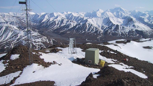
FHWA planned and supervised numerous geo-technical borings and surveys for unstable slopes along the road. FHWA has instrumented some of these borings to monitor water level, temperature (for seasonal frost and permafrost), and land displacement. A team of government and university researchers is using this data to fine tune thermal, deformation, and rockfall models. The models will, in turn, inform appropriate conceptual designs, benefit/cost assessments, and eventual risk reduction. The U.S. Army Corps of Engineers Cold Regions Research and Engineering Lab also deployed a suite of complementary geophysical techniques to determine the presence of permafrost and depth to bedrock along approximately 10 miles (16 km) of road that has experienced past geotechnical challenges (Bjella et al. 2017).
Summary
Geohazards always have been, and always will be, part of Denali. To maximize safety, resiliency, and the wisest use of our resources, we should continue to manage geohazards proactively. This requires a substantial and sustained effort and a range of new programmatic tools are now making this easier.
In the future we hope to: (1) support additional permafrost studies in areas where permafrost thaw may be a contributing factor to instability; (2) instrument and monitor additional sites of concern; (3) refine the landslide susceptibility modeling; (4) maintain the USMP; (5) improve funding structures; (6) continue implementation of risk reduction; (7) maintain and expand our network of partners; and (8) increase geohazard awareness. While these efforts will reduce the risk from geohazards along the road, we never can fully eliminate this risk in such a dynamic environment.
Learn more about geohazards in Denali.
Acknowledgements
A large number of individuals and organizations made this research possible. We would like to thank participating staff and students from: all divisions of Denali National Park and Preserve; the Federal Highway Administration-Western Federal Lands Highway Division; NPS Alaska Regional Office; NPS Geological Resources Division; the USGS Geosciences and Environmental Change Science Center, and Western Geographic Science Center; Montana State University and Western Transportation Institute; Colorado State University, University of Alaska Fairbanks, University of Alaska Anchorage; Landslide Technology; Alaska Department of Transportation and Public Facilities, the Army Corps of Engineers, and many others.
References
Alaska Earthquake Center. 2016.
Earthquake Monitoring in Denali. Available at http://www.nps.gov/articles/denali-earthquake-monitoring.htm (accessed October 10, 2018)
Bjella, K., S. Saari, A. Balser, and A. Staples. 2017.
Denali National Park Road - Geophysical Investigations: Subsurface Features for the Park Entrance, Dog Kennels Loop, Igloo Forest, Polychrome Pass, and Stony Point Areas: Cold Regions Research and Engineering Laboratory, U.S. Army Engineer Research and Development Center, Western Federal Lands Highway Division Geotechnical Report No. 03-17.
Capps, D. M., R. Rosenberg, A. Collins, D. A. Anderson, S. Hooper, H. Rogers, B. Collins, and E. Bilderback. 2017.
Geohazards Risk Assessment of the Denali National Park Road, in Proceedings North American Symposium on Landslides, Roanoke, VA. Association of Environmental & Engineering Geologists.
Denali National Park and Preserve. 2018.
Park Statistics. Available at: https://www.nps.gov/dena/learn/management/statistics.htm (accessed December 18, 2018)
Federal Highway Administration, Federal Lands Highway Division. 2019.
Unstable Slope Management Program for Federal Land Management Agencies, Publication No. FHWA-FLH-19-002.
Gonzalez, P., F. Wang, M. Notaro, D. J. Vimont, and J. W. Williams. 2018.
Disproportionate magnitude of climate change in United States national parks. Environmental Research Letters 13: 12.
Helm v. State of Washington. 2015.
Tracy Helm and Christopher Helm, husband and wife, Michael Brady Helm, a minor, and Hailey Nicole Helm, a minor v. State of Washington, Department of Transportation, a division of Washington State government, and Paula J. Hammond, Secretary of Transportation, Court of Appeals of the State of Washington, p. 1.
Keller, E. A. and R. H. Blodgett. 2006.
Natural hazards: Earth’s processes as hazards, disasters, and catastrophes, Upper Saddle River, NJ, Pearson Education, Inc., 395 p.
Loso, M., A. Arendt, C. Larsen, J. Rich, and N. Murphy. 2014.
Alaskan national park glaciers - status and trends: final report: National Park Service, Natural Resource Technical Report NPS/AKR/NRTR—2014/922.
Mathews, L., R. Z. Melnick, R. Edmonds, E. San Filippo, and M. Murthy. 2019.
Cultural Landscape Report for Mount McKinley National Park Road Historic District: Denali National Park and Preserve, Alaska.
Merando v. United States. 2008.
Anton Merando, as General Administrator and Administrator AD Prosequendum of the Estates of Kathleen Merando and Kaylyn Merando, Appellant v. United States of America; County of Sussex; Township of Walpack; Public Service Electric and Gas; John Does 1-10 (Said Names Being Fictitious); XYZ Corps. 1-10 (Said Names Being Fictitious); Jersey Central Power and Light. Court of Appeals for the Third Circuit.
Patton, A. I., S. L. Rathburn, and D. M. Capps. 2019.
Landslide response to climate change in permafrost regions: Geomorphology 340(1): 13.
Rupp, S. and W. Loya. 2009.
Projected climate change scenarios for Denali National Park & Preserve: University of Alaska Fairbanks, Climate change summary reports of National Parks, Preserves and Monuments.
Sousanes, P. 2016.
Denali Climate and Weather Monitoring. Available at https://www.nps.gov/articles/denali-crp-climate-weather-monitoring.htm (accessed December 18, 2018)
Steese, J. 1927.
Letter from James Steese to Arno Cammerer, Assistant Director of the National Park Service, Denali National Park archives.
Stock, G. and B. Collins. 2014.
Reducing rockfall risks in Yosemite National Park. Eos 95(29): 2.
Wright, K. and T. Chenoweth. 2012.
Historical analysis of avalanche fatalities in Denali National Park, in Proceedings 2012 International Snow Science Workshop, Anchorage, AK, International Snow Science Workshop, p. 8.
Learn More About Geology and Geologic Topics in Denali
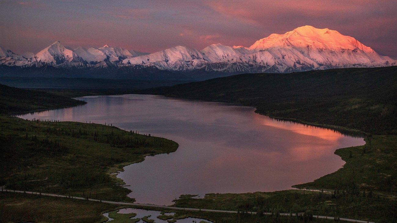
Mount McKinley and the Alaska Range
The Alaska Range is a 600-mile long arc of mountains that features North America's tallest mountain, Mount McKinley.
Landslides
Remnants of landslides and slumps can be seen along the park road. Learn more about this geohazard in Denali.
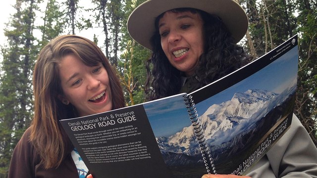
Denali Geology Road Guide
Discover what geologic features can be seen from the park's 92 mile road using this free downloadable book (PDF 8.6 MB).
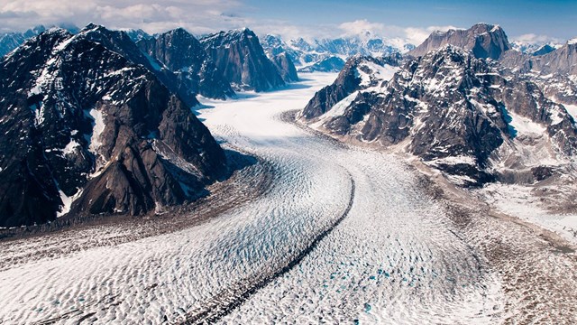
Glaciers
Glaciers cover one million acres, or one-sixth of Denali National Park. Learn more about this land that is sculpted by ice.
Denali or Mt. McKinley?
What's in a name? Surprisingly, a lot. Learn more about what the mountain is called and why.
Earthquakes
Earthquakes are frequent in the Denali area. It is estimated that there are 600 seismic events of a magnitude of 1 or higher in the park.
Last updated: January 31, 2025