Part of a series of articles titled Alaska Park Science, Volume 18, Issue 1, Understanding and Preparing for Alaska's Geohazards.
Article
Addressing Earthquake and Tsunami Hazards in Alaska Parks
Geophysical Institute, University of Alaska

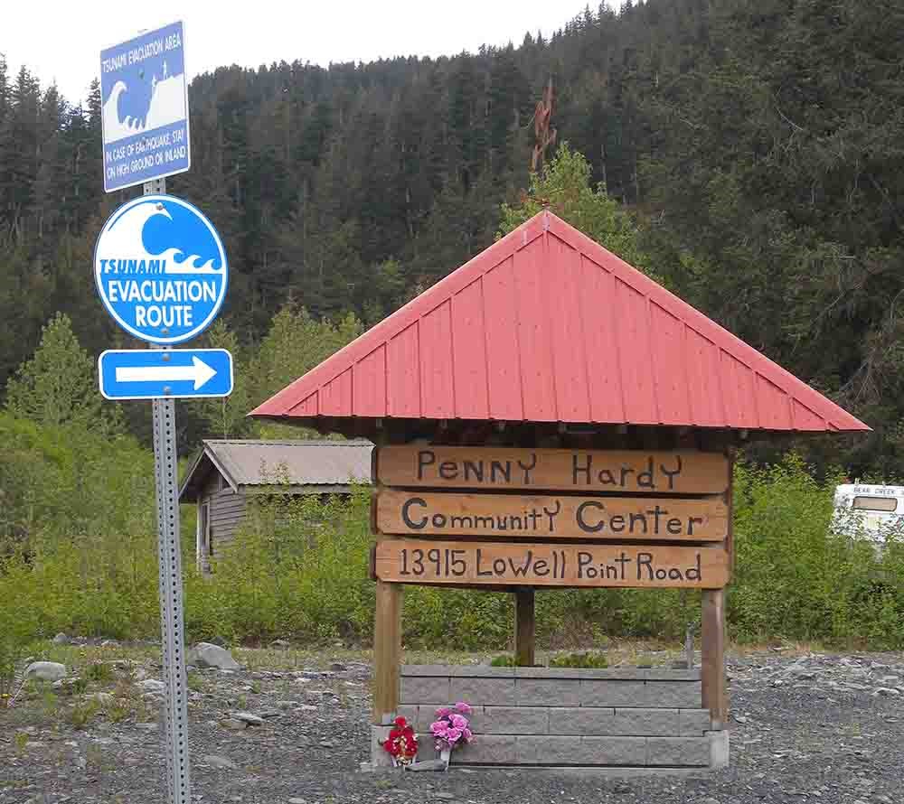
Photo courtesy of Alaska Earthquake Center
Alaskans who lived through the 1964 magnitude 9.2 Great Alaska earthquake described shaking so fierce that it felt like being tossed in a boat on the sea. This shaking triggered landslides, avalanches, and ground failures all across southern Alaska. The tsunamis that ensued were responsible for more than one hundred casualties. This pattern of violent earthquakes followed by deadly tsunamis has been a constant throughout Alaska’s historical record (Lander 1996). Diaries from the Russian period describe canoes full of men lost and villages washed away by tsunamis after strong earthquakes. Many older stories passed down by Alaska Native groups contain themes of violent ground shaking and waves washing people into the ocean.
An event comparable to 1964 would play out differently now (West et al. 2014). Alaska is far more populated and has infrastructure and critical facilities only dreamed of fifty years ago. But the earthquake remains a useful case study for Alaska’s national parks. Away from the coast, many visitors and employees are likely to be outside or in relatively modest structures where most should be fairly safe, even though park infrastructure might be severely damaged. In coastal parks, the opposite is true. Alaska’s fjords, beaches, and bays—the very features that draw visitors—are some of the most dangerous places a person could be when a major quake strikes.
This illustrates two points about earthquake hazards in Alaska’s national parks. First, the parks’ hazards are as different as the parks themselves. Second, earthquake hazards are inseparable from what makes the parks valuable in the first place. Southeast’s dramatic coastline and the Denali Massif’s incredible relief are products of the forces that shaped and continue to shape the parks. Earthquakes and tsunamis are as much a part of what makes the parks wild as bears and wolves. Just like dangerous wildlife, the perspective of park managers should include not only how to keep people safe, but also how to convey awe for the powerful role that these forces play in the park.
In this article, we will offer a brief outline of Alaska’s earthquake activity as it relates to the national parks, followed by a discussion of preparedness for earthquake and tsunami disasters. We will also point to some resources that can help park managers to plan, and we will describe an approach to contextualize the hazards that we feel might connect with visitors.
Earthquakes in Alaska
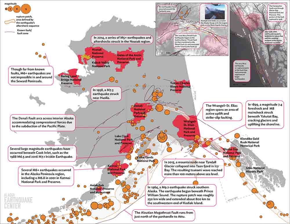
To understand earthquakes in Alaska’s parks, start by looking at the landscape itself (Koehler 2013). On a map of Glacier Bay National Park and Presere, you will see the Fairweather Fault marked by a deep trough that parallels the coast and separates the coastal foothills from the Fairweather Range. Looking at this feature, it is easy to imagine the tectonic plate under the Pacific Ocean sliding north beside Alaska’s panhandle. Motion along this fault is quite fast, about two inches per year, so the Queen Charlotte-Fairweather Fault system regularly produces major strike-slip earthquakes in the magnitude 8 range. To give an idea of how active this fault is, the 2013 magnitude 7.5 earthquake near Craig re-ruptured a part of the fault that had previously ruptured as recently as 1949, in a magnitude 8.1 earthquake (Holtkamp and Ruppert 2015).
To the north, the intersecting mountain ranges in Wrangell-St. Elias National Park and Preserve reveal the complex interactions of this plate impinging on southcentral Alaska. This interaction is complicated by the so-called Yakutat block—a piece of ocean crust carried northward along the Fairweather Fault that is being slowly scraped off onto North America. In 1899, this collision produced two magnitude 8 earthquakes near Yakutat Bay, triggering tsunamis and causing as much as 45 feet (13 m) of permanent uplift. The entire area is extremely active seismically, and even small earthquakes there can trigger huge landslides capable of setting off megatsunamis in the region’s narrow fjords and bays.
Continuing north, the Yakutat block collision plays a role in driving the Denali Fault that connects Wrangell-St. Elias to Denali National Park and Preserve in a great mountainous arc. One-hundred-ninety miles of the central part of the fault ruptured in 2002 together with segments of neighboring faults. The combined magnitude 7.9 earthquake caused heavy damage to sections of the Richardson Highway and Tok Cutoff and triggered numerous landslides and avalanches, but caused no major injuries. The western end of the fault, which runs through Denali National Park and Preserve, did not rupture in 2002 but can be expected to produce a comparable earthquake in the future.
So far, our tour of Alaska tectonics has skirted around the best-known hazard. From just north of the panhandle all of the way west to Attu Island, every southern and coastal National Park Service location is at risk from great earthquakes along the megathrust fault where the Pacific Plate subducts under the North American Plate. These earthquakes can exceed magnitude 9 and generate devastating, Pacific-wide tsunamis. In addition to these infrequent events, the subduction zone generates many strong, shallow earthquakes along crustal faults as well as deeper earthquakes within the subducting slab. The 2018 magnitude 7.1 Anchorage earthquake is a recent example of the latter.
Elsewhere in the state earthquakes occur in places where many Alaskans might not expect them (Koehler et al. 2018). Over the last century, magnitude seven earthquakes have struck across the Fairbanks region, and another magnitude seven struck near Huslia (Davis 1960), south of Kobuk Valley National Park and Gates of the Arctic National Park and Preserve. Magnitude six earthquakes have occurred on the Seward Peninsula and the Norton Sound coast. In 2014, a vigorous swarm roughly between Noatak National Preserve and Red Dog Mine persisted for months and produced five magnitude 5.8 earthquakes. These proved to be more of a nuisance than a danger, but the initial quakes did cause minor structural damage in Noatak.
Despite this history, there are large gaps in our knowledge of seismic hazard, especially in western and northern Alaska. Because they are more sparsely populated and less seismically active than southern Alaska, the scientific community has historically put far less effort and resources into researching and monitoring them—though that has been changing recently. Researchers continue to investigate and assess the hazards in each of these regions. But the earth continues to surprise us as well with events that were not previously on our radar.

Preparing for Earthquakes in the Parks
Not only can damaging earthquakes happen at any time, but they do, and frequently. In the half century following 1964, Alaska has been generally lucky. Recent offshore magnitude 7.9 events have not generated deadly tsunamis. The 2002 Denali fault earthquake caused damage but no loss of life, and the magnitude 7.5 Craig earthquake occurred far enough offshore that it had only modest impact. The most impactful earthquake in recent time is unquestionable the 30 November 2018 earthquake north of Anchorage. Despite considerable damage, Alaska fared comparatively well considering the strength of shaking. There are clear demonstrations from this event about the important role of building codes and public education campaigns over the years prior to the earthquake. The impact was also lessened by the location of the earthquake which was nearly 31 miles (50 km) below the surface. Any of these earthquakes could have been devastating if they had happened closer to towns or cities or had they triggered tsunamis. In the middle of the last century, earthquakes in 1946, 1958, and 1964 all caused loss of life in or outside of Alaska.
Given this frequency, park managers should understand that there is a realistic chance they will be part of a disaster response during their careers. Its strikes us as prudent to include this specifically in staff training.
There are a lot of buzz words in emergency management, but the concepts are straightforward and can be lumped into to two categories: (i) reducing the risks before disasters occur, and (ii) building resilience to respond and bounce back when they do. By far, the lowest hanging fruit is identifying and reducing vulnerabilities. For parks, this means assessing facilities for dangers they might pose to occupants and seeking ways to reduce damage to those facilities. This includes buildings, bridges, docks, and any type of precariously perched, or aerial, infrastructure. While close inspection can at times turn up significant structural short-comings, more frequently the fixes will be easy and economical such as buttressing fuel containers, securing building frames to their foundation, or anchoring cabinets, shelving, and computers in place. Administrative facilities, though perhaps less glamorous than other National Park Service (NPS) assets, should not be overlooked. These facilities play essential roles during the response effort, but only if they weather the strong shaking and retain their core capabilities—electricity, heat, water, phone, internet, transportation, etc. Managers should be particularly attuned to the secondary impacts of strong shaking. Soil failure, slumping, landslides and avalanches are common risk multipliers during earthquakes. These factors may be particularly acute for some NPS facilities located in remote and dramatic settings.
The Federal Emergency Management Agency (FEMA) promotes an economical method for evaluating buildings called Rapid Visual Screening (RVS). The RVS approach looks at factors such as age and type of construction to identify vulnerabilities and prioritize improvements. Rapid Visual Screening does not eliminate the need for more in-depth assessment, but it acts as a sort of triage for determining which facilities should be prioritized. RVS results can also provide strong arguments when seeking funding to upgrade or retrofit facilities. Under the leadership of the Alaska Seismic Hazards Safety Commission, many of Alaska’s schools have been assessed in the last few years using the RVS method, at a cost of under $1,000 per building (State of Alsaka 2019).
Many different activities can help build re-silience. Developing written plans for responding to earthquakes, creating inspection checklists, training staff, and educating visitors are all excellent steps toward building resilience. Realistic planning requires imagining what scenarios are likely. What if an earthquake renders park roads impassable for days? What happens when a park’s administrative offices lose power or become unsafe? Consider distant earthquakes as well. For example, extensive damage in Southcentral could disrupt deliveries and leave visitors stranded at parks that were otherwise unaffected by an earthquake. Envision as many plausible scenarios as possible. Earthquakes consistently surprise us. In 1964, nobody anticipated that Alaska would experience the second largest earthquake ever recorded. But the strength of the magnitude 7.9 Denali fault earthquake 16 years ago was a surprise too, as was the January 2018 magnitude 7.9 offshore Kodiak. One fact we can almost certainly count on is that the next big earthquake will be different from what we have seen historically.
In a significant disaster response, NPS personnel would presumably fall under the interagency coordination defined by FEMA’s Incident Command System (ICS). The numerous ICS certification courses available, both on-line and in-person, give managers an easy way to provide professional development opportunities for staff while simultaneously enhancing NPS’s earthquake planning and response.
No disaster response is perfect, and even the best planning will need to be augmented by considerable improvisation. Painful as these lessons can be, building resilience is an iterative process in which the lessons of each disaster (or disaster averted) help us to build and plan more effectively for the next one.

Photo courtesy of Chris Larsen, University of Alaska Fairbanks Geophysical Institute
Preparing for Tsunamis in the Parks
The first step is to recognize that most, though not all, tsunamis will come as part of the aftermath of an earthquake. Many people’s ability to respond to a tsunami may be greatly hampered by the earthquake itself. This might include computers broken on the floor, inoperable phone lines, or essential staff who left to go check on family. As 1964 demonstrated so clearly, earthquakes and tsunamis are often part of the same bad day.
On paper, the process of identifying tsunami hazards is relatively clear. People and facilities are either located within a tsunami hazard zone, or they are not. Risk reduction is largely accomplished by minimizing the permanent assets inside a tsunami hazard zone. One exception to this is the construction of so-called vertical evacuation structures. These structures can provide good alternatives to evacuation in places where there are significant numbers of people and less-than-ideal evacuation routes.
Investing in response efforts is particularly valuable for tsunamis. Unlike many hazards, in some cases we are aware of tsunamis minutes to hours before they strike. While there are not many response activities that can protect buildings and facilities, there is considerable potential to save lives if response plans can be executed rapidly. Response efforts should be two-pronged. In some situations there may be a formal tsunami warning notice distributed by the National Oceanic and Atmospheric Administration (NOAA). If so, it is imperative that managers have pre-determined plans that can be put into motion immediately. But many tsunami incidents may not be preceded by an official warning. The second prong of the response is to teach staff as well as visitors the warning signs of potential tsunamis in advance (e.g., ground shaking that is “strong and long,” waters receding or advancing very quickly, loud rumbles.)
Maritime traffic may be where response pays off the most for many Alaska parks. Narrow fjords, inlets, and channels can amplify ocean currents created by passing tsunamis. Though the waves may not be high, the currents they create can far exceed anything occurring from tides or storms. For kayakers, fisherman, day-tours, and cruise ships, even modest advance notice might be the difference between being in a safe location, and being subjected to powerful destructive currents. Marine-band radio provides some good options. As remote communications become increasingly common, even in the backcountry, NPS would do well to consider how to ensure tsunami warnings are disseminated and received as widely as possible.
One caveat to consider is that, to date, most of Alaska’s tsunami hazard mapping efforts have focused on communities, not parks. However, the state has well-developed procedures and professionals who can work with managers to determine local needs and then execute advanced modeling to assess the particular tsunami hazards.
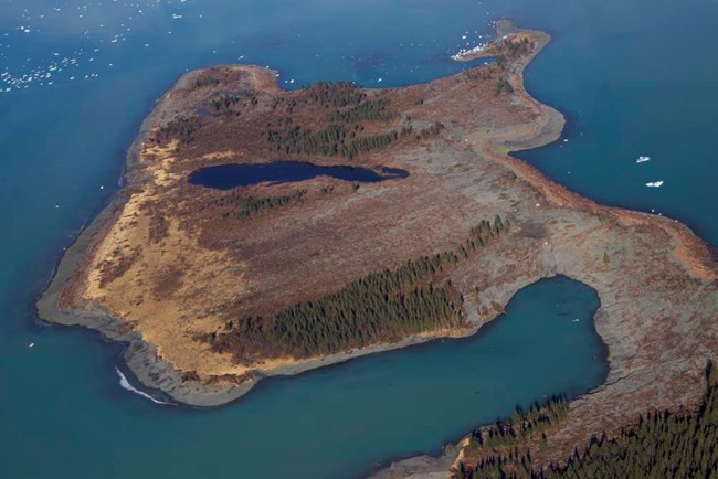
A second important caveat is that most tsunami resources, including warning systems and mapped hazard zones, have been developed for a range of well-understood scenarios generated by earthquakes and submarine landslides. Massive so-called mega-tsunamis, such as the 1,700-foot (518 m) Lituya Bay wave in 1958, or the Taan Fjord landslide and tsunami in 2016 are currently outside the scope of any systematic hazard assessment. It is tempting to treat these as “black swan” events that are so unique and rare that, like meteor impacts, we simply cannot plan for them. At some point, however, Alaska will need to come to terms with these mega-tsunami events. Alaska’s coastal history makes quite clear that they are not rare, and there is some suggestion that the frequency of these events may be increasing as climate change and receding glaciers destabilize coastal terranes.

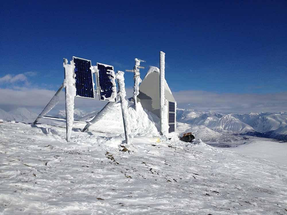
Photo courtesy of Chris Bruton, Alaska Earthquake Center
Engaging Park Visitors
NPS is unusually well-acquainted with operating facilities in hazardous environmental conditions. NPS is also experienced with how to educate and manage visitors exposed to environmental risks—extreme weather, limited emergency facilities, wildlife, etc. The authors presume that NPS is better positioned than most to approach earthquakes and tsunamis in a responsible, yet realistic, way. No amount of preparation can make these risks go away. They are just as inherently a part of the parks as glaciers, foxes, and lupine. Nearly every interpretive center in the parks addresses the profound role of geology. Though we frequently describe geology as a set of slow inexorable processes, much of the landscape that underpins the parks has been created in short bursts of geologic activity manifest as earthquakes, tsunamis and their sibling hazards of landslides, avalanches, and volcanic eruptions.
These events are, arguably, part of the core value and beauty of most of Alaska’s parks. NPS is perhaps uniquely positioned to educate people on the sharp distinction between natural hazards and natural disasters. Natural hazards are inexorable forces of nature that cannot be diverted or controlled, while natural disasters are a wholly human creation that result from our co-existence, and at times lack of respect, for the hazards. People, including park managers and park visitors, have the ability to keep natural hazards from becoming natural disasters. One example is the urgency of teaching people to self-evacuate from coastal areas when they feel strong shaking. Nothing people do will change the innate hazard of a tsunami. Yet they have considerable control over whether or not it becomes a disaster. In the hands of skilled interpretive staff, that simple message is full of teaching potential.
Most park visitors will never experience these events firsthand, just as most will never come face-to-face with a bear. Yet these hazards have the potential to be an important part of the park experience. The unmatched power displayed by earthquakes and tsunamis can captivate visitors like few other phenomena. Proactively engaging visitors in learning about and preparing for these hazards serves the dual functions of increasing park safety while also enriching the visitor experience. Knowing that these hazards exist, learning about their role in the ecosystem, and learning how to plan for and live amongst them, seems in perfect alignment with the mission of the National Park Service.
References
Davis, T. N. 1960.
A field report on the Alaska earthquakes of April 7, 1958. Bull. Seis. Soc. Am. 50(4): 489-510
Holtkamp, S. and N. A. Ruppert. 2015.
A high-resolution aftershock catalog of the magnitude 7.5 Craig, Alaska, earthquake on 5 January 2013. Bull. Seism. Soc. Am. 105(2B). doi: 10.1785/0120140179
Koehler, R. D., G. A. Carver, and Alaska Seismic Hazards Safety Commission. 2018.
Active faults and seismic hazards in Alaska: Alaska Division of Geological & Geophysical Surveys Miscellaneous Publication 160, 59 p. Available at: http://doi.org/10.14509/29705 (accessed 20 May 2019)
Koehler, R. D. 2013.
Quaternary Faults and Folds (QFF): Alaska Division of Geological & Geophysical Surveys Digital Data Series 3. Available at: http://doi.org/10.14509/qff (accessed 20 May 2019)
Lander, J. 1996.
Tsunamis affecting Alaska, 1737-1996. Boulder, CO. NOAA. Available at: https://www.hsdl.org/?view&did=762299 (accessed 20 May 2019)
State of Alaska. 2019.
Alaska Seismic Hazards Safety Commission (listed by school district under 2015-2017). Available at: http://seismic.alaska.gov/presentations_reports.php (accessed 20 May 2019)
West, M. E., P. J. Haeussler, N. A. Ruppert, and J. T. Freymueller. 2014.
Why the 1964 Great Alaska Earthquake Matters 50 Years Later. Seismological Research Letters 85(2): 245–251, doi:10.1785/0220140020
Last updated: October 26, 2021
