Debi Ropken
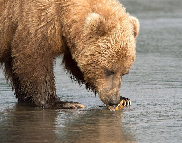
Southwest Alaska’s coastal brown bears are the largest of their kind in the world, deriving much of their bulk from the abundant salmon resources that pulse into the rivers from the sea each summer. This age-old relationship between bear and fish has forged one of the most apparent and enduring links between the ecosystems of the land and the sea in coastal Alaska.
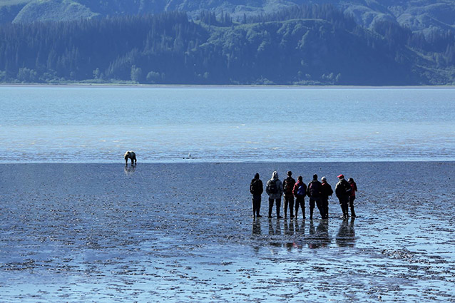
Less apparent, but perhaps no less important, is the connection between bears and intertidal resources such as clams and mussels. Along the shores of Lake Clark National Park and Preserve and Katmai National Park and Preserve, bears spend seemingly countless hours in the mudflats digging, chomping, slurping, and digging again. Their presence in these coastal areas is so regular and predictable that an industry in bear viewing has developed around them over the last couple of decades and continues to grow (Figure 2).
NPS Photo
But just how critical are these shellfish to brown bears? How much nutrition do they actually provide? How healthy are the shellfish populations? Would it matter if these populations were impacted by human-caused changes such as increasing ocean acidity, overharvesting, or even another oil spill? At what point does human presence on these same beaches affect bear behavior and access to these food resources? And how can park managers best mitigate the impacts of human-caused changes in order to maintain healthy coastal ecosystems for bears and clams? These are some of the questions being investigated as part of the Changing Tides project, an ambitious three-year study that began in the summer of 2015.
Field work aimed at addressing these questions falls into two main components (1) brown bear fitness and use of marine resources and (2) the abundance, distribution, and health of clams and mussels. Within each component, a whole suite of data is being gathered by teams of collaborators from the National Park Service, the U.S. Geological Survey (USGS), the Alaska SeaLife Center, and various universities.
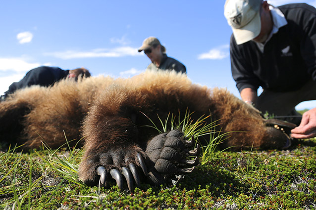
To gain a better understanding of brown bear use of mussels and clams, USGS biologist Grant Hilderbrand is leading an effort to put GPS collars on up to 12 bears each summer to track movements along the rugged coast of Katmai (Figure 3). “Part of what I think is fascinating about this study is that we just don’t really know where all these bears go, what they do, or how they spend their year,” Hilderbrand says. He and his team were able to collar nine bears in the first field season. Locations transmitted every hour revealed that all of the collared bears stayed along the coast all summer and occupied relatively distinct territories. Hilderbrand has just begun to analyze the data more closely to gain a better picture of how much time they spend in the intertidal zone.
NPS Photo
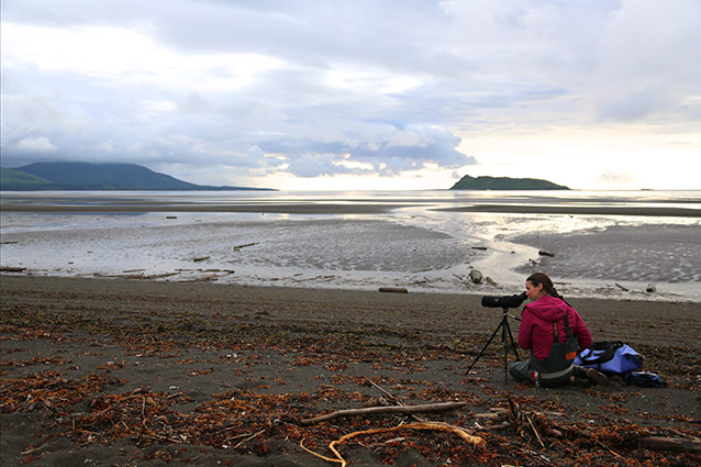
What the bears are doing when they are in the intertidal zone and what food they are eating are questions that are being investigated in a couple different ways. For one, graduate student Joy Erlenbach from Washington State University spent the better part of four months in the field observing bears and recording their behavior (Figure 4). Through long days of cold, sideways rain, across miles of puddled mudflats, and occasionally even in bright summer sunshine, she squinted through her spotting scope, hoping to gain insight into what food resources and habitats are most important to these coastal bears. “Bears constantly surprise me with their different behaviors. I get to see little cubs riding on mom’s backs, and bears mating, and wrestling, and chasing each other on the intertidal. It’s pretty much always something new every day.” Erlenbach speculates that intertidal resources may be particularly important during the springtime when the bears are first emerging from hibernation. “If other areas are still snow covered, they might not have access to vegetation in those areas, whereas coastal areas, and the intertidal specifically, are more likely to be snow free.”
NPS Photo
Another method that is helping us learn what the bears are doing is to add small video cameras to some of the GPS collars. Two bears donned such collars last summer, and the analysis of the many hours of video has just begun. A preliminary peek at some of the footage revealed that when bears dig in the mud, in addition to shellfish, they sometimes catch and devour small flounder that are nestled in the muck waiting for the tide to roll back in. Bears are opportunistic feeders, and the study has shown that in addition to salmon, they will also eat vegetation, clams, and seals.
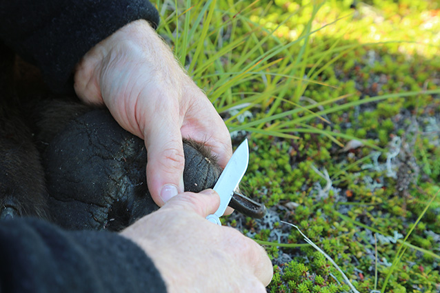
This steady diet of marine resources provides energy for foraging, mating, and nursing; and also helps bears pack on the pounds needed to survive winter hibernation. “We’re handling the bears three times a year…in the spring, the summer, and the fall,” says Hilderbrand. Each time the bears are handled, they are weighed and measured. Several of them gained more than 88 pounds (40 kilograms) between May and July, and one of them gained a whopping 140 pounds (63 kilograms). Bears averaged around 15 percent body fat in May, but bulked up to just under 40 percent by fall. A blood sample, hair, and a sliver from the bear’s claw are also collected when the bears are handled (Figure 5); chemical analyses of these samples provide clues about what the bears have been eating and can reveal shifts in diets over time.
NPS Photo
The other major component of the project is looking directly at the bivalves that the bears are eating. Several species are thought to be potential prey, including blue mussels, razor clams, and butter clams. National Park Service biologist Heather Coletti is leading the effort to better understand these species. She explains “These invertebrates are critical prey resources for a variety of species. They are also considered indicators of the marine nearshore and are susceptible to changing ocean conditions. But they are difficult to measure in terms of health and abundance. Changing Tides is giving us an opportunity to fill that knowledge gap and create better tools to assess the health of these important species."
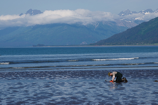
Clams and mussels were collected from the shores of both Katmai and Lake Clark national parks in 2015 (Figure 6). Some of the samples were kept alive in small aquarium-like containers and transported to the Alaska SeaLife Center in Seward where researchers could measure things such as shell weight, shell thickness, total weight, and overall dimensions. Individuals were placed in tanks with algae so their feeding rate could be calculated; the concentration of algae was measured at the beginning and then again three hours later. They also measured the production of byssal threads in blue mussels, the tiny strands they use to attach themselves firmly to the rocky shoreline. All of this information adds to the basic understanding of how these animals survive along the wild coasts of Alaska.
NPS Photo
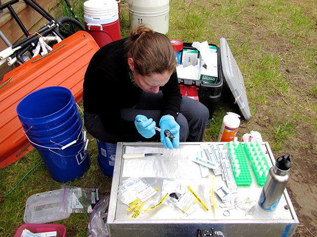
Other specimens were dissected and their tissues will be analyzed to provide clues to more specific questions, like how many calories a clam provides for a bear, or what certain protein and genetic markers in clams and mussels look like (Figure 7 and 8). These markers can show whether the bivalves have been exposed to environmental stress such as elevated temperatures, increased acidity, pollution, or disease. Measuring and describing the markers in these sample tissues gives researchers a tool that can help them compare the health of clam and mussel populations at different sites and assess their exposure to environmental stress.
NPS Photo
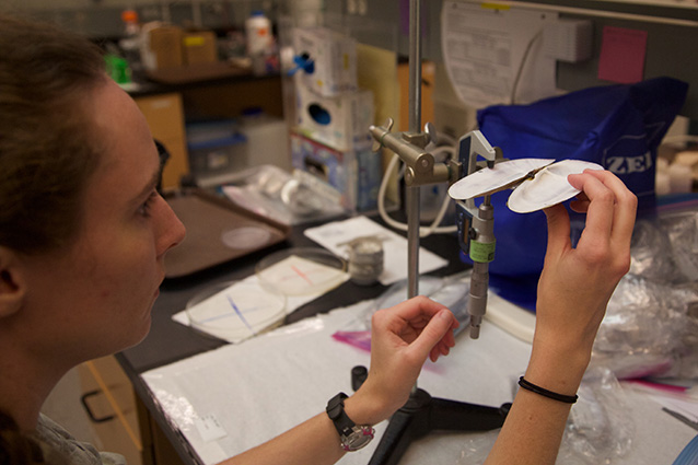
Researchers also hope to gauge the abundance and distribution of marine bivalves as a part of this study (Figure 9)—in other words, to assess how much of this prey resource, particularly razor clams, is out there for bears to use. The question of how to measure razor clam abundance has puzzled both biologists and managers for decades. The current method used by state fisheries managers involves intensive sampling in relatively small areas on the east side of Cook Inlet where people typically dig for clams.
NPS Photo
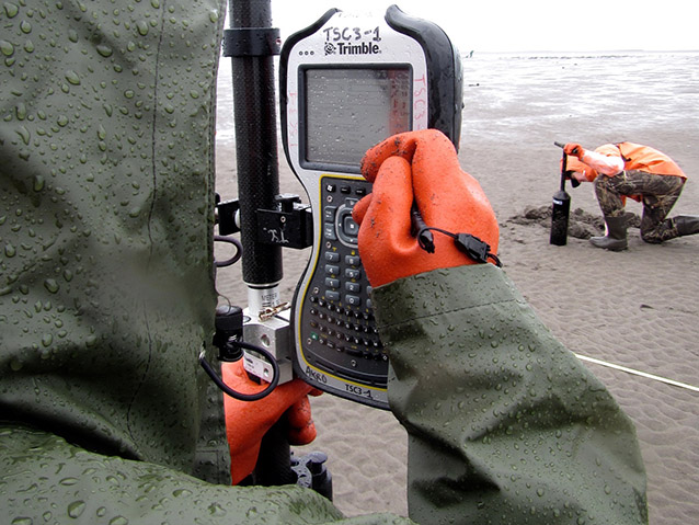
While there is both commercial and personal harvest of clams along shores of Lake Clark National Park on Cook Inlet’s west side, no abundance sampling has been done there. A team spent a week in the field during July 2015 slogging across the mudflats near Polly and Silver Salmon creeks, testing several different sampling methods. These included using photo sampling to document clam “shows,” which are small holes in the sand from the clam’s siphon; counting every clam “show” in defined areas; and doing some good old-fashioned digging as well. No method proved foolproof, and if nothing else, the effort confirmed that it is extremely challenging to accurately estimate clam populations over large areas.
NPS Photo
All these efforts will combine to create not just a better understanding of how bears use specific intertidal resources, but also a broader understanding of how the sea is tied to the land, how the mysterious web of marine life is intertwined with the more familiar territory of forest, mammal, and solid ground. Ultimately, by understanding these connections, park managers will be better equipped to take actions to protect these unique ecosystems in the face of such stressors as increased human activities, changing ocean conditions, and potential disasters such as oil spills. If we don’t know how the ecosystem functions, and where the critical connections lie, it is hard to know what parts to protect in the face of stressors such as increased human use, changing ocean conditions, or potential disasters like oil spills. The Changing Tides project is an important and ambitious step in protecting and preserving these resources for future generations.
Part of a series of articles titled Alaska Park Science - Volume 15 Issue 1: Coastal Research Science in Alaska's National Parks.
Last updated: November 22, 2016
