NPS Photo
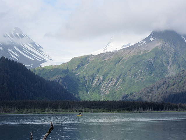
The rain pelted us as we moved heavy equipment from the deck of the M/V Serac into the two awaiting skiffs that sat rolling in the wind-driven chop. The eight-foot aluminum poles, inflatable pontoons, and other sediment-coring equipment quickly filled up the small skiffs. Launching into the open waters of the fjord, we carefully navigated over the kelp-laden shoals to avoid fouling the propeller and threaded our way to the entrance of the adjacent lagoon we sought to enter. After fighting against the outflowing tide and driving rain, we finally arrived on the protected and pristine shores of an inner lagoon in Kenai Fjords National Park.

NPS Photos
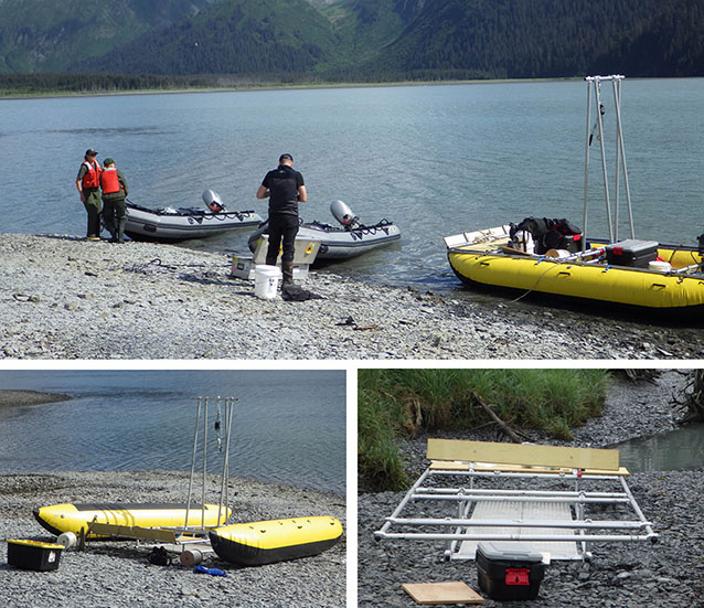
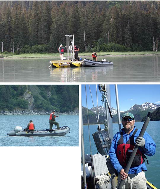
Once on the beach, we worked together to assemble and launch the newly-built coring platform (Figure 2), and then figured out a way to anchor ourselves over the deepest portions of the lagoon to collect sediment cores from its depths (98.4 feet [30 meters]). Our coring sites were selected based on an acoustic sub-bottom seismic survey carried out during the previous day allowing us to peer into the depths of the lagoon’s sediments. The seismic reflection profile had revealed a rich sedimentary archive contained within the deep basin of the lagoon. With the assistance of the National Park Service skiffs, three anchors were dropped from the coring platform into the lagoon and the raft triangulated in on the first coring target (Figure 3). The gravity corer, weighing 120 pounds, and topped with lead weights and a set of four stabilizer fins with a removable 6.5-foot (2-meter) stainless steel barrel mounted on the bottom, was slowly lowered by hand using a block-and-tackle system until it sat 22.9 feet (7 meters) above the seafloor. Once in position, we released the line, sending the corer plummeting into the sediments. The corer was then laboriously hauled in with heavy anticipation. Once on the deck of the coring platform, the sediments were carefully extracted and we celebrated a well-preserved 5.2-foot (1.6-meter) sediment core. This was one day’s adventure during 10 days of coastal geologic research within the park. Over the next two days we collected six more cores from our coring platform and two from the deck of the Serac totaling 39.7 feet (12 meters) of sediments.

NPS Photos
This fieldwork represents a broader project deciphering the glacial and sea-level history of the fjords and coastal lagoons within Kenai Fjords. The seafloor sediments of deep coastal lagoons within the park could potentially provide a millennial-scale record of local environmental change and a timeline of catastrophic events such as volcanic eruptions, glacial advances, and tsunamis. Understanding how the park’s coastline responded to past tectonic and climate-driven changes should provide valuable context to ongoing and future conditions.
Sediment grain size analysis coupled with radiometric dating of these cores is currently proceeding at the Alaska Coastal Geoscience Lab at the University of Alaska-Fairbanks. Preliminary results appear to be showing that McCarty Glacier may not have extended as far as many previous researchers surmised. We look forward to sharing results from this research in a future issue of Alaska Park Science.
We acknowledge the people who assisted us in this soil sediment endeavor: Melissa Knight (M/V Serac captain), Jennifer Pletz (M/V Serac deckhand), Dr. Aron Crowell, Jonathan Hardes, Ivana Ash, and Norma Johnson. We also thank the Woods Hole Oceanographic Institution Coastal Systems Group for providing the coring and seismic equipment.
Part of a series of articles titled Alaska Park Science - Volume 15 Issue 1: Coastal Research Science in Alaska's National Parks.
Last updated: November 22, 2016
