Article

Andersonville Civil War Prison Geophysical Survey Project
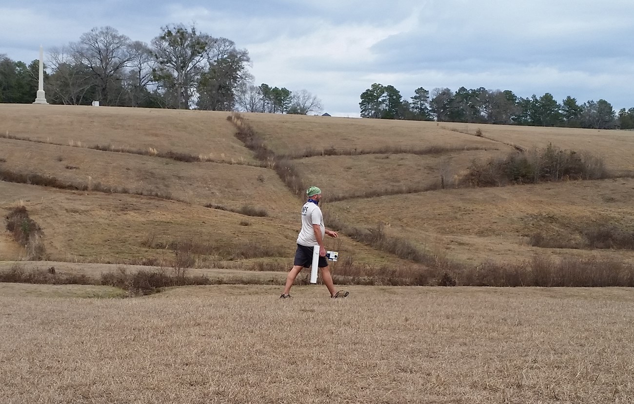
Archeologist Eric Bezemek uses a magnetometer on the south slope of Andersonville prison.

(NPS Photo)

From January 29 to February 8, 2018, SEAC Archaeologists began a three-year geophysical survey project at Andersonville National Historic Site to learn more about life inside the Civil War prison during its use to confine Union soldiers in 1864 and 1865 (Figures 1 and 2).

Geophysical surveys allow for the non-invasive mapping of subsurface anomalies. Through use of ground penetrating radar, magnetometer, conductivity meter, and resistivity meter instruments, two areas within the prison enclosure were examined for the presence of subsurface remains associated with structures that were present during Union incarceration.

In the two areas examined, a total of 17,600 m2 was surveyed (Figure 3). The first area, located on the south slope of the enclosure, was composed of 24 20x20 meter and two 10x20 meter grids near the South Gate that with the primary aim of finding the sick call enclosures, the gallows, and the barracks buildings that historic references indicate were located within the vicinity. The second area, located on the north slope of the enclosure, was comprised of 19 20x20 meter grids near the North Gate that focused on pinpointing the Sutler’s store.
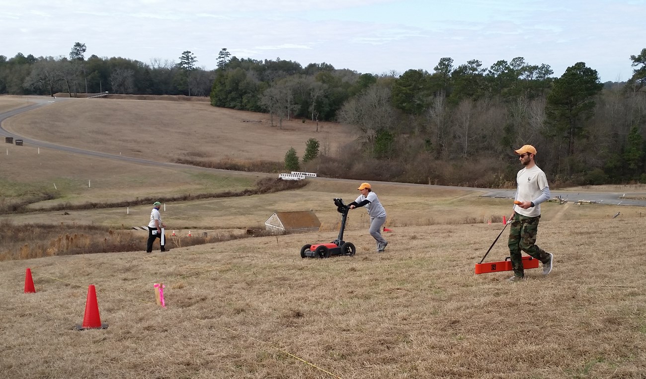
SEAC archeologist use conductivity, ground penetrating radar, and magnetometer to survey the north slope of Andfersonville prison
SEAC archeologist use conductivity, ground penetrating radar, and magnetometer to survey the north slope of Andersonville prison

NPS

Once analyzed, the overall survey data revealed numerous circular pit feature anomalies, which appear to represent temporary shelters (shebangs) or wells, along with a number of other prominent subsurface features including the stockade line and the deadline. The area surveyed along the south slope however, did not yield evidence of either the gallows or sick call enclosures; most likely due to the temporary nature of the structures, the construction of Prison Site Road that surrounds the prison, and/or the intensive cultivation that took place on the south slope during the late 19th and early 20th centuries. The area surveyed along the north slope did not yield any evidence of the Sutler’s store, however, it is not clear whether it was destroyed during the installation of cement drainage ditches placed in the area by the Civilian Conservation Corps to control erosion, or if the structure was located further east of the survey area.

Because collection of the geophysical data at Andersonville is ongoing and will extend over two years, SEAC will continue to geophysically survey different portions of the park. Future efforts will continue to focus on the Market Street area of the prison, the 3rd hospital site to the south of the prison, and possibly the 2nd hospital site to the southeast.
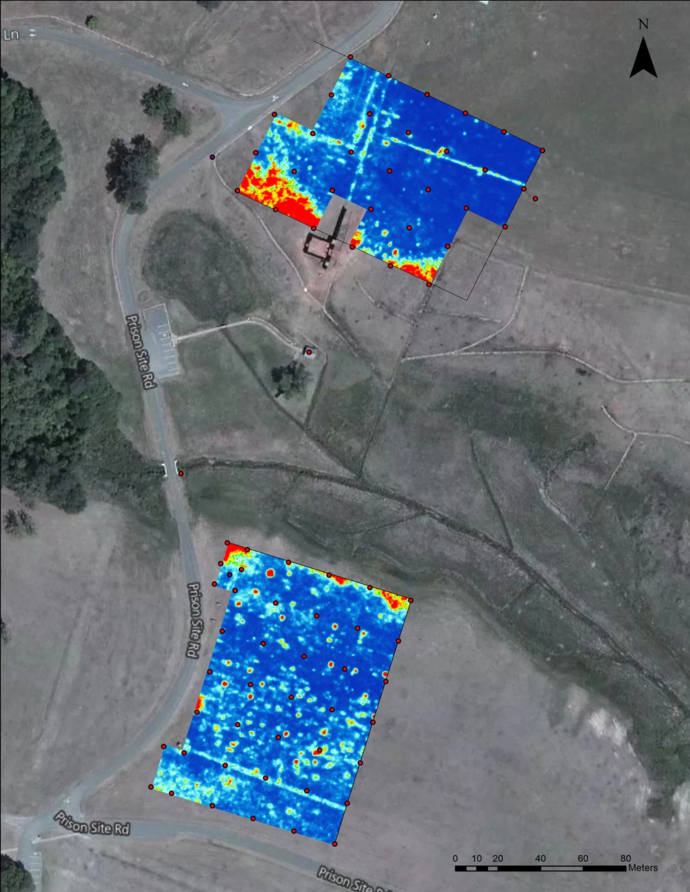
Ground penetrating radar data from the south and north slopes of the Andersonville prison enclosure surveyed by SEAC in early 2018.

(NPS photo)

Andersonville National Historic Site

Last updated: August 29, 2019