Part of a series of articles titled Condition of Selected Natural Resources at Mesa Verde National Park: A 2025 Assessment.
Article
A 2025 Check-up for the Mancos River in Mesa Verde National Park
A 2025 Natural Resource Condition Assessment evaluated six resources at Mesa Verde National Park. This article describes what we learned about one of the resources—the Mancos River.
NPS / Southern Colorado Plateau Network
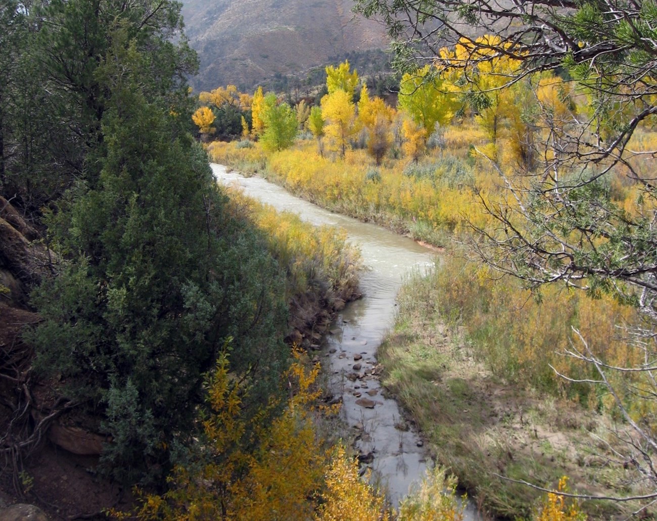
The Mancos River is a tributary to the San Juan River and flows south through about 5 miles (8 kilometers) of eastern Mesa Verde National Park (NP). The Mancos River is one of six resources included in the 2025 Natural Resource Condition Assessment (NRCA) for Mesa Verde. An overview article is available that describes the intent of the NRCA project and the other resources assessed for the park. For the Mancos River, the NRCA team, led by Conservation Science Partners, carried out a thorough evaluation of the river’s current condition.
The river and plant communities along it provide unique habitat for many species in the park and offer other ecological benefits. For example, the forests along the river provide stability to the river channel, reduce stream temperatures, and provide cover for fish and other aquatic life. The stretch of the river within the park is influenced by activities in the watershed upstream of the park. These activities, which can negatively affect the river, include agriculture, livestock grazing, water removal, and historic mining (Stacey 2007).
The assessment for Mesa Verde’s stretch of the Mancos River consisted of a separate condition assessment for 1) water quality, 2) macroinvertebrates and their habitat, 3) fish and aquatic habitat, and 4) the riparian corridor. While not always described in this article, the NRCA team used specific criteria to determine whether condition was good, fair, poor, etc. for each indicator. When possible, they used quantitative (numerical or countable) criteria, but they also used qualitative (descriptive and non-numerical) data.
Water Quality Check-up
Good water quality is important for aquatic and terrestrial life, including humans. The condition assessment for water quality within the park’s stretch of the river used the findings of an NPS Southern Colorado Plateau Network’s (SCPN) monitoring dataset (2009–2021) for water quality. This dataset contains measurements of water chemistry and core parameters (temperature, pH, and dissolved oxygen). The NRCA team compared average annual values for the parameters to the state standards for Colorado set by the Colorado Water Quality Control Commission. The NRCA team used three indicators for the water quality condition assessment:
- inorganic/non-mineral water quality indicators,
- nutrient indicators, and
- trace metal and mineral indicators.
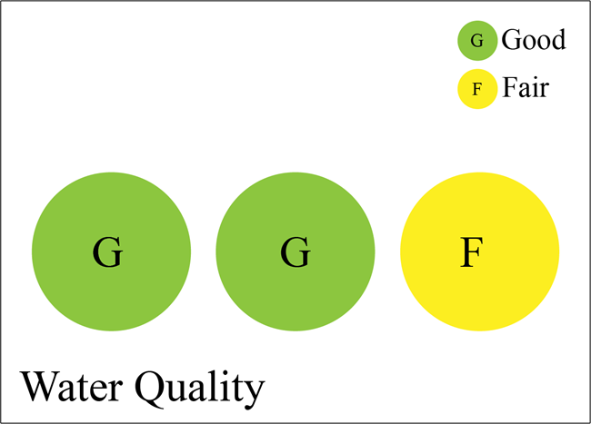
The SCPN’s findings for both inorganic/non-mineral indicators (pH, dissolved oxygen, and non-winter temperatures) and nutrient indicators (nitrite, ammonia) reflected good water quality over the monitoring period, as these indicators met state standards (Figure 1). However, trace metal and mineral indicators (such as iron, aluminum, copper) rated as fair, as only 73% of these 15 indicators were in compliance with state standards during the monitoring period; this was likely due in part to the effects of upstream legacy copper mining. Copper exceeded state standards for nine out of 12 years of data collection, while other water quality indicators exceeded standards only occasionally.
NPS
Figure 1. Summary of the three water quality indicators of condition, from left to right—inorganic/non-mineral indicators (good), nutrient indicators (good), and trace metal and mineral indicators (fair).
Macroinvertebrate Check-up
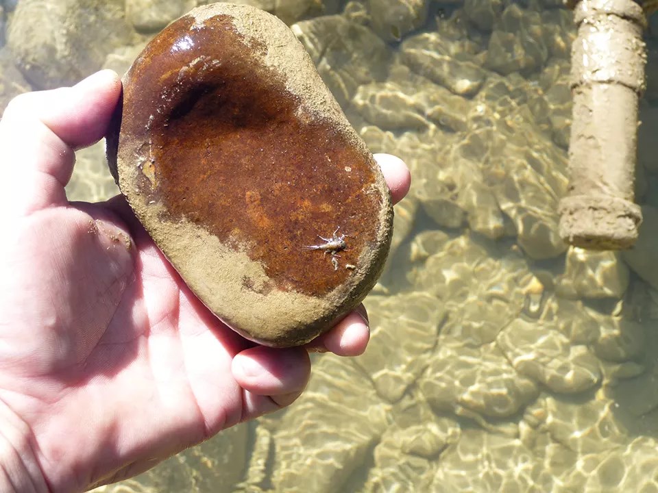
Aquatic macroinvertebrates are small organisms that lack a backbone and live all or part of their lives in water. Understanding the condition of macroinvertebrates provides important information on the health and integrity of the freshwaters in which they live. These organisms are also a primary food source for fish and other aquatic life.
For the macroinvertebrate condition assessment, the NRCA team used a SCPN monitoring dataset (2008–2019) and analyses that included data from two sites on the river within the park (Stumpf and Ploughe 2024). Monitoring results suggested that both of the sites experienced periods of temperature and hydrologic stress (that is, when water flow is low or nonexistent) during the 12-year period. The NRCA team used four indicators of condition for the assessment:
- stream flow (or discharge) trends,
- relative abundance of pollution-tolerant versus intolerant groups of macroinvertebrates,
- trends in Trichoptera (caddisflies) abundance, and
- percentage of samples that meet Colorado’s water quality standards for aquatic life.
NPS / Southern Colorado Plateau Network
From the assessment, the NRCA team found that condition ratings for the four indicators ranged from fair/poor to poor, likely due to warming and drying trends in the Mancos River:
-
Stream flow showed a negative (decreasing) trend in flow velocity at the upstream monitoring site from 2008 to 2019 (Stumpf and Ploughe 2024). This lead to a fair/poor rating for this indicator. There was no observable trend in flow at the downstream monitoring site.
-
At the upstream site, the relative abundance of moderately tolerant macroinvertebrate groups increased by an average of 2.6% per year (Stumpf and Ploughe 2024). At the same time, the relative abundance of intolerant groups decreased by an average of 2.7% per year. The decrease in numbers of intolerant groups was probably due to temperature and water stress, most likely due to river warming and low flows. Based on the results, the NRCA team concluded the condition was poor for this indicator. There was no observable trend at the downstream site.
-
Trichoptera (caddisflies) are very sensitive to swings in stream temperature, because these insects live in the water during their larval stage. From the 2008–2019 data the NRCA team found that the relative abundance of Trichoptera at the upstream site decreased by an average of 2.7% per year, and species richness of Trichoptera decreased by an average of 0.6% per year. Due to these negative trends, the NRCA team rated condition for this indicator as poor.
- The fourth indicator used Colorado’s Multi-Metric Index (MMI) Bioassessment Tool (Colorado Department of Public Health and Environment 2003) with the 2008–2019 SCPN data. The MMI determines whether or not the aquatic life of streams and rivers meets the state’s water quality standard for warm-water aquatic life. At Mesa Verde, 28% of the upstream site samples and 21% of the downstream site samples did not meet the state’s standard for aquatic life (Stumpf and Ploughe 2024). These results correspond to an NRCA condition rating of fair/poor and fair for the sites, respectively.
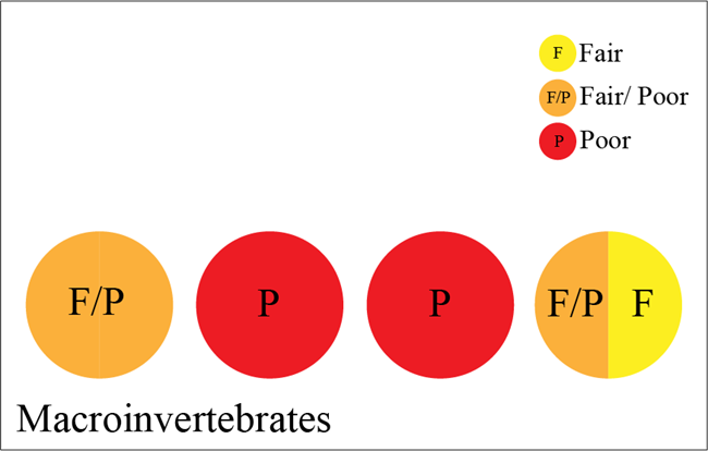
Figure 2 summarizes condition findings for the four indicators.
NPS
Figure 2. Summary of the four macroinvertebrate indicators of condition, from left to right—stream flow trends (fair/poor), relative abundance of pollution-tolerant vs. intolerant macroinvertebrate groups (poor), trends in caddisfly abundance (poor), and percentage of samples meeting state water quality standards (fair/poor and fair).
Fish and Aquatic Habitat Check-up
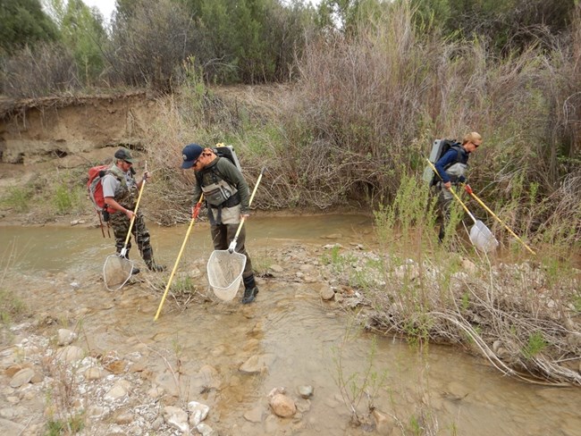
Biologists have surveyed for fish in the Mancos River for more than 50 years. Based on the surveys, 21 species are present or have occurred historically in the river (NPS 2024). Of these, seven are native species. Three of the natives—bluehead sucker (Catostomus discobolus), flannelmouth sucker (Catostomus latipinnis), and roundtail chub (Gila robusta)—are species of special conservation status (Utah Department of Natural Resources 2006, Colorado Parks and Wildlife 2015).
NPS
For the fish and aquatic habitat condition assessment, the NRCA team used of a long-term (1944–2022) Colorado Parks and Wildlife (CPW) fish survey dataset (CPW 2023), results from past Rapid Stream Riparian Assessments (RSRAs) on Mesa Verde’s stretch of the river, and data from the closest stream gage on the river. The NRCA team used three indicators of condition for the assessment: 1) fish counts and abundances over time, 2) fish habitat quality using indicators from RSRA surveys, and 3) river flow.
The NRCA team found that condition was fair for two of the indicators and poor for one of the indicators, as described below:
-
For fish counts and abundances over time, the NRCA team looked at relative abundances of species from the CPW long-term dataset, as well as a 2022 NPS fish survey on the Mancos River within the park. Results indicated that, as a group, native species were stable over time (although there was an increasing trend in one species and a decreasing trend in another), and non-native species decreased in relative abundance. These results indicate a condition rating of fair because even though native fish abundances exceeded those of non-natives, the relative abundances of natives were unbalanced. The reason for the increasing relative abundance of one species, speckled dace (Rhinichthys osculus; native), in the Mancos River might be related to its adaptations to drying conditions.
-
For the fish habitat indicator using RSRA surveys, the NRCA team used results from a 2024 assessment conducted near the downstream boundary of the park. The overall score for this indicator was fair. This was because individual components were rated as excellent (such as for pool/riffle distribution), average (such as for overbank cover), and poor (such as for underbank cover). Also, fish/aquatic habitat on the Mancos River appeared stable because prior RSRA surveys conducted on the same part of the river scored similarly.
-
The NRCA team analyzed river flow data from the closest downstream gage to the park (the Towaoc Gage on the Ute Mountain Ute Reservation). The team used data from 1975 to the present to look at annual minimum flows and maximum flows. Results suggested negative trends in minimum flows and maximum flows over the 50-year period. Of potential concern, especially for the fish community, is that minimum flows are more often approaching zero each year. Further, it appears that maximum flows are becoming much more variable (with higher peaks and lower lows). The NRCA team rated the indicator as poor due to the negative trends.
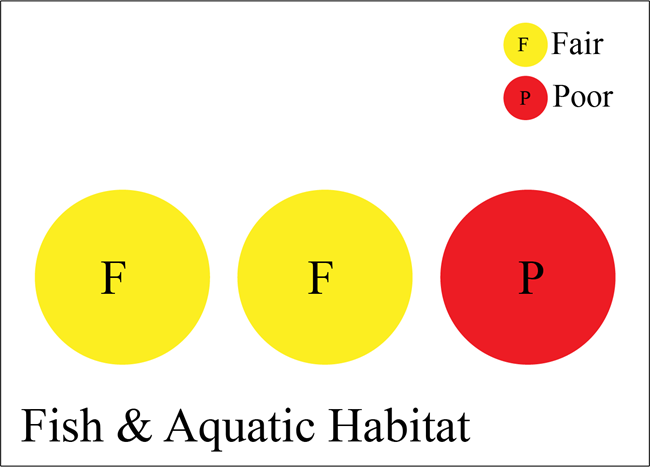
Figure 3 summarizes the condition findings for the three indicators.
NPS
Figure 3. Summary of the three fish and aquatic habitat indicators of condition, from left to right—fish counts and abundances over time (fair), fish habitat quality (fair), and river flow (poor).
Riparian Corridor Check-up
To assess the condition of the riparian corridor, the NRCA team used three components from the most recent Rapid Stream Riparian Assessment (RSRA) within Mesa Verde’s river segment. The RSRA was conducted by park staff in 2024. The three components were 1) riparian vegetation health and function, 2) riparian structure and wildlife habitat, and 3) fluvial geomorphology. The NRCA team compared the 2024 results to those from similar assessments in the same area 18 and 12 years before (in 2006 and 2012).
For the three indicators, the NRCA team judged condition to be good and stable for riparian vegetation, fair and stable for riparian structure and wildlife habitat, and good/fair (with a stable to upwards trend) for fluvial geomorphology, as described below:
-
For riparian vegetation health and function, the 2024 RSRA indicated a score of 4.1 out of 5.0, which was about the same as in 2006 and 2012. The score corresponds to an NRCA condition rating of good. The good rating was warranted because there were shrubs and trees of all ages and sizes in the riparian zone, there were almost no non-native woody species present, and there was only a slight amount of grazing and browsing from feral livestock.
-
For riparian structure and wildlife habitat, the NRCA team determined the condition to be fair based on a score of 3.0 out of 5.0 from the 2024 RSRA survey. One reason for the fair rating was that the densities of cottonwood trees (Populus deltoides and P. angustifolia) in the middle and upper canopies were lower than desirable. This has been the case since the 2006 assessment.
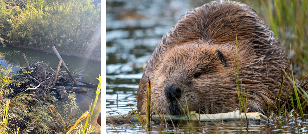
- The 2024 fluvial geomorphology score from the RSRA was 3.4 out of 5.0 and corresponds to a good/fair condition in the NRCA. The 2024 RSRA score indicates an upward trend when compared to the 2006 and 2012 scores. Two reasons for the upward trend were improvements in floodplain connectivity and the presence and activity of beavers (Castor canadensis). Beavers maintained dams on the river in 2024.
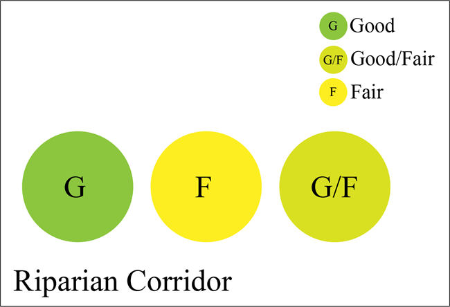
Figure 4 summarizes the condition findings for the three indicators.
NPS
Figure 4. Summary of the three riparian corridor indicators of condition, from left to right—riparian vegetation health and function (good), riparian structure and wildlife habitat (fair), and fluvial geomorphology (good/fair).
NPS / Tammy Cook (left) and NPS (right)
What can park managers do with this information?
The assessment will help guide planning, stewardship, and management for the Mancos River in the park. The NRCA process led to a number of recommended considerations for monitoring and management, a few of which are mentioned here:
-
Continue with efforts to remedy past channelization. Park managers could continue to address past channelization and reconnect the Mancos River with its historic floodplain. Because the park’s stretch of the river is not grazed by livestock, there would be no grazing-related bank erosion or damage to streamside plants.
-
Continue to manage the park’s section of the Mancos River corridor and associated riparian zone. The goal would be to maintain it as structurally complex, healthy, and extensive as possible. The river corridor and riparian zone is important for migratory birds, for sensitive fish species, and for wildlife such as beaver, elk, deer, and bear.
-
Continue partnerships for native and non-native fish monitoring and management. Park managers have worked with Colorado Parks and Wildlife (CPW) and the Ute Mountain Ute Tribe on native fish stocking in the Mancos River. Also, annual fish surveys with CPW and regional NPS fish biologists would be beneficial, if possible.
-
Include indicators of warming and hydrologic stress in future monitoring of the Mancos River. This would help park managers better understand aquatic community responses to these stressors.
References
Colorado Department of Public Health and Environment. 2003. Standard operating procedures for collecting and preserving benthic macroinvertebrate samples. Colorado Department of Public Health and Environment, Water Quality Control Division-Monitoring Unit.
Colorado Parks and Wildlife. 2015. State wildlife action plan (p. 865). Colorado Parks and Wildlife.
National Park Service (NPS). 2024. Fish sampling in Mesa Verde National Park, April 2022. Trip report (draft). Report to Mesa Verde National Park.
Sites Project Authority and Bureau of Reclamation. 2021. Sites Reservoir Project revised draft environmental impact report / supplemental draft environmental impact statement (see Chapter 7). November. Sacramento, California. Available at https://sitesproject.org/revised-draft-environmental-impact-report-supplemental-draft-environmental-impact-statement/.
Stacey, P. B. 2007. Functional assessment of the Mancos River watershed: Mancos Valley and adjacent areas. University of New Mexico, Albuquerque, New Mexico, for Mancos Conservation District.
Stumpf, S., and L. Ploughe. 2024. Long-term trend in the aquatic macroinvertebrate community of the Mancos River at Mesa Verde National Park: Aquatic macroinvertebrate monitoring 2008–2019. Science Report. NPS/SR—2024/209. National Park Service. Fort Collins, Colorado. https://doi.org/10.36967/2306058. (Listed in the NRCA report as: Stumpf, S. E. 2024. Long-term trend in the aquatic macroinvertebrate community of the Mancos River at Mesa Verde National Park (Monitoring Report 0009-0004-3442–3551; p. 47). National Park Service, Southern Colorado Plateau Network).
Utah Department of Natural Resources. 2006. Range-wide conservation agreement and strategy for roundtail chub (Gila robusta), bluehead sucker (Catostomus discobolus) and flannelmouth sucker (Catostomus latipinnis). Prepared for the Colorado River Fish and Wildlife Council, by the Division of Wildlife Resources, Salt Lake City, Utah.
Last updated: August 28, 2025
