Last updated: August 5, 2020
Article
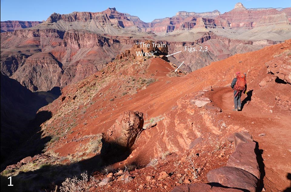
A Closer Look: Geology of the 'Train Wreck' on South Kaibab Trail
This article is incomplete and under construction
by Karl Karlstrom and Laura Crossey, University of New Mexico, January 2-4, 2020,
Geologic mapping has been done in Grand Canyon for 160 years, but new details can still be found, recorded, and appreciated. Karl Karlstrom and Laurie Crossey from the University of New Mexico were working on geologic relationships along the Kaibab Trail.
Past workers have undoubtedly seen these too, but interpretations change, and next generations may also want to comment on and interpret them for themselves. If you can see the evidence and visualize the past landscapes and structures here, you deserve a geology merit badge.


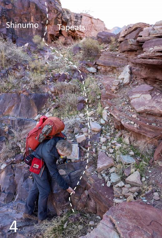
(Fig. 3) If you step over to the base of the Tapeats (36.094107;-112.089424) you can also see Shinumo blocks encased in the Tapeats Sandstone.
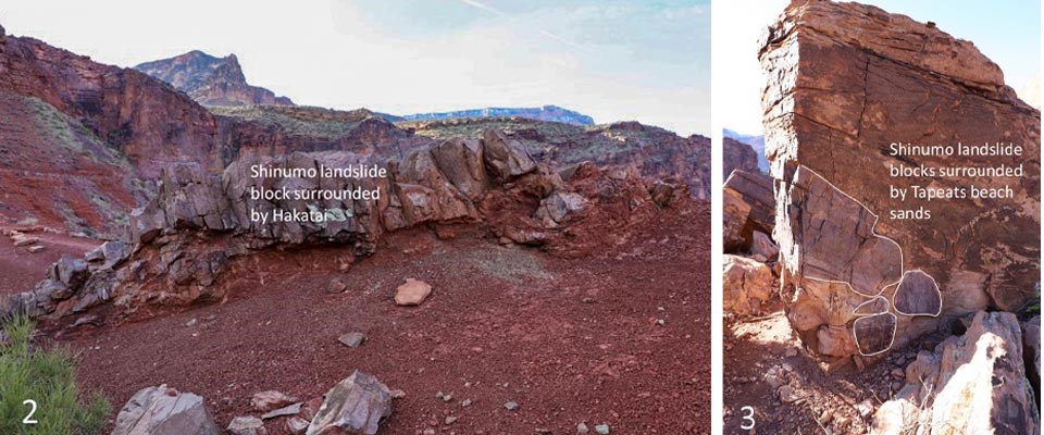
How did the Shinumo blocks become encased in the Tapeats Sandstone? We interpret these to be evidence that when the Cambrian seas advanced across the land 508-505 million years ago, that beach sands (later to become the Tapeats Sandstone) covered and engulfed talus and landslide blocks that had fallen down the sides of an adjacent rock island (a monadnock) of Shinumo that was sticking up in the Cambrian sea. Look up at the Shinumo cliff and see if you can visualize how that ancient sea shore looked.

This has been mapped as the “Tip Off fault”, but we now think it is an onlap of sand layers against a near-vertical Shinumo paleocliff because we see no fault gouge or offset.
Here the Tonto Group was deposited across (lapped against) significant 505 Ma topography (the monadnocks) such that in some places (at the Train Wreck), the Tapeats rests unconformably on Supergroup.
