Last updated: December 21, 2023
Article
Shrinking Glaciers in Wrangell-St. Elias National Park and Preserve
Alaska is one of the most heavily glaciated areas in the world outside of the polar regions. Approximately 21,835 square miles of the state are covered in glaciers—an area nearly the size of West Virginia. Glaciers have shaped much of Alaska’s landscape and continue to influence its lands, waters, and ecosystems. Because of their importance, National Park Service (NPS) scientists and partners measure glacier change. They have found that glaciers are shrinking in area and volume over nearly all the state. From 1985 to 2020, glacier-covered area in Alaska decreased by 13%. Over the same period, Wrangell-St. Elias National Park and Preserve saw a 5% reduction in glacier-covered area. As our climate continues to warm, these changes will continue to occur and likely accelerate, profoundly impacting the landscape of Alaska and our parks for generations to come.

Glaciers in Wrangell-St. Elias
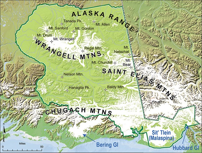
Wrangell-St. Elias National Park and Preserve is the glacier heavyweight of Alaska. It has the most glaciers of any park (3,121 at last count) and they cover 6,757 square miles of land. That’s 60% of the glacier cover in ALL the U.S. national parks and five times more glacier cover than the next most-glaciated park in Alaska (Glacier Bay). Three of the 10 largest glaciers in the world (not counting the Greenland and Antarctica icesheets) are in Wrangell-St. Elias: the Malaspina, the Bering, and the Hubbard. Not surprisingly, they all are found along the southern margin of the park, where heavy snowfalls settle in high coastal mountains (Figure 1).

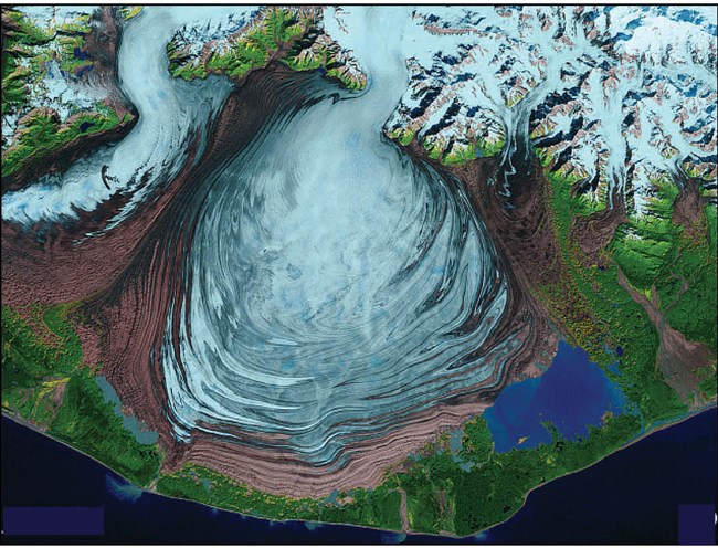
Malaspina Glacier is a piedmont glacier that spills out of the mountains and into a broad coastal plain, spreading like pancake batter as it approaches the coastline (Figure 2). Malaspina—aptly known as Sit’ Tlein (“Big Glacier”) by the Tlingit—is losing mass by surface melt, but is presently protected from the influence of the Pacific Ocean by a thin, vulnerable ribbon of beach. There is new evidence that saltwater is beginning to breach that barrier, exposing the glacier ice to new and more efficient means of losing mass: submarine melting and iceberg calving. These phenomena, which are unique to tidewater glaciers, have the potential to dramatically accelerate the glacier’s retreat. In the case of Malaspina Glacier, which is bedded well below sea level, such retreat has the potential to open a new, large embayment in the southern coast of Alaska.

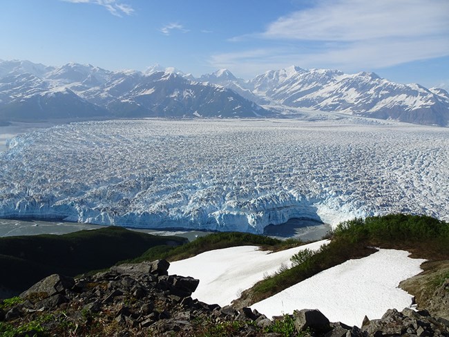
Hubbard Glacier (Figure 3) is already a tidewater glacier—in fact, it is the biggest tidewater glacier in North America. It calves huge icebergs into the Pacific Ocean along a 6-mile-wide terminus and, unlike most tidewater glaciers in Alaska (and virtually all non-tidewater glaciers), it is actually growing. In a warming climate, how can this be? It is because tidewater glaciers don’t just respond to climate—unlike glaciers that terminate on land, most tidewater glaciers exhibit a pattern of cyclic advance and retreat that scientists have observed both in nature and in numerical models to occur independently of changes in climate.
Statewide Glacier Change
Alaska’s high-latitude and high-elevation mountain ranges have historically had average annual temperatures cold enough to sustain glaciers. However, global air temperatures are increasing, and Alaska and other high-latitude regions are warming faster than the average global rate. Data from NOAA’s National Centers for Environmental Information indicate Alaska’s statewide average annual temperature has been increasing by 0.6°F per decade since 1950. As temperatures warm, the elevation at which snow and ice remain frozen is getting higher, with more rain and less snow at lower elevations. The effects are most visible at a glacier’s lowest elevations, where most glacier termini are rapidly retreating.

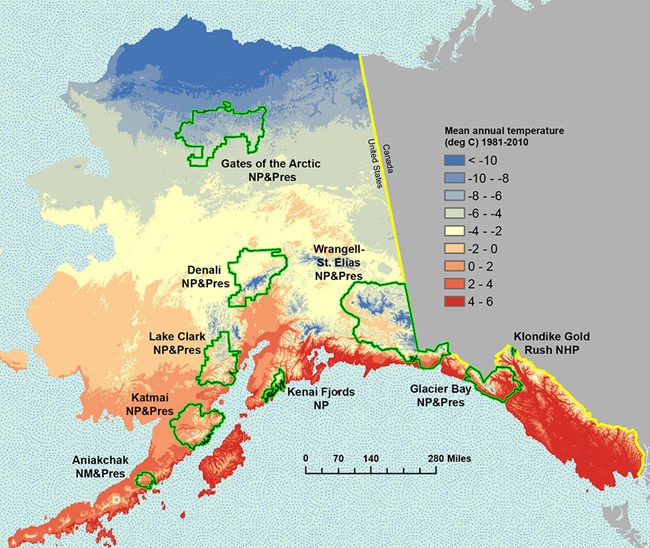
Glaciers within national parks in the state (parks shown in Figure 4, along with average annual temperatures) decreased by 8% from the 1950s to the early 2000s. From 1985 to 2020, glacier-covered area in Alaska decreased by 13%, or 3,253 square miles (8,425 km2). During that later interval, the largest changes in glacier-covered area in Alaska occurred at elevations of 2,625–7,218 feet (800–2,200 m) and in southern Alaska—the region that encompasses the greatest glacier-covered area. Little change was seen in the relatively small glaciers of the Brooks Range in northern Alaska.
Because of the importance of Alaska’s glaciers and the implications of glacier loss, including for how we manage parks, glacier monitoring and assessment will continue to be a critical, ongoing activity of the NPS and its partners.
