Last updated: January 8, 2025
Article
Winter Camp at Wood River

USACE
While Lewis stayed in St. Louis, Clark and the rest of the expedition built Camp Dubois where the Wood River joined the Mississippi, living there for five months during the winter of 1803–1804. Originally, the camp was located on the east bank of the Mississippi, in present-day Illinois. With the subsequent movement of the Mississippi River, the location of their campsite now sits on the western bank in Missouri.13
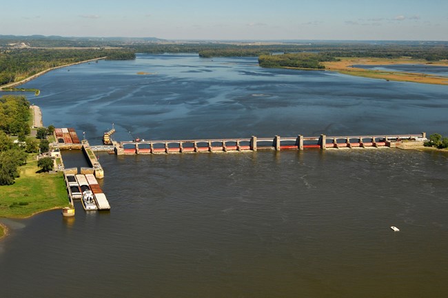
Higher average and peak temperatures have led to wetter springs and summer droughts in this area, with ecological and economic consequences. Channelization and engineering structures, such as dams and levees, have been used to stabilize the river and promote commercial transportation. However, greater rainfall due to climate change still increases the risk of flooding, threatening the urban infrastructure that has developed along the river since the expedition stayed here. In 2011, record flooding closed navigation on a long stretch of the river and caused over $3.5 million in damages to property and agriculture.14
Citations:
13 NPS, “Winter Camp at Wood River,” Pittsburgh to the Pacific: High Potential Historic Sites of the Lewis and Clark National Historical Trail, 2022, 33, https://www.nps.gov/lecl/getinvolved/upload/2022_LCNHT_HPHS_Report_508compliantUPDATE-2.pdf; Gary E. Moulton, footnote on December 12, 1803 entry, in Gary E. Moulton, Journals of the Lewis and Clark Expedition, https://lewisandclarkjournals.unl.edu/item/lc.jrn.1803-12-12.
14 U.S. Environmental Protection Agency, “What Climate Change Means for Illinois,” August 2016, 1–2; Jason S. Alexander, Richard C. Wilson, and W. Reed Green, “A Brief History and Summary of the Effects of River Engineering and Dams on the Mississippi River System and Delta,” U.S. Geological Survey, 2012, 9, https://pubs.usgs.gov/circ/1375/C1375.pdf.
