Article

Weir Farm National Historical Park Constructs New Stone Causeway

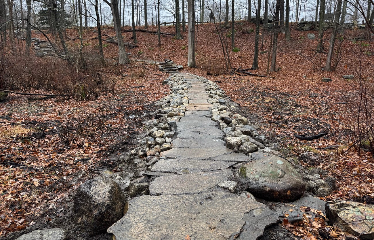
A stone causeway forms a path through a wetland area, with a surface of large flat stones and smaller rounded stones on the sides
The recently constructed causeway through a wetland area at Weir Farm National Historical Park.

NPS

The Weir Farm landscape was the home, workplace, and inspiration to American painter Julian Alden Weir from 1882 to 1919. Weir was drawn to the location by the scenic qualities of the Connecticut landscape, and he made an effort to preserve the rural setting and agricultural use of the existing farm. The landscape is associated with other artists of the American Impressionist movement, and it was also home to American sculptor and Weir’s son-in-law Mahonri Young from 1931 to 1957.

Some of the aesthetic features of the property also had practical purposes. For example, stone causeways became a common feature in southwest Connecticut, as farmers needed to cross wetland areas to access their fields.

A stone causeway was part of the landscape before Julian Alden Weir’s purchase of the property in 1882. It was originally constructed by building up layers of stone to form a raised corridor traversing a wetland area. Overtime, the path deteriorated and vegetation grew among the stones.

Slender trees and moss grow on an area of rocks and soil in the middle of a wetland area
In 2011, trees and vegetation grew around the remaining rocks of the historic stone causeway.

NPS / Olmsted Center for Landscape Preservation

Building the Causeway

In early 2025, Weir Farm National Historical Park completed a two-year project to build a native stone causeway. The causeway is based on the historic precedent in this cultural landscape, and its restoration was a treatment objective of the park's Cultural Landscape Report.
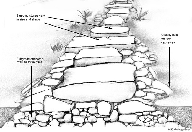
A labeled diagram shows construction of a stepping stone path, with a base, flat stones, and retaining stones on sides of causeway.
Example of stepping stone construction for crossing a seasonally wet area, from the 2006 Acadia Trails Treatment Plan (page 139).

NPS

The route connects the visitor center parking area with Weir Pond via a wetland where livestock once grazed. A series of boulders that served as stepping stones formerly delineated the route through the wetland. To provide an improved trail for visitors and avoid building a dam in the wetland hydrology, park staff developed a design for a permeable causeway.

The base of the causeway would be composed of rounded rock, known in Connecticut as “gargoyles”, that would allow water movement through the causeway, connecting one side of the wetland to the other.
Grass grows around a row of scattered stones, the trace of a former causeway through a wetland.
Scattered stones mark the historic route of the causeway across a seasonally wet area.

NPS

Weir Farm National Historical Park Facility Manager Kevin Monthie's innovative approach to the project was environmentally sensitive, cost effective, and provided employee and volunteer enrichment.
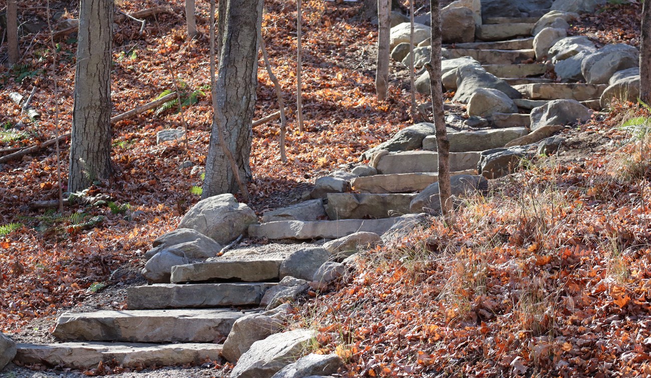
A gently-curving set of stone steps with a rock border ascends a slope in a wooded area
Newly constructed stone stairs connect a visitor parking area, near the Burlingham Complex, to the causeway path through the wetland.

NPS

In the first year, staff and volunteers built a set of stone steps at the start of the 200 linear foot route. The work began during a stone masonry workshop, where experts taught techniques of historic wall repair and construction.

Internationally renowned mason Neil Rippingale, proprietor of NR Stonecraft, returned to the park the following year for the construction of the remaining part of the route, consisting of the stone causeway. Monthie engaged Rippingale to lead the effort and coach staff and volunteers to help him build.
Three people stand on stone steps on a wooded hillside, with several construction tools and work equipment on the ground.
Neil Rippingale (at front right) discusses the project with volunteer Artie Hidalgo (rear), standing on the new stone stairs at Weir Farm NHP.

NPS

To avoid damage to the wetland, the project was timed with the driest conditions. A horizontal winch and hoist system of highline cables was used to move rock into place, keeping heavy equipment out. Rippingale coached the assembly of the permeable base for the causeway and the installation of barrier fabric on top. A tread of crushed bluestone (“Item 4”) was added for one segment of the causeway, and another segment received a topping of large granite flagstones, acquired from the local Roxbury Granite Quarry. The tread materials were retained in place with capstone rock of “gargoyles” or even larger “puddingstones”. The completed effect is a 30 - 36 inch wide, 200 foot long, durable route that harmonizes with the cultural landscape, completed on a modest budget.
The stone causeway forms a raised pathway through a wooded area, leading to stone steps on a slope
The newly built stone causeway and stairs through the wetland area, shown during the dry season.

NPS

The rains eventually returned over the winter, filling the wetland with water and magnifying the beauty of the stone causeway. Monthie looks forward to the time when skunk cabbage and peepers find a home among the gargoyles, further naturalizing the look of the causeway.
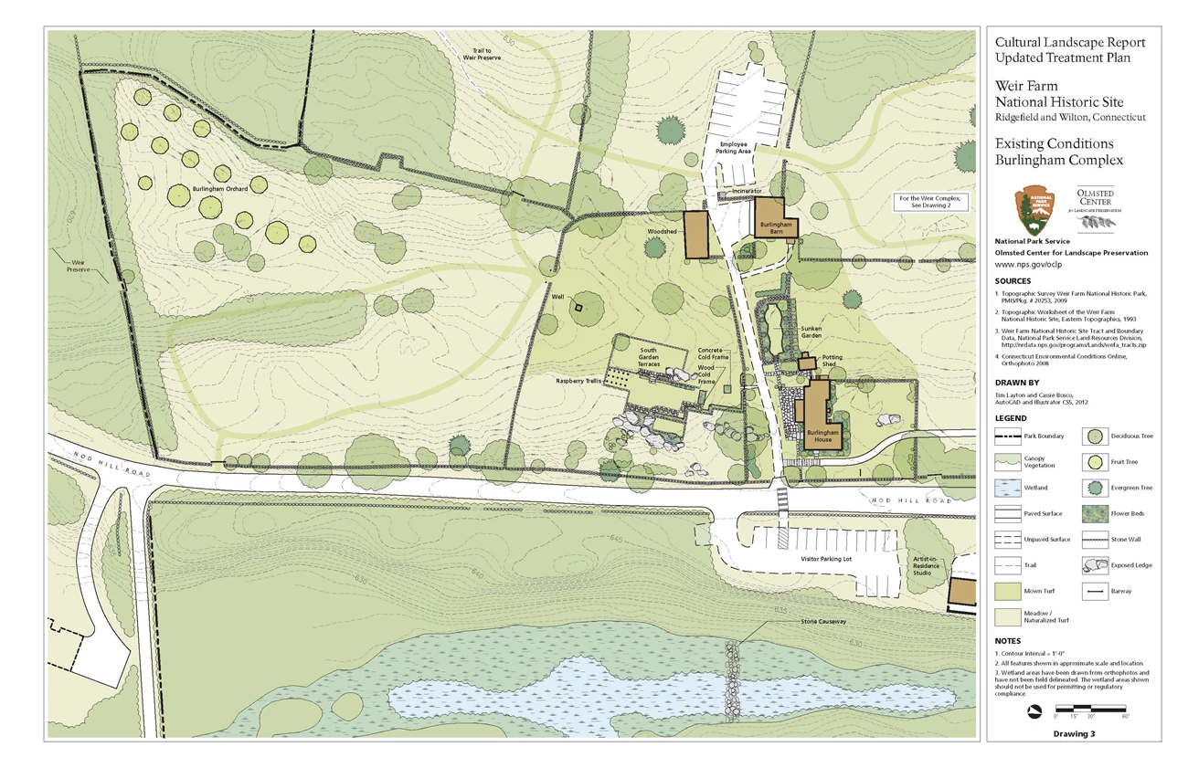
Labeled site plan shows 2012 features of the Burlingham Complex area at Weir Farm, with the stone causeway at center bottom.
A site plan in the 2013 Cultural Landscape Report for Weir Farm National Historic Site, Volume II (Treatment Plan and Record of Treatment) shows the location of the causeway and wetland, located near the bottom-center of the image and close to the Burlingham Complex. Note that north is to the right.

NPS / Olmsted Center for Landscape Preservation

Weir Farm National Historical Park

Last updated: May 21, 2025