Last updated: February 13, 2024
Article
The Plateau Postcard: Winter 2024
Printable Version
The Plateau Postcard is the official newsletter of the Southern Colorado Plateau Network (SCPN). We are one of 32 National Park Service Inventory and Monitoring Networks across the country established to collect, organize, analyze, and synthesize natural resource data and information about national parks, and provide the results in a variety of formats useful to natural resource managers. SCPN comprises 19 national park units located throughout the diverse landscapes of northern Arizona, northwestern New Mexico, southwestern Colorado, and southern Utah.
Most importantly, we are a community of individuals who collectively love the Colorado Plateau.
In this edition, we learn about how we are trying to predict pinyon-juniper die-offs, as well as a new tool we developed to help make us all better field scientists, and we hear from Bob Parmenter about his remarkable career at Valles Caldera National Preserve. Every edition starts out with a postcard from us to you, dear reader, and this issue brings tidings from Aztec Ruins National Monument...
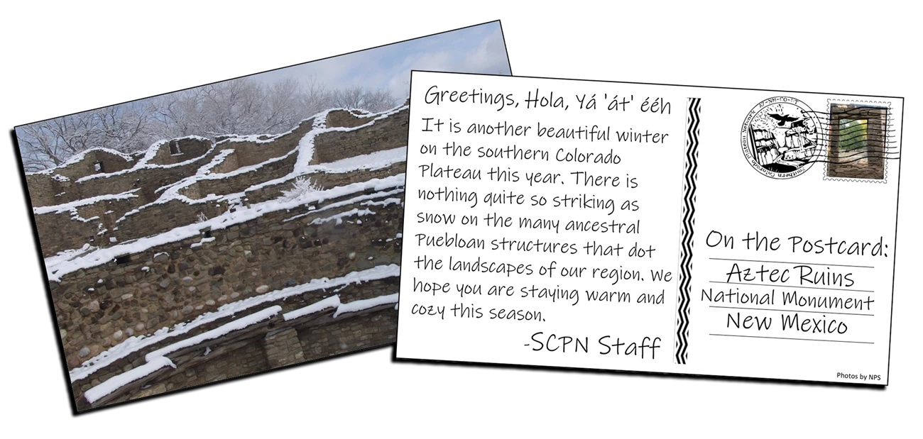
Greetings Parks and Partners
Happy 2024! We will drink a cup of kindess yet!
Chris Calvo’s recent interview with Dr. Parmenter in this issue highlights a few of the many contributions Bob has made to science and NPS. All the best during retirement Bob! Unfortunately, we will lose another valued colleague and friend this month, as Kristen Philbrook (Wildlife Biologist, Regions 6-8) is retiring after 30-years of service (pictured below, center).
Kristen was born in St Paul and spent her youth in southern MN and Erie PA. She then attended Hope College before earning a Master of Science degree from Northern Arizona University. Kristen started her career as a seasonal technician for the Bureau of Land Management and Colorado Parks & Wildlife, before spending 25-years working in the US Forest Service.
Kristen joined NPS in 2018 as a Wildlife Biologist for Regions 6-8, i.e., 85-parks ranging from Montana to the Mexico border. Kristin has worked closely with every unit in SCPN and visited 25 parks, mostly in NM & AZ, during her tenure at NPS. One notable example of Kristen’s excellent service was her work with numerous parks to fund priority research while serving on the Emerging Wildlife Disease review panel. When asked, she refused to pick a favorite park, but she did share that Grand Teton was her first. I am truly grateful for the short-time I was able to work with Kristen and wish her all the best in retirement. She’s starting things off with a 3-week Caribbean tennis camp followed by skiing!
Best wishes for a safe and productive year,
- Matthew Johnson, SCPN Program Manager
Bats and White-nose Syndrome
Matthew Johnson/NPS
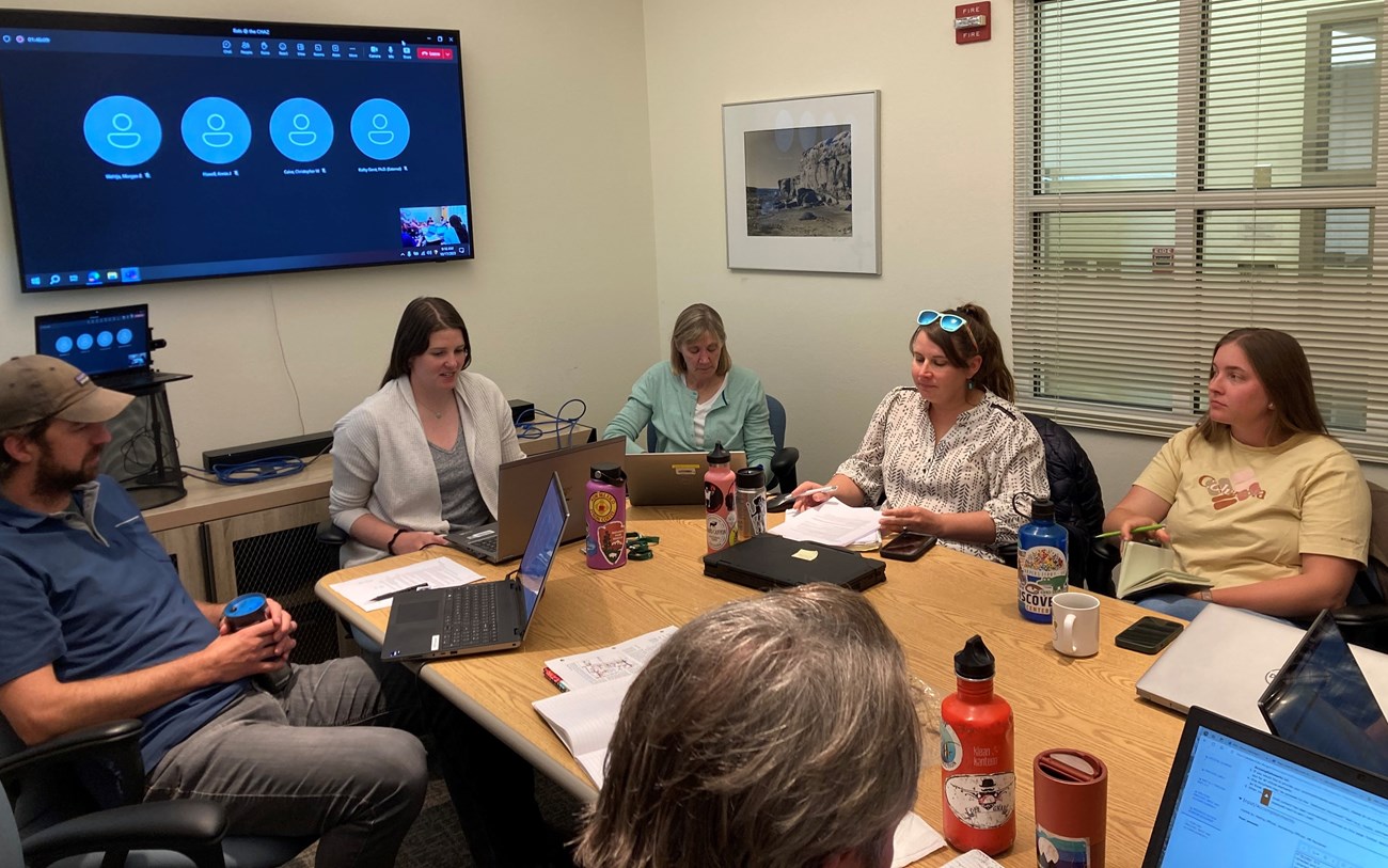
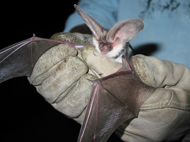
In October, many of us gathered at the Chaco-Aztec Museum & Archives Facility (CHAZ) in Albuquerque, New Mexico to discuss our incredibly diverse bat community and outline a detailed implementation plan for a multi-park bat project recently funded by NPS’s Emerging Wildlife Disease Program. Many thanks to Cynthia Wiley (Museum Curator) and Brenna Lissoway (Archivist) for hosting us at the CHAZ and sharing some of their amazing collection!
NPS
Plateau Perspectives
Mariusz Jeglinski
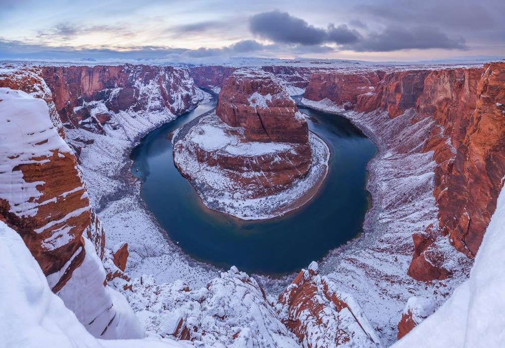
We can almost guarantee that you, dear reader, have seen this iconic southern Colorado Plateau location in at least one photograph. It is of course the famous Horseshoe Bend at Glen Canyon National Recreation Area, where the Colorado River created a roughly 1,000 ft (305 m) deep, 270º horseshoe-shaped bend. But maybe, just maybe, you have never seen it in the snow!
Tracking Pinyon-Juniper Vulnerability in SCPN Parks
Can Satellites be Used to Predict Die-off Events?
SCPN is partnering with four parks that have experienced pinyon-juniper die-offs to test whether indications of the mortality events can be identified in remote sensing imagery months or years in advance. We expect vegetation to be stressed well before it dies from an extended drought, and we also hope more rapid-onset mortality events may be presaged by telltale signs of vegetation susceptibility.
While mortality appears as a clear and unmistakable break in an inter-annual record of growth cycles, gradual vegetative decline in these evergreen systems is more subtle and harder to detect. Detection is further complicated by a critical shortcoming of the satellite indices most often used to track vegetation condition. In western conifer ecosystems with sparse canopies, indices are more sensitive to the effects of sun angle and shadowing than to plant photosynthetic capacity (Norris & Walker 2020). The lack of a reliable satellite-based record of plant condition over time means NPS managers have no advance warning about Pinyon-Juniper vulnerability prior to a die-off event.
We hope to change all that.
SCPN’s Landscape Ecologist Jodi Norris is partnering with USGS Remote Sensing Scientist Jessica Walker to identify a replacement satellite index to use in pinyon-juniper ecosystems. One of the desired criteria for this new index is sensitivity to vegetation stress that precedes disturbance events such as the die-offs observed in the four test parks. A verified signal of vegetation condition trend will be the basis for estimating plant stress and vulnerability.
If the effort succeeds, NPS managers will be able to view weekly updated vegetation condition maps across our widespread pinyon-juniper ecosystems, with the hope of providing managers with an early warning of areas most susceptible to die-off.
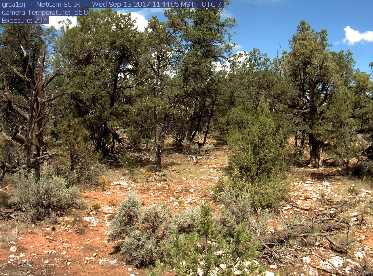
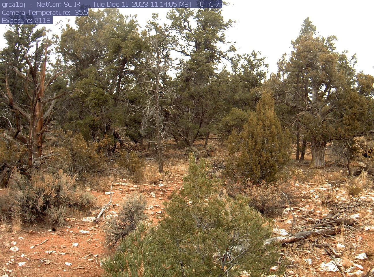
Left image
Credit: NPS
Right image
Credit: NPS
Bob Parmenter - A Remarkable Career, an Invaluable Perspective
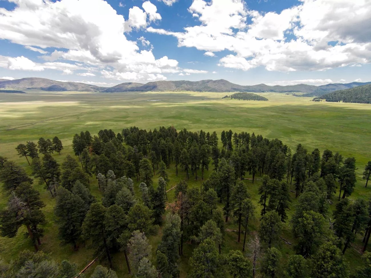
When someone gets to work in a landscape for just one field season, they usually walk away knowing that place like a close friend. Now imagine working 20+ years in an area. Especially one as beautiful and diverse as Valles Caldera National Preserve (VALL) in New Mexico. That’s what Chief of Science & Resource Stewardship Bob Parmenter has accomplished. He is retiring soon, but that is not going to stop him from continuing his pursuit of research in this iconic area of the Plateau. We were fortunate enough to interview Bob in the Fall of 2023.
Interview conducted by Christopher Calvo
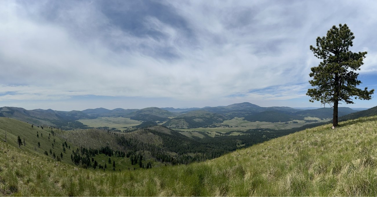
C. Daily/NPS
I grew up in northern Virginia, and frequented Shenandoah National Park with my family as a kid in the 1950s and then with high-school friends in the 1960s – lots of hikes and camping trips along the Blue Ridge Parkway and the Appalachian Trail. And living close to Washington D.C., I also visited the NPS sites in the city quite often, especially while hosting out-of-town visitors!
How did you become interested in science, and what motivated you to pursue a career in this field? Who were some of your influences/mentors?
Northern Virginia was very rural in the 50s and 60s – this was before the I-495 Beltway was even built! I spent a lot of time in the woods and creeks near my home, catching frogs and snakes and turtles to keep as pets for a while, and then releasing them to catch more of different species. I used to ride horses through fields that are now inside the Beltway, and of course, are long buried under shopping centers and residential developments. But those childhood experiences put me on the path to learn about Nature and all the species that lived in my neighborhood. My mother was very tolerant of all the creatures I’d bring back to the house – she had been born on an African mission in what was then the Belgian Congo in 1925, so she had lots of pet wildlife when she was a kid – so a kindred spirit in that regard. And all my childhood buddies were similarly inclined to explore the local forests and swamps with me – so it was all a very positive, reinforcing experience to learn about Nature. In high school, I had a biology teacher, Mrs. Abell, who was very dynamic as an instructor, so she provided a great role model for science – a number of us students talked her into teaching an Advanced Biology class our senior year. At Colorado College, Professor Richard Beidleman was my most memorable professor – he was an ecologist/naturalist, and took our classes on extended field trips throughout the Southwest and to many National Park units. At the University of Georgia, for my Masters in Zoology, I worked with Professor Whit Gibbons, a Herpetologist, and Professor Gene Odum, an Ecologist – both excellent ecologists and very entertaining individuals! And then at Utah State University for my Ph.D., Professor Jim MacMahon was my advisor, and he provided a wealth of information on all aspects of ecology – we’re still publishing research papers together even now!
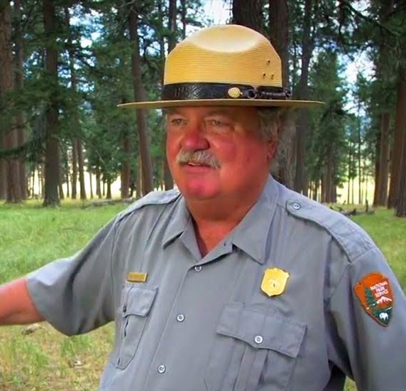
NPS
Without question, the event that spawned a massive amount of research, both with NPS staff and outside researchers, was the 2011 Las Conchas Fire, which burned 156,000 acres including ~30,000 acres of the Preserve. We realized that with a warming climate, this fire would not be the last of its kind in the Preserve, so we wanted to understand the ecological impacts and recovery processes. As such, we set about monitoring vegetation, wildlife - both vertebrates and invertebrates, soils, streams, fish, aquatic invertebrates, and so on, with an experimental design that included burned areas and unburned controls, replicated plots, and stratified sampling over different habitat types including mixed-conifer and ponderosa
forests, grasslands, wetlands, and riparian zones. Those monitoring sites are still being sampled to get long-term patterns, and we’re still working on publishing a number of these data sets.
How has Valles Caldera changed since you first started there in 2003 till now?
When I first arrived here at VALL in spring, 2003, the landscape looked absolutely gorgeous – indeed, it was the “pristine” landscape that convinced Congress to purchase the property in 2000. However, upon closer inspection, there were five areas in need of considerable restoration. First, the forests had been clear-cut mostly during 1963-1972, and had grown back in high-density “dog-hair thickets” of second-growth stands; this had created unbelievably high fuel loads.
So, forest restoration, including thinning and burning, was clearly needed. Second, the grassland valles had been seriously overgrazed by sheep and cattle for perhaps 200 years, with damage to creeks and wetlands. Third, the logging operations in the 20th century had created nearly a thousand miles of logging roads, causing soil erosion problems, and dissecting the landscape – VALL has around 6 miles of road for every square mile of land. Fourth, in support of the livestock grazing, the ranch owners had built 185 cattle stock-tanks, which cut off the hydrologic connectivity of the upland catchments with the lower watersheds. And fifth, the ranchers had built 77 miles of fences, net-wire for sheep, barbed-wire for cattle, partitioning the landscape into dozens of pastures and creating lethal barriers to wildlife movements.
So, the good news is we’re almost finished with the forest thinning, having completed ~10,000 acres of forest, including the south-facing slopes of all the unburned areas. Also, our partners, including Los Amigos de Valles Caldera, Rio Grande Return, Rio Puerco Alliance, Keystone Restoration Ecology, and WildEarth Guardians, have finished about 80% of the needed wetland and stream restoration. And finally, all 77 miles of old livestock fencing have been removed. We still need to deal with reclaiming the roads, and removing the stock tanks, but with time, we’ll get those done as well.

NPS
At my home, I put out bird seed in the winter, and enjoy observing the various species around my house. Over the years, I’ve noticed the replacement of mourning doves by white-winged doves (a southern species), presumably associated with climate warming. It reminds me that climate change is happening at a fast enough rate to be observable in real time!
As for human activity, at VALL, we humans have re-introduced three species that had been extirpated recently from their native habitats. In 2007, we put several hundred Rio Grande suckers and Rio Grande chubs into the San Antonio Creek watershed, and they have been thriving ever since. In 2013, we re-introduced the northern leopard frog to the Jemez Mountains, and this species has now dispersed into the major watersheds on VALL and seems to be doing very well.
How has collaboration with other professionals played a role in your work, and what are some key lessons you’ve learned from interdisciplinary teamwork?
I’ve always been a team player and working with a broad range of people has certainly helped forge my current approach to scientific applications. I’ve learned that to have a successful team, I need to recognize early-on the role I’m supposed to play in each project – using a football analogy, sometimes I’m the quarterback calling the play, sometimes I’m the ball carrier, and sometimes I’m in support as a down-field blocker. Each project is different, so being adaptable is important.
How do you see the future of biology/ecology evolving, and what areas of research do you believe will be particularly important in the coming years?
I suspect that ecological responses to climate change will be in the forefront – it’s not enough to know how the climate is changing, but what those impacts are on ecosystem structure and functioning. In concert with ecological research, the ability to examine genetic changes and evolutionary processes under a changing climate may start taking an important role. Finally, genetic engineering has a huge potential to impact both human ecology and nature in general.
What role do you think individuals, communities, and governments should play in fostering a more sustainable relationship with the environment?
Given that private industry has been the proximate source of most of the world’s current environmental problems, the solutions to fixing these issues and preventing
future problems falls on individuals, groups/communities and government as there is no one else. With proper direction, regulation and guidance, private industry can also be the source of solutions – but left unchecked, industry will create more problems than it solves.
What advice would you give to young scientists who are just starting their careers?
Think big and think long-term! Embrace teamwork and colleagues in research projects, and accept constructive criticism to help build stronger ideas, concepts and experimental approaches to problems.
NPS
What are your plans after retirement?
I’m doing the paperwork now to become an NPS “Volunteer” and continue working on the science part of my job – continuing data analyses, writing journal articles, doing educational field trips – everything except the administrative functions!
Any words to your VALL family?
It’s been a great 20+ years at the Preserve, and I look forward to many more as a volunteer scientist – what a great team with whom to work!
Becoming Better Scientists After Every Single Hitch

NPS
A hitch is biologist slang for a bout of field work. For our hard-working upland vegetation and soils crew, a typical hitch is eight days long. As scientists we make detailed preparations before heading out on the first hitch of the season, and do our absolute best to collect quality data. But, what if we could do better? Of course, we naturally become more proficient at tasks over time, but what if we could increase our rate of improvement by instantly assessing our work? That is the idea behind a great new technique being used by SCPN Plant Ecologist Megan Swan.
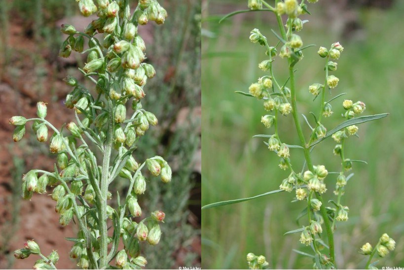
Megan and Data Specialist Cindy Parker developed a tool that focuses on something called observer error. Observer error exists in almost all data sets whether you are measuring, counting, or estimating something. It just happens. Sometimes we overestimate grass cover, or we misidentify a plant, and it’s important to catch these things as soon as possible. “I think the idea of observer error, that we don’t collect data with 100% accuracy, can be a tough thing to think about as someone whose job it is to collect and interpret data.” Megan says. “It’s unpleasant to face, but ultimately, knowing as much as you can about the variance between observations can really help inform your interpretation of the data. I went into it with that mindset, and then after a few years I wondered if it could be useful in more of a real-time context to provide feedback to the field crew on how things are going.”
When asked what the crew’s overall response has been to the tool, Upland Vegetation Crew Field Leader Hannah Andrascik smiled and said “I think they liked it, and it made them a little bit nervous. I think it really does make them feel a greater connection to the data they collect during those long, hot days in the field. But there is definitely a little added accountability there too, knowing everyone will be able to see your data. But then again, who doesn’t want to be a super finder?”
Max Licher/CC-BY-SA
Recent Publications
Report: Site Characterization and Change Over Time in Semi-Arid Grassland and Shrublands at Three Parks: Chaco Culture National Historical Park, Petrified Forest National Park, and Wupatki National Monument - Upland Vegetation and Soils Monitoring 2007-2021 (U.S. National Park Service) (nps.gov)Data Publication: Data Publication Brief - Aquatic Macroinvertebrates and Upland Vegetation/Soils (U.S. National Park Service) (nps.gov)
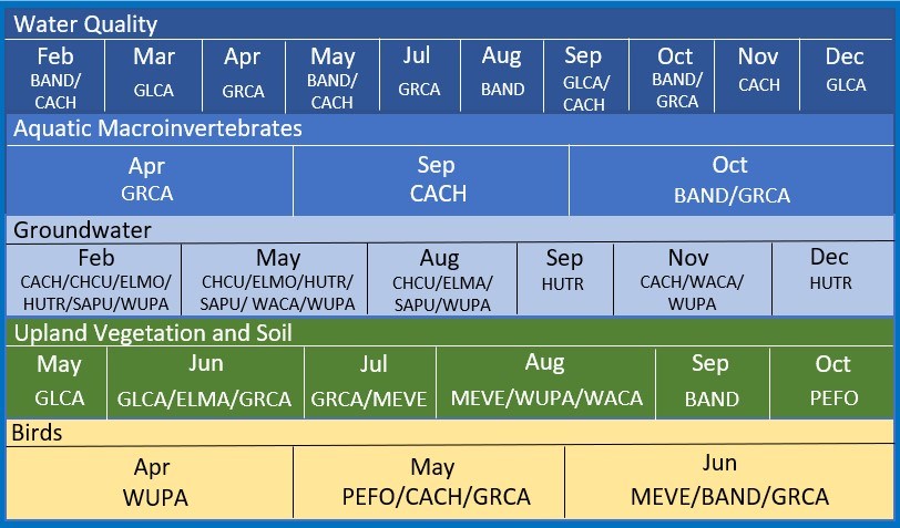
Southern Colorado Plateau Network 2024 Field Schedule
These are the parks, historical sites, monuments, and recreation areas we proudly work for:

Southern Colorado Plateau Network - 930 N Switzer Canyon Dr. Suite 200, Flagstaff, AZ 86001
Tags
- aztec ruins national monument
- bandelier national monument
- canyon de chelly national monument
- chaco culture national historical park
- el malpais national monument
- el morro national monument
- glen canyon national recreation area
- grand canyon national park
- hubbell trading post national historic site
- mesa verde national park
- navajo national monument
- petrified forest national park
- petroglyph national monument
- rainbow bridge national monument
- salinas pueblo missions national monument
- sunset crater volcano national monument
- valles caldera national preserve
- walnut canyon national monument
- wupatki national monument
- yucca house national monument
- newsletter
- southern colorado plateau network
- inventory and monitoring division
- upland vegetation
- phenology
- bats
- remote sensing
