Last updated: March 21, 2024
Article
The Barlow Road on the Oregon Trail

NPS Photo
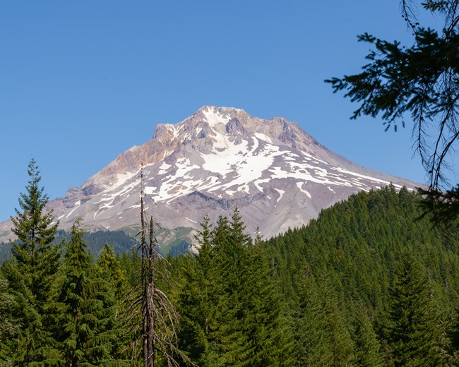
Back in the storied time, the Klickitat tell, Wy’East was a proud and handsome man until the Creator turned him into a mountain for fighting with his brother over a woman. For thousands of years the Molalla, Cascades, Kalapuya, Clackamas, Klickitat, Wasco, and others hunted this mountain’s slopes, fished its streams, and named its hallowed places. Their paths etched the mountainsides long before 1792, when a British explorer renamed the peak after Admiral Samuel Hood.
Few Americans had ever seen anything like the majestic, snow-robed volcano they knew as Mt. Hood. It was a peak of remarkable beauty, an Oregon Trail icon, and the final challenge to reaching journey’s end. Although a well-known Indian path, the Lolo Pass Trail, skirted the northwest flank of Mt. Hood, it was too narrow and rugged for covered wagons. Some overlanders drove their cattle that way to the Willamette Valley, but the forest grew so thick on the mountainsides that, in places, a cow could barely squeeze between the trees. Early immigrants who wanted to take their wagons to the valley had to float the Columbia River from The Dalles.
Samuel Barlow’s wagon company rolled into The Dalles in late September 1845, and the situation he found there did not suit the wagon master at all. Some 60 families were already waiting for two small boats to arrive, on no particular schedule, to carry them downriver. Barlow’s newly arrived party would have to wait at least 10 days for a turn in the boats, and the fare would cost them dearly. He decided, instead, to cut a new wagon road around Mt. Hood to Oregon City.
“God never made a mountain that he had not made a place for some man to go over it or around it. I am going to hunt for that place,” Barlow declared, heedless of the warnings from local men who knew the mountain. Other immigrant families decided to follow him.
The company’s seven wagons, 19 adults, and several children rolled out of The Dalles on September 24, heading south along a well-used Indian and cattle trail (today’s US-197). Those 35 miles to Tygh Valley were tame enough. The small wagon train made camp near a Tygh Indian village while Barlow and several others hiked into the mountain wilds to scout a route through. More men followed them with dull axes and rusty saws, clearing a wagon-width passage through thick timber, huge fallen trees, and a dense understory of “laurel,” or rhododendrons. Meanwhile, Joel Palmer’s 23-wagon company of overlanders arrived unexpectedly from The Dalles to join the effort.
As the road-builders labored into mid-October, Palmer and a companion scouted ahead, backtracked, and circled in search of a way to take wagons through a maze of ridges and canyons. Several days of bushwhacking, trying Indian trails, and testing river bottoms left the men bewildered. Overhead, heavy, dirty-wool clouds settled above the treetops, threatening rain and snow. “I began for the first time to falter,” Palmer remembered, “and was at a stand to know what course to pursue.” He could advise his wagon party to return to The Dalles, and suffer their anger and blame; or he could lead them deeper into the mountains and risk them getting trapped between rising rivers. Then he had another idea.
Upon returning to camp, Palmer proposed to stash wagons and belongings on the mountain and pack to the settlements. The men hurriedly built a log cabin, “Fort Deposit,” to store their possessions until they could return to retrieve them. Several men started ahead to buy provisions, while one family turned back to The Dalles. The others bundled their remaining food and bedding onto the backs of their livestock and struck out, some of them barefoot and all of them hungry, through curtains of winter drizzle, cold as iron.
After packing along an Indian path on the south flank of Mt. Hood, the overlanders started across the Pacific-facing slope of the mountain, the side that catches the rain. It was then that “the real simon-pure hard times commenced,” recalled William Barlow, Samuel’s son, some 62 years later.
Part of the difficulty was the weather, with rain, snow, and wind. Part was the terrain, with its rocky slopes and canyons, its old growth forest and tangled deadfalls, its mud and marshes that mired the heavily laden pack animals. And part of the problem was the worn-out condition of the travelers. Only the weakest of the women and children were permitted to ride on the backs of horses and oxen; everyone else had to walk through the mud, wade the icy mountain streams, and pick their way through the marshes. They trudged onward, three to five miles each day.
Upon reaching the crest of Laurel Hill, the divide between Camp Creek and the Zigzag River, the immigrants gawked at an impossibly long, steep descent before them, 2,000 feet from top to bottom. Having no way to go but forward, they gritted their teeth and stepped onto the slope, skidding down “like shot off a shovel,” remembered William Barlow in 1902. The party next trudged over Devil’s Backbone, a long, narrow ridgetop that provided barely enough room for future wagons to pass in single file, with deep canyons on either side.
[Devil’s Backbone] was a long divide between two streams, but very narrow, with just room for wagons and teams to pass …. The sight was a grand one, but the road you must keep or plunge headlong with self, family, wagon and team down, down towards the regions below. —Charles Howard Crawford, 1851 emigration

NPS Photo
The Barlow-Palmer party descended at last to the comfort of Philip Foster’s farm at Eagle Creek, Oregon, on December 23. Oregon City was just an easy few days’ drive to the west. Despite their difficulties, not one member of the wagon company died during the ordeal.
With a government-issued charter and financial backing from Philip Foster, Sam Barlow hired a crew in spring 1846 to cut a road from Foster’s to Fort Deposit, where he had left his wagons. He began charging a $5 toll per wagon plus 10 cents per head of livestock, as authorized by his charter, to recoup the costs of his labor and supplies. A thousand emigrants, 152 wagons, nearly 1,600 head of mules, horses, and cattle, and 1,300 sheep reached the settlements by the new road in mid-September. The toll was expensive but still much cheaper than boat passage on the Columbia River. Yet immigrants felt outraged, accusing Barlow of trying to extort their last nickel at journey’s end. Some angrily refused to pay, holding up traffic until they were allowed to pass. Some had no money but signed promissory notes or offered tattered, trail-worn clothing from their wagons. Some managed to duck around the tollgates or “ran like a turkey” from the gatekeeper, as described in a later toll book. Having collected only enough to cover half of his expenses, Barlow eventually abandoned the project and allowed others to take up the toll road charter.
We… encamped near the ‘Gate’ which is nothing more than a tent with two men sitting at the ‘rceipt of custom’ to take from the way worn emigrint his last red cent under the authority of a ‘Democratic’ Charter. —Abigail Scott, age 17, September 20, 1852
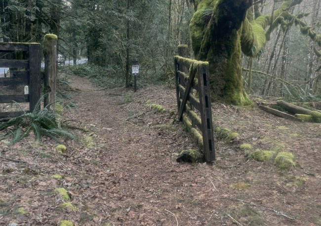
Various owners through the years collected the tolls, made improvements, and maintained the road—or didn’t. Every big windstorm knocked down huge trees. Snowmelt and rain tore wagon ruts into gullies. Underbrush constantly crowded the trail. Some operators left the never-ending upkeep to the immigrants, who would have to clear the way themselves if they wanted to reach the settlements. Travelers often complained about the road’s condition, accusing gatekeepers of “charging the dead” by making everybody pay at the east end of the road when many, they argued, would die before coming out the west end. They had a point. Some travelers did die along the Barlow Road, just heartbreaking hours from trail’s end. One such was a pioneer woman, her name unknown today, who lies in a lonely grave below Barlow Pass.
The dread Laurel Hill slide remained a challenge. Immigrants yoked their oxen to brace and hold the wagon back as it rolled forward, and they chained up the wheels to prevent them from turning. They cut and attached trees, top-first with branches projecting forward, behind or under the wagons to create drag. Then, tying one end of a rope to the rear axle and snubbing the other end around a tree stump, they slowly let down the wagon, hand over hand. The skidding wheels, branches, and iron-shod hooves loosened the dirt and rocks, which winter rains washed away to create long, scree-lined troughs, or chutes. Repeated use gouged the chutes—there were at least five through the years—as much as seven feet deep. Because it was impossible to pull wagons up Laurel Hill, the Barlow Road was necessarily a one-way, east-to-west route until 1861, when road-builders opened a better route that went around the obstacle.
We had to chain the wagon wheels and slide the wagons down the rutty, rocky road. My aunt Martha lost one of her remaining shoes, it rolled down the mountainside. I can hear her now as she called out in her despair, ‘Oh, me shoe, me shoe! How can I ever get along?’ So she wore one shoe and one moccasin the rest of the journey. —Harriet Scott Palmer, reminiscence, emigration of 1851
While descending this hill, or mountain, Grandma was sitting in the back seat of the buggy, she could not hold herself in but fell forward and struck the ground head first. She was hurt but little by the fall. —Stewart B. Eakin, August 19, 1866
Upon entering the valley at last, overlanders discovered Philip Foster’s end-of-the-road farm to be a most welcome oasis. Foster shrewdly turned his homestead into a tidy, welcoming inn for arriving wagon parties. His little store sold provisions, he offered meals and rooms as well as cabins for lengthier stays, and he provided pasture and feed for his customers’ livestock. Today a local historical society interprets his farm for visitors.
Despite complaints about the cost and conditions, an estimated three-quarters of the continuing Oregon immigration chose to travel the Barlow Road instead of risking their lives on the river. In good weather, with dry ground, and taking advantage of alignment changes to avoid hills and stream crossings, travelers could expect to spend about six days crossing country that occupied the Barlow and Palmer companies for three months.
Samuel Barlow lived quietly on his Oregon land claim at the present-day town of Barlow until his death in 1867. Joel Palmer led another wagon train to Oregon in 1847. He wrote a popular Oregon Trail emigration guide, made himself a name in Oregon politics, served with distinction as Superintendent of Indian Affairs and Indian agent, and died at age 71 in 1881. Philip Foster maintained and operated the toll road for a time after Barlow’s departure and ran his successful farm-store-inn business until his death at home in 1884. Young Abigail Scott, who complained of the tollgate in 1852, wed Benjamin Duniway in 1853 and six years later penned the first novel, about traveling to Oregon in a covered wagon, to be written in the Pacific Northwest. She later emerged as a leading figure in the fight for women’s voting rights. When Oregon passed women’s suffrage in 1912, Abigail became the first Oregon woman to register for the vote.
