Last updated: November 18, 2026
Contact Us
Article
Spadra Park Exhibit Audio Description

NPS Photo
Spadra Park Exhibit Audio Description
-
Spadra Park - Spadra's Busy Steamboat Scene Exhibit Audio Description
Wayside interpretive exhibit, full audio description is available.
Drops That Filled the River – Blood, Sweat, and the Trail of Tears. 1011 words.
This graphic panel is mounted beside the parking lot with a view over the wide Lake Dardanelle in front of you. To the left is the roofed shelter building.
Across the top of this vertical panel is a color illustration of a plain wooden flatboat behind a steam-driven paddleboat. The flatboat has a low, one-story structure filling most of the deck with a flat roof and openings for a door and window. Men, women, and children stand on the roof as well as down on the deck. Some are dressed in European-style clothing while others wear tunics over leggings, and head wrappings.
Text at left below the image reads, “Spadra’s Busy Steamboat Scene. Arkansas rivers have been important transportation routes for millennia. Arrival of the first steamboats in the 1820s, however, ushered in a new era of two-way commerce and travel. Early settlers in Arkansas used flatboats and keelboats to easily move downriver. Traveling upriver was difficult until steam technology. Steamboats made transportation both downriver and upriver convenient. They could pull, push, or lash to the side additional boats, such as the flatboats and keelboats used on the Trail of Tears.” End of text.
Below the text is a black and white photo from a hilltop overlooking a wide bend in the river curving off to the right. A stone wall borders the hilltop with a gate at left. The caption reads, “A look back in time – this 1940s postcard shows how the Arkansas River possibly looked in the 1800s. The US Army Corps began to straighten and channel the river for improved navigation and flood protection in 1954, later creating recreation access points like Spadra Park.”
Text in the middle of the panel below that large illustration reads, “Sidewheel Steamers. Most of the Cherokee, Muscogee (Creek), Choctaw, Chickasaw, and Seminole who traveled the Trail of Tears through Spadra en route to Indian Territory were on keelboats (shown above) towed by a sidewheel steamboat (shown below). Sidewheel steamers had a shallower draft that allowed the boat to operate at lower water levels.” End text.
Below the text is a color illustration looking at a steamboat from the front. The lower deck is full of crates and barrels. Two tall smokestacks rise about midway back with a pilot’s cabin perched behind them. At the back on the right is the arch over the paddle wheel mounted on the side.
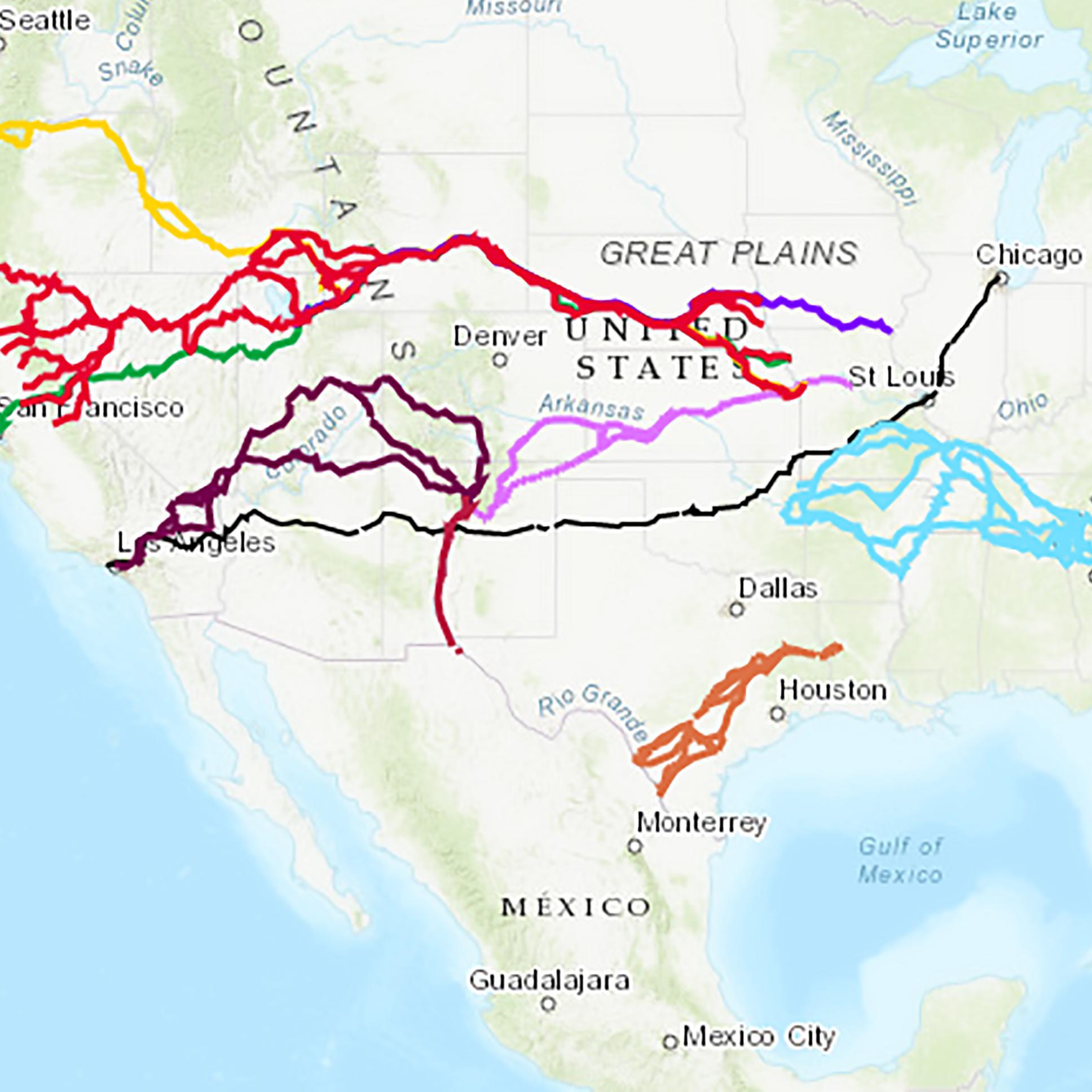
On the right side of the panel is a column with a satellite image of the area at top. A blue line winds along the path of the river from right to left with your location at Spadra Park near the middle. This marks the water route taken by all five tribes. Other colors mark the other paths taken. Across the bottom is a red line from right to left marking the route taken by the Choctaw, with segments taken by the Cherokee, Seminole, and Muscogee. Above the river a green line follows the river close, then veers more northward. This was the route followed by Muscogee. Above that is a white and yellow line from the east to Clarksville (north of your current location) marking a route of the Cherokee, Seminole, and Muscogee. At Clarksville, a yellow line leads south to the river, tracing a path followed by the Seminole. From Clarksville, a green and white line heads northwest, the route taken by Muscogee and Cherokee.
Text below the map reads, “Multiple Paths Crossed near Spadra.
Spadra was an important steamboat landing, but Spadra Creek was also a significant location on the Trail of Tears. Records indicate that 20,000 tribal members crossed the creek. Documents also hint at their varied and tragic experiences. Here are a few examples.“May 1834, Cherokee Nation. A detachment voluntarily removing to the west crossed Spadra Creek, bought corn and bacon from a local, then continued seven miles to camp in a heavy rain. Sadly, detachment leader Lt. Joseph Harris wrote in his journal that while the “Health of Company [was] improving...Rob Shelton’s boy child died & was buried today.”
“November 1836, Muscogee Nation. Citing bad roads and severe weather on the land route, Lt. John Sprague convinced 1,200 Muscogee to board the John Nelson at Spadra – just in time for the crew to threaten mutiny due to anger with their acting captain. The threat of monetary losses if the Muscogee disembarked helped resolve their differences, and the steamboat departed for Fort Gibson.”
“July 1838, Seminole Nation. During the summer of 1838, low water stranded 33 Black Seminoles at Lewisburg. Their conductor hired two ox teams and wagons, and they continued by land 54 miles. They forded Spadra Creek to reach the steamboat landing, joining another Seminole contingent on the Itasca within about two weeks.” End text.
Across the bottom of the panel is a dark band. Text at left reads, “Trail of Tears Water Route - 77 More Miles to Indian Territory. The US government forcibly removed the Cherokee Nation in 1838-1839. Other Native peoples forcibly removed from the southeastern United States included the Muscogee, Choctaw, Chickasaw, and Seminole Nations. All groups traveled by land and water routes.” End text.
At bottom right text reads, “Drops That Filled the River: Story and Itinerary. Travel the Arkansas River and follow the stories of the Trail of Tears Water Route. go.nps.gov/WaterRouteAR.” A QR code to the left of the text takes you to that web site.
Just to the right is the Audio Description icon with text that reads, "Listen, Learn and Follow the Trail. Audio description available. Learn more about this story and the Trail of Tears. go.nps.gov/Spadra." There is also a QR code to take you to that web site.
Across the top of the panel is a black bar. At the left end text reads "Spadra Park." At the right end is the logo and text for Trail of Tears National Historic Trail. Other text reads, "US Army Corps of Engineers, Trail of Tears Association, Arkansas Chapter, and National Park Foundation."
End of Description.