Last updated: February 10, 2022
Article
John Smith's Map of Virginia: A Closer Look
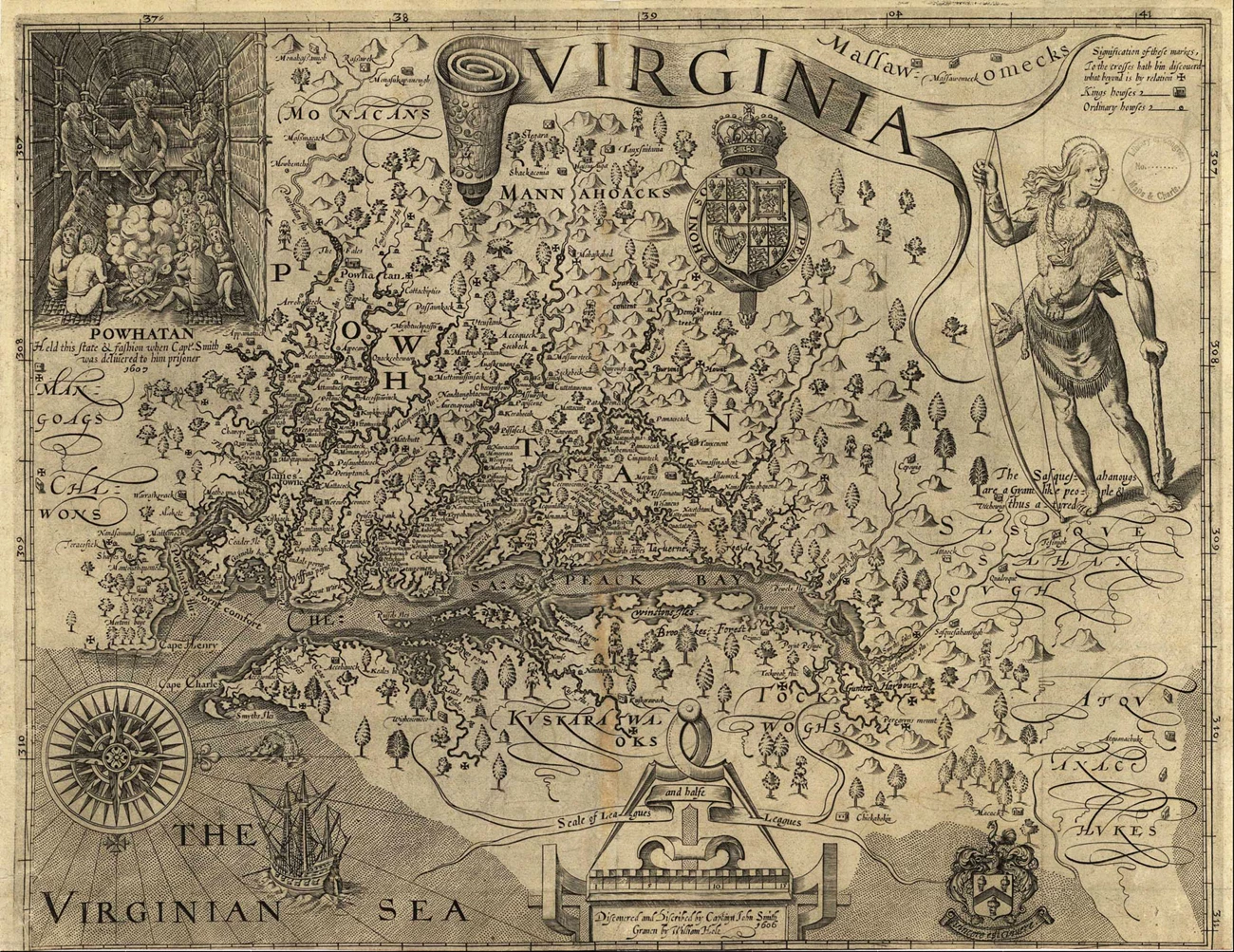
Captain John Smith created the first detailed map of the Chesapeake Bay. In addition to the region’s geography, Smith labelled the locations of dozens of American Indian towns. His map of “Virginia” – which also depicts what is today Washington D.C., Maryland, Pennsylvania, and Delaware – was published in 1612. It remained in active use for seven decades by Europeans looking to explore, build settlements, and trade in the region.
The map’s geographical accuracy is impressive given that Smith traveled about 2,500 miles in a series of short expeditions and had only rudimentary mapmaking tools to work with. A significant portion of the geographic and cultural information was communicated to Smith by American Indians themselves. American Indians did not make paper maps like Europeans did, but they had other equally effective methods for recording and sharing information about location and geography.
Smith’s map is an invaluable resource for contemporary Tribal citizens, researchers, and others interested in the details of Native societies in the Chesapeake prior to European interference.
Basic Information
Smith’s was the first detailed map of the Chesapeake Bay and what is now Virginia, Maryland, Delaware, Pennsylvania, and Washington D.C. It shows:
- The shoreline, rivers, tributaries, bays, and islands he visited on his voyages
- More than 200 Indian towns and their names
- Illustrations of Powhatan, a paramount Chief, and of a Susquehannock warrior
Smith compiled the information he learned about the Bay in 1608 while still in Jamestown and sent an early map back to England. This first map ultimately fell into Spanish hands and became known as the "Zuñiga Map."
Smith returned to England in 1609 following an injury, and three years later in 1612 he prepared and published the definitive version of his map. Titled “A Map of Virginia. With a Description of the Countrey, the Commodities, People, Government and Religion,” the work was published by Oxford University Press.
The publication included a map engraved by William Hole based on Smith’s descriptions and calculations. Smith also wrote a narrative description of Virginia and the Indigenous people of the region that appeared alongside the map.
As they sailed throughout the Bay in 1608, Smith and his crew wrote notes, made sketches, and used navigational equipment to record approximate locations.
In the 1600's, determining exact geographic locations was difficult because of primitive navigational tools. Smith probably used a compass in conjunction with a speed measuring device such as a chip log, to see how far they had traveled from a given point. He estimated their latitude with a quadrant, however a tool for determining longitude had not been invented yet.
Importantly, American Indians that Smith and his crew met along the way provided a great deal of information. For example, Native people informed him of towns that were located further upstream than the crew could travel in their shallop.
- The map does not show the route of Smith’s voyages. Scholars have mapped the voyages using the information Smith recorded in his writings.
- The date on Smith's map is 1606, which is before the start of his earliest explorations of Virginia and the Chesapeake Bay in 1607.
- North is not at the top of the map as is the norm today, but to the right. Captain Smith drew the map from the perspective of a ship coming from the Atlantic.
- A league - the scale used - equals 3 miles long.
Parts of the Map
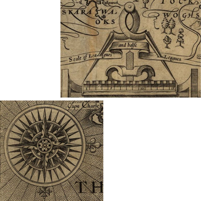
The map's SCALE is used to show distance. The unit of measurement used on Smith's map is a “league”, a unit which is equal to about three miles.
A COMPASS ROSE is used to indicate the cardinal directions, north, east, south, and west. Here, the compass rose indicates that north is to the right side of Smith's map.
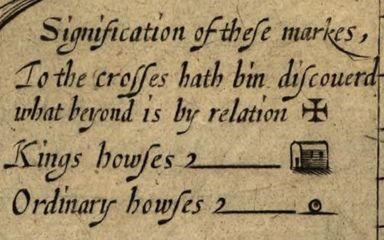
The map has a KEY to tell readers what the different symbols on the map mean. The first symbol is a cross. Crosses on the map mark how far Smith traveled up the different rivers in the Bay. Second, there is a house symbol to label what Smith calls a "King's House." In other words, this is a town where a regional chief, or weroance lived. Finally, there is a circle used to mark the remaining towns.
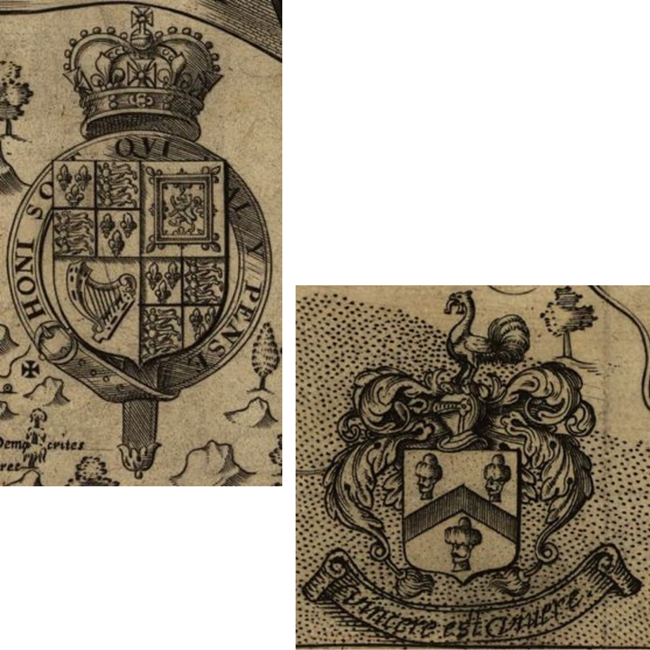
The COAT OF ARMS of England and of John Smith are shown. The Royal Coat of Arms, left, dates back to the 12th century. John Smith also includes his own coat of arms, which features his motto, "To live is to conquer" and the heads of three men he killed while fighting in Eastern Europe.
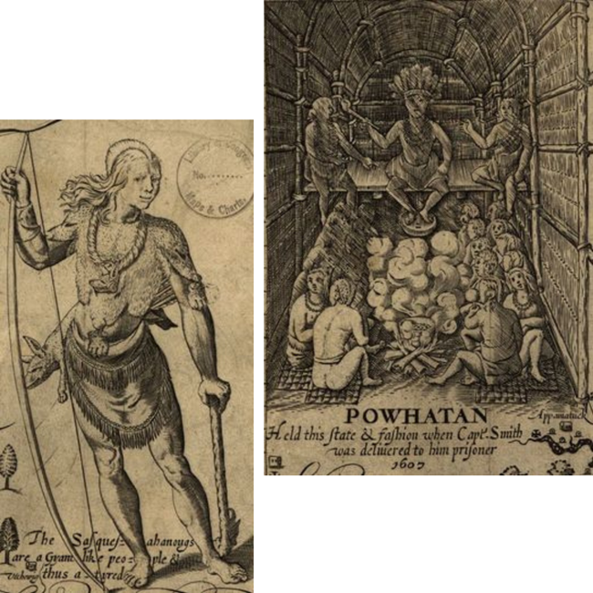
There are two illustrations on Smith's map that depict AMERICAN INDIANS. On the left is an illustration of a Susquehannock man carrying a bow, club, and wearing a bear-skin mantle. On the right is paramount chief Powhatan presiding over his longhouse at Werowocomoco. As paramount chief, Powhatan received tribute from some 30 tribes in Tidewater Virginia, known in Powhatan's language as Tsenacomoco.
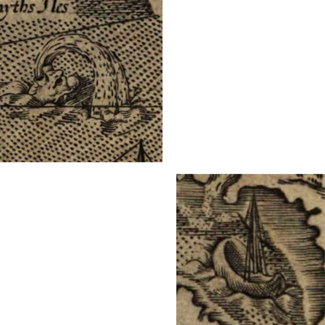
Two SEA MONSTERS writhe in the waters of the Chesapeake Bay. Sea monsters were commonly included as decorative embelishments by map makers in the early 1600s.
John Smith's SHALLOP, the vessel he captained throughout the Chesapeake Bay, is shown on the map sailing towards the Bay's upper reaches.
