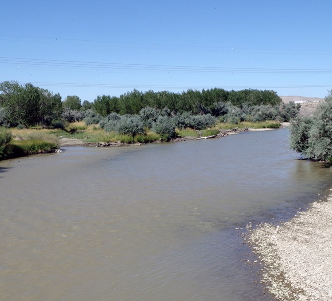
Part of a series of articles titled Water Resources Monitoring in the Shoshone River at Kane, Wyoming, 2019.
Article
Shoshone River at Kane, Wyoming

NPS
The Shoshone River starts in western Wyoming at the confluence of the North Fork and South Fork of the Shoshone River at the Buffalo Bill Reservoir near Cody, Wyoming. The river is an approximately 100-mile (161 km) tailwater river originating from the Buffalo Bill Dam near Cody, Wyoming, and extending to its confluence with the Bighorn River in Bighorn Canyon National Recreation Area. The Buffalo Bill Reservoir was created following the construction of the Buffalo Bill Dam between 1905 and 1910. This concrete arched dam was the tallest (at 350 feet) in the world at the time of construction and was named after Colonel William F. “Buffalo Bill” Cody. It was constructed as part of the Shoshone Project (one of the Bureau of Reclamation's earliest irrigation projects) as a means of storing snowmelt for irrigation in the Bighorn Basin (USBR 2022). The construction of this dam at the confluence of the North Fork and South Fork of the Shoshone River serves as a testament that both tributaries produce snowmelt generated runoff originating from the Absaroka Mountains on the east side of Yellowstone National Park.
The upper reaches of the Shoshone River are a destination fishery recognized as “blue ribbon” by the Wyoming Game and Fish Department (Day et al. 2003). Angling, rafting, and kayaking are popular activities in the 24-mile (38.6 km) reach of river from Buffalo Bill Dam northeast to Willwood Dam. Recent estimates indicate that commercial guiding of these activities contributes approximately $35 million annually in economic benefits to Park County (PCFCD 2019). Because of its value to the economy and designation as a high-quality fishery, considerable research has examined the habitat and flow needs of two species of salmonids (Yellowstone cutthroat trout and brown trout) that are present in the upper reaches of the Shoshone River (see Annear et al. 2002 and Dare et al. 2002 as examples). Lower reaches below Willwood Dam have experienced fish kills—in 2007 and 2016. Sediment releases associated with planned and unplanned dam operations and maintenance contributed to documented fish kills (AP News 25 October 2016; Bie 2016).
Near Lovell and Kane, Wyoming, assessments of fecal coliforms and Escherichia coli indicate that the segment of the Shoshone River (WYBH100800140504_00) from the confluence with Bighorn Lake to a point 9.7 miles (15.6 km) upstream had concentrations that were four to five times the Wyoming Department of Environmental Quality's fecal coliform criterion (Clark and Gamper 2003). In 2014, the U.S. Environmental Protection Agency approved an E. coli Total Maximum Daily Load (TMDL) for the impaired segment of the Shoshone River, and this segment was moved from the 303(d) list to Category 4A (WYDEQ 2016). Class 4A waters indicate that a state developed TMDL has been approved by EPA for that water body or segment. In this same reach, suspended sediments and nitrate + nitrite as nitrogen levels are high throughout much of the year (Kaylor et al. 2015). The Greater Yellowstone Inventory and Monitoring Network monitors the Shoshone River at Kane, Wyoming, at the Hwy 37 bridge crossing within the segment of the river that has an approved TMDL for E. coli.

NPS

USDA NAIP Imagery 2020/NPS
References
Annear, T. C., W. Hubert, D. Simpkins, and L. Hebdon. 2002. Behavioral and physiological responses of trout to winter habitat in tailwaters in Wyoming. Hydrological Processes 16:915–925.
Clark, M. L., and M. E. Gamper. 2003. A synoptic study of fecal-indicator bacteria in the Wind River, Bighorn River, and Goose Creek Basins, Wyoming, June-July 2000. U.S. Geological Survey, Water Resources Investigations Report 03-4055. Cheyenne, Wyoming.
Dare, M. R., W. A. Hubert, and K. G. Gerow. 2002. Changes in habitat availability and habitat use and movements by two trout species in response to declining discharge in a regulated river during winter. North American Journal of Fisheries Management 22:917–928.
Day, P. D., T. C. Annear, S. Yeke, and R. McKnight. 2003. Winter flow recommendations for the Shoshone River below Buffalo Bill Dam. Report to Wyoming Game and Fish Department. 74 pgs.
Kaylor, K., W. A. Sigler, and A. Ray. 2015. Water quality data summary report for Bighorn Canyon National Recreation Area: Preliminary analysis of 2014 data. Natural Resource Data Series NPS/GRYN/NRDS—2015/810. National Park Service, Fort Collins, Colorado.
Powell-Clarks Fork Conservation District (PCFCD). 2019. WaterSMART cooperative watershed management program phase I grants. A collaborative effort among partners to address sediment contributions to the shoshone river. Powell-Clarks Fork Conservation District, Powell, Wyoming.
U.S. Bureau of Reclamation (USBR). 2022. Projects and facilities: Buffalo Bill Dam. Available at https://www.usbr.gov/projects/index.php?id=33 (accessed 25 May 2022).
WYDEQ 2016. Wyoming 2014 Integrated 305(b) and 303(d) Report. Document #16-0126. Wyoming Department of Environmental Quality, Cheyenne, Wyoming.
Last updated: October 27, 2022
