Last updated: February 3, 2025
Article
Soil Surface Elevation Monitoring at VIIS

NPS photos / SFCN staff
Overview
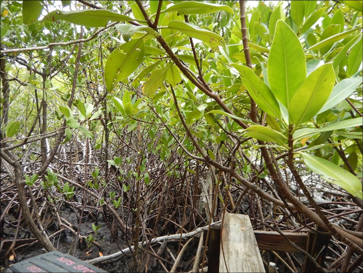
Mangrove wetlands provide flood control, storm protection, shore stabilization, capture soil runoff, carbon storage, and habitat for fish and wildlife communities. The soil elevation in mangrove forests affects tidal inundation period and frequency, sedimentation, erosion, and the shrink and swell of soil materials, which all impact mangrove seedling growth, composition, and survival. If the rate of relative sea level rise is greater than the rate at which mangrove soil elevation increases, then as the trees die off there is no mangrove growth to replace them. These areas will eventually convert to shallow open water marine habitats and the mangrove forest will move inland. Understanding this rate of change is critical to predicting the long-term ability of mangrove forests to regenerate. The National Park Service (NPS) South Florida / Caribbean (SFCN) Inventory and Monitoring (I&M) Network established a long-term soil surface elevation monitoring program in Biscayne National Park, Salt River Bay National Historical Park and Ecological Preserve, and Virgin Islands National Park
Methods
Three benchmarks are established at each monitoring location, and each benchmark uses a removable SET measuring device to determine surface elevation. The SET instrument is temporarily attached to a permanent benchmark. The distance to the sediment surface is measured with fiberglass pins lowered to the surface. Marker horizons are layers of feldspar placed on the soil surface. They help determine what is affecting soil elevation change measured by the SET. Factors affecting the change include sediment deposition or erosion, root growth, decomposition, shrink and swell, and compaction.

NPS photo / SFCN staff
Findings
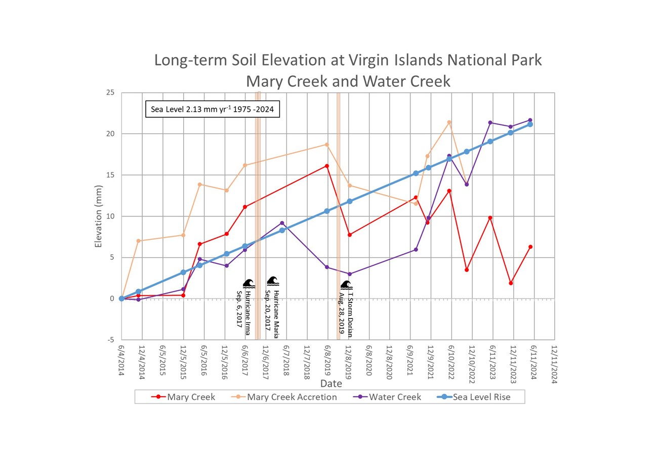
Sampling occurred in November 2023 and May 2024 at the Mary Creek and Water Creek soil elevation monitoring stations in Virgin Islands National Park. Elevation at Mary Creek increased from its establishment in 2014 until 2019. But since 2019, the elevation appears to be steadily decreasing. On the flip side, overall elevation at Water Creek appears to be on the increase since 2014.
In 2017, both sites were impacted by Hurricane Irma and Hurricane Maria. There was up to 90% tree mortality at the Mary Creek site and recovery has been slow and limited. The effects of the storms on the soil elevation took time to appear. Post-storm decline at Water Creek was less severe. Since 2021, mangrove regrowth has increased and there is a marked increase in soil surface elevation. However, the long-term impacts of mangrove die-off are unknown and will require continued elevation monitoring.
Surface accretion data has been more difficult to collect at each site. Measured using a layer of feldspar sprinkled onto the soil surface at the previous sampling event, over time, soil deposition occurs and can be measured above that feldspar line. In May 2023 at Mary Creek, accretion data collection was suspended due to the soil losing structure because of mangrove root mortality after the 2017 hurricanes. Accretion data will be collected once the sediment becomes sampleable. Attempts to establish accretion plots at Water Creek have been made, but the feldspar washes away. Without established marker horizons, surface accretion can't be reported.
The graph below depicts the absolute change in mangrove soil surface elevation at the Mary Creek and Water Creek sites (data processing level = provisional). No accretion is reported for Water Creek. Vertical bars indicate storm events. The blue line represent sea-level, sea-level estimate is from the Charlotte Amalie NOAA tide gauge station on Saint Thomas (https://tidesandcurrents.noaa.gov/).

Full Report
Link to report on NPS Integrated Resource Management Applications (IRMA) Portal
