Last updated: November 25, 2025
Article
SECN Highlights February 2024

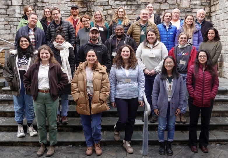
SECN at the TIMU Science and History Symposium
Several members of the SECN staff presented at the Timucuan Science and History Symposium, held January 26 at the Ribault Club in Jacksonville, Florida. Aquatic Ecologist Eric Starkey and Botanist Forbes Boyle gave status reports on water quality and terrestrial vegetation monitoring at the park. Biological Technician Mallorie Davis and Science in the Park Intern Alyssa Sanderson presented a poster on Status of Redbay and Swampbay within Timucuan Ecological and Historic Preserve Following 20 years of Laurel Wilt Disease. Coastal Ecologist William "Ches" Vervaeke reported on the fate of the park's northernmost mangroves after last year's freezes. Ches also collaborated on a poster titled, Developing an Updated Shoreline Monitoring Protocol Through Comparative Data Collection and Analysis, with a group from the University of North Florida. The annual event is hosted by Timucuan Ecological and Historic Preserve.
Links to Meeting Presentations:
- Estuarine Water-Quality Monitoring in Timucuan EHP 2005-2023 (Eric Starkey)
- Status of Terrestrial Vegetation Within Forested Habitats of Timucuan (Forbes Boyle)
- Status of Redbay and swampbay with Timucuan Ecological and Historic Preserve Following 20 years of Laurel Wilt Disease (Mallorie Davis and Alyssa Sanderson)

NPS photos / SECN staff

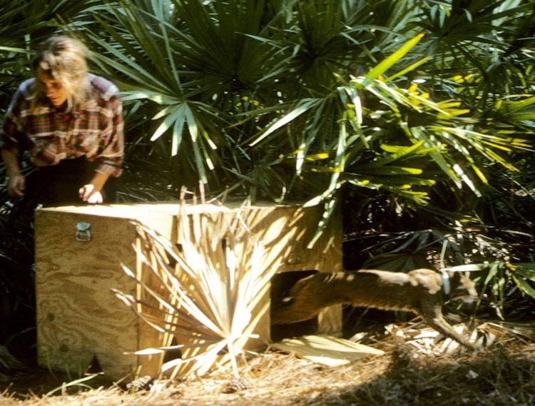
Photo by Duane Diefenbach
Cat Scat Fever at Cumberland Island National Seashore
Not nearly as well known as the island’s feral horse population, bobcats are a silent and often unseen predator that were reintroduced to Cumberland Island National Seashore (CUIS) in the late 1980s. Visitors rarely see these stealthy hunters, but they represent an important part of the island’s ecosystem and their hunting behaviors can directly influence white-tailed deer and other prey populations that in turn affect important elements of the island’s ecology. SECN Program manager Brian Gregory recently joined USGS Coop Unit Leader, Duane Diefenbach, and his research team from Penn State and a few other volunteers to hike the island’s trails looking for telltale signs of this keystone predator, specifically their distinctive scat, which the cats often leave in prominent places to mark home areas or ranges. Collecting cat scat along roads and hiking trails is a low-tech method that Duane and his team combine with high-tech DNA sequencing to yield important clues about the island’s cat population. The valuable genetic material left behind in the scat can tell investigators and park managers a lot about specific individuals and the population’s overall abundance and genetic health.
Duane and Leslie Hansen were part of the team that reintroduced bobcats in 1988 and they have followed the population as researchers ever since. Previous work has shown that after the cat population became established on CUIS, white-tailed deer abundance declined and body size increased. With a reduction in the deer population, a trophic cascade occurred whereby vegetation communities on the island changed. By the late 1990s live oak regeneration (both root sprouts and seedlings) had changed from nearly nonexistent to 10/m2.
Duane noted, “Thirty years ago I could not have imagined the changes that have occurred on the island. Today deer are comparatively scarce and places in the maritime forest where you used to be able to see hundreds of yards are filled with understory vegetation. The prominent deer browse line that Leslie and I remember from 1988-1991 is gone. I am awestruck over how important bobcats are to the ecology of Cumberland Island.”
The bobcat population averages fewer than 30 animals and so the population is at greater risk of inbreeding, and loss of genetic diversity is occurring. A better understanding of the population dynamics of the bobcats, as well as genetic monitoring, will allow park managers to determine when inbreeding becomes a concern. The results from Duane’s work and much-needed follow-up studies will help determine if the park should act to translocate bobcats from the mainland to maintain genetic diversity and maintain the population’s viability. Continued monitoring of the bobcat population in conjunction with other park monitoring projects such as deer population studies, ongoing vegetation monitoring and public hunt harvest numbers will help park understand trends relative to deer carrying capacity and other potential impacts on the island unique habitats.

NPS photo
Dragonfly Mercury Samples Collected
While assisting the bobcat scat team in January, SECN Program Manager Brian Gregory took advantage of the overlapping timing of projects and the willing assistance of two other members of the team, to collect dragonfly larva from two ponds on Cumberland Island. David Walters (USGS research ecologist) and Dean Thames (NPS volunteer and citizen scientist) helped gather these samples as part of the Dragonfly Mercury Project. These samples are collected in parks across the county to assess the potential health risks due to mercury contamination.
David, also a co-principal investigator for the Dragonfly Mercury Project, was happy to assist with sampling and added, “Parks are great places to assess mercury contamination and dragonfly larvae are excellent biosentinels because of their voracious feeding habits and their location at the base of the food chain. The DMP also relies heavily on citizen science to collect dragonflies for mercury analysis. Parks are a great place to get the Nation's youth and other groups engaged in our natural lands and in cool science."
Other parks in the Southeast Coast Network have been a part of this project and have data available on the Dragonfly Mercury Project Data Dashboard. Check it out!

Photos by Dean Thames

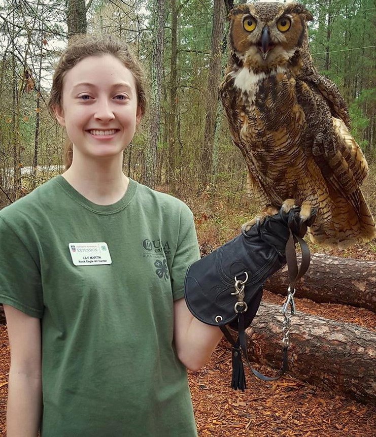
Photo courtesy of Lily Martin
Lily Martin's Owl Research is Published
Lily Martin, a former SECN Wildlife Intern, recently published her MS research on owl population estimations in The Journal of Raptor Research. While assisting the network with its bird and vocal anuran monitoring, Lily explored how automated recording devices could be utilized to estimate owl population trends versus distance sampling or mark-recapture approaches. She conducted her research on barred owls and great horned owls using ARDs deployed at Chattahoochee River National Recreation Area. Lily earned her master's degree in Wildlife Ecology and Management from the Warnell School of Forest and Natural Resources at the University of Georgia. She is currently an Assistant Regional Biologist with the Florida Fish and Wildlife Conservation Commission's Wildlife Diversity Conservation Section. SECN Wildlife Biologist Michael Parrish is a co-author on the project. The abstract for her paper is available at The Journal of Raptor Research.

Photo courtesy of USFWS
Ches attends USFWS Applied Landscape-Scale Conservation Biology Course
Coastal Ecologist William "Ches" Vervaeke participated in the USFWS Applied Landscape-Scale Conservation Biology Course last month at the National Conservation Training Center in Shepherdstown, West Virginia. This course provides a foundation in the conservation biology and landscape ecology principles needed for designing sustainable landscapes. Within the context of landscape conservation and climate change, topics included species diversity, genetic drift, effective population size, demographic and environmental stochasticity, single population and meta-population viability analyses, habitat fragmentation, and connectivity. Ches will be better able to assist parks with assessing and addressing conservation of different species and the habitats associated with species of interest.
I&M Leaders Meet in Arizona
The NPS Inventory and Monitoring Leadership Team, led by Meg White, along with regional program managers, network program managers and key members of the Central Support Office, met at the Desert Research Learning Center in Tucson, Arizona at the end of November. Brian Gregory, SECN Program Manager, attended the meeting and participated in discussions about plans to update core guidance for managing networks. I&M Leadership believes these updates are needed now because after 20 years of implementation, the world in which we began monitoring operations has fundamentally changed.
Brian noted, “In most cases the updated guidance reflects much of what we are already doing at the SECN, however, one element of these expectations is an increased emphasis on communicating I&M science to broader audiences. This is appealing to me as it highlights our Program’s efforts to help parks protect and preserve, especially as we continue to see significant changes to natural resources in our parks due to changing climatic condition.” Other topics at meeting addressed broader plans to make IMD more sustainable and relevant across multiple scales while encouraging more collaboration and building programmatic capacity.
Tags
- timucuan ecological and historic preserve science and history symposium
- timucuan ecological and historic preserve
- laurel wilt disease
- redbay
- swampbay
- terrestrial vegetation monitoring
- estuarine water and sediment quality
- cumberland island national seashore
- bobcats
- journal of raptor research
- barred owl
- great horned owl
- automated recording devices
- wadeable stream habitat monitoring
- u. s. fish and wildlife service
- horseshoe bend national military park
- congaree national park
- landbird community monitornig
- anuran community monitoring
- fort sumter and fort moultrie national historic park
- cape lookout national seashore
- kennesaw mountain national battlefield park
- fort pulaski national monument
- canaveral national seashore
- fort matanzas national monument
- cape hatteras national seashore
- chattahoochee river national recreation area
- fort frederica national monument
- moores creek national battlefield
- ocmulgee mounds national historical park
- surface elevation tables
- shoreline change monitoring
- dragonfly mercury project
- secn network highlights
