Article

Sea Level Change Over Time on Mount Desert Island
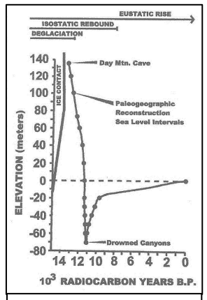
Graph of Sea Level Change in Coastal Maine
Sea level change curve for Acadia National Park. Rubin et al., 2002.
Various seaside features found at 220 feet above today’s sea level are evidence of Mount Desert Island’s complex geological history. These include cobble beaches, sea caves and sea monuments. The ocean level has changed over geologic time. In Maine, evidence for significant, long-term changes have been recognized since at least 1836 when Charles Jackson noted seashells high above the ocean in what is now called glacial-marine mud (Presumpscot Formation). Glacial theories, advanced in the middle of the 19th century, explained many ocean side geological features resulting from a great Ice Age.
Granite Boulder in Gorham Mountain Sea Cave

NPS/ Sardius Stalker

We now know there were multiple glacial periods with the last advance around 18,000 years ago. It originated in Northern Canada and extended south to Georges Bank 200 miles south of Mount Desert Island. This giant sheet of ice, more than 5,000 feet thick, covered the island and would not retreat until about 10,000 years ago. At one point when the land was still depressed in the aftermath of the glacier, the sea cave on Gorham Mountain, accessible by the Cadillac Cliffs Trail and the sea stack and boulder beach on Day Mountain were ocean front property. In the back of the Gorham sea cave is a large rounded granite boulder, presumably hurled into the cave during a storm.

As the ice receded, the land rebounded above present-day levels. Offshore islands were part of the mainland. Blue Hill and Frenchman Bays as well as Somes Sound were freshwater lakes. Then, as sea level rose from glacial melt and the land settled, saltwater flooded into these freshwater lakes. Somes Sound was the last area intruded with high tides bringing in saltwater 7,000 years ago. PaleoIndians lived in some of these now submerged areas.

When you look into the Gulf of Maine from the rocks above, understand change continues. Waves crashing (and crash they do during storms) into Monument Cove will eventually sculpt the sea stack until it becomes part of the cobblestone beach.
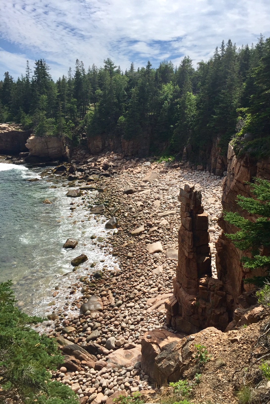
Monument Cove along the Park Loop Road
Monument Cove along the shore of Park Loop Road

NPS/Anne Warner

The next time you’re hiking below the ridge of Gorham Mountain on the Cadillac Cliffs trail, pay closer attention to the beautiful rounded rocks and tall cliffs. This scene is similar to what you observe along our current coastline. Looking at a park map, you will see that Somes Sound—today a saltwater fjard--has the same orientation as many of the freshwater lakes in Acadia. Just as Jackson noted seashells high above the ocean in 1836, all of these are common threads - clues pointing us to the scenario of sea level change.

Acadia National Park

Last updated: September 2, 2020