Last updated: October 28, 2022
Article
Sargent Mountain Pond: Maine's First Lake

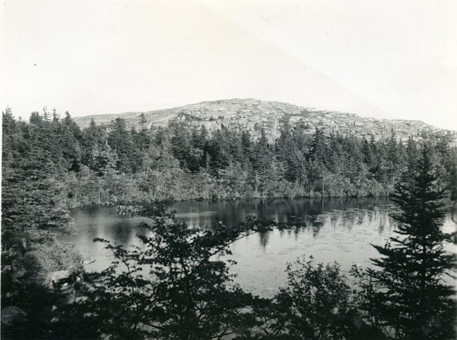
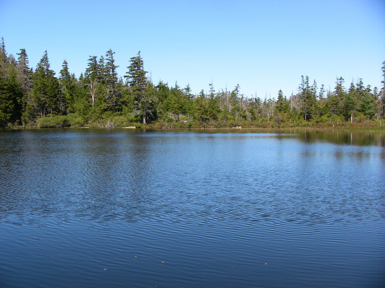
For at least a hundred years before other lakes appeared, Sargent Mountain Pond sat alone in its granite bowl, collecting its autobiography from the surrounding landscape.
Sargent Mountain Pond can be reached by any of three trails in Acadia National Park. All of them are steep and made of boot-battering granite, and all of them offer stunning views of mountain, valley, and sea. On this November Friday, I am approaching the pond from the south and east via the Penobscot Mountain Trail, which rises steeply from Jordan Pond. In the busy summer months this area is the hub of tourist activity; now the parking lot is empty. The leaves are down but snow has not yet flown. At the junction with the Jordan Cliffs Trail, I stay left on the Penobscot Mountain Trail, ascending via boulder climbs and bedrock walls to the exposed, bare top of Penobscot, a true mont desert, looking more gray than the usual sparkling pink in the overcast. I follow the trail along the spine of the mountain to the peak of Penobscot and down the other side, into the hollow filled with spruce and fir and cedar and birch. The pond comes suddenly; I am there. In summer, tourists would be snacking at the pond’s edge, or locals might be swimming in the clear, dark waters. But today I am alone.

Sargent Mountain Pond has been a destination since before the trails existed. In 1855, Charles Tracy, a New York lawyer and friend of the landscape artist Frederic Church, was anticipating a hike to “Summit Lake” when he wrote in his journal, “If it is clear tomorrow, we shall try to make the ascent of the mountains east of Lake Notch [Upper Hadlock Pond], at least far enough to see the lake of the mountains which lies very far up the steeps, there is no guide nor path.” According to Tom St. Germain’s wonderful history of Acadia’s trails, local legend told that the “Lake of the Clouds” was the bottomless home to a mysterious serpent. In 1881, a few energetic members of the Champlain Society, a group of Harvard students who camped near Somes Sound and conducted the first natural history surveys of the island, “decided to penetrate the trackless wilds to the summit of Sargent’s Mountain.” But after three summers of camping, hiking, collecting plants and birds, studying rocks and monitoring the weather, some of the young men became distracted by the social scene, leaving just two members “to carry on the serious work of the Champlain Society,” including “the exploration of Harbor Brook Valley and the Amphitheatre as well as that part of Sargent Mt. around the Lake of the Clouds.”
I have come up the other side, but draw no less satisfaction from reaching the lake. I try to picture it in late winter, frozen over, like it was a few years ago when a group of scientists and students from the nearby university hiked via the western route, climbing single-file up the treacherous, icy trail. To go back in time, they drilled from the level platform of the frozen surface, deep into the bottom of the lake, sixteen feet down through layers of sediment that reflect millennia of change. They were counting on things preserved in the mud—a fragment of fossil, a grain of pollen, a band of minerals—to tell the story of the lake and its surrounding landscape.
Questions build upon each other, validating and strengthening explanations, expanding into theories that ultimately change the original process of observation, changing what is seen. The core extracted from the bottom of Sargent Mountain Pond supported the theory that it was Maine’s first lake, older than any other, the first to fill up with water as the glacier melted.
Geologists are the great storytellers of science. Their perception of time is so different from the ordinary person’s, it’s a wonder they can function at all. They know how abruptly climate can change, covering the earth with ice. They now that even bedrock is temporary. They know that water shapes the planet and fire beats below. We gauge our lives in years and generations; they speak in eons and radiocarbon dates. The geologists who took the core from the bottom of Sargent Mountain Pond worked with other scientists—paleoecologist, biologist, chemist, forest soil ecologist. Though each examined a different aspect of the core according to his or her expertise, through a shared language of time and place, they found common ground and together narrated a Holocene history of Maine from a single location:
The great mass of ice slides southeast, as far as Long Island and Cape Cod, covering northeastern North America with a sheet of frozen water a mile and a half thick. The only season is winter; the only colors muted shades of white, black, and brown.
Then the air begins to warm, and more suddenly than it arrived, the glacier starts to melt. At its edge near Georges Bank in the Gulf of Maine, icebergs calve into the frigid Atlantic. The edge thins, shrinking ever northward; the surface lowers, dissolving downward. Islands of rock— nunataks—emerge from the surface of the shifting ice, islands that would one day be the summits of mountains.
For two thousand years, ice still buries the surrounding valleys; but beneath the glacier, streams of water and grit carve channels through softer stone, leaving sandbars and jumbled mounds of rock and clay at the glacier’s edge. On one nunatak, water fills a basin in the granite, the first lake in the landscape that will become Maine.
Three thousand years later, to the north, Katahdin emerges from beneath the ice and snow; to the south, woolly mammoths browse on shrubby willows, ferns, and sedges taking root on the newly exposed tundra. People follow the path of the receding ice to hunt and fish.
Around the hemisphere, sea level rises as shrinking ice returns fresh water to the ocean. The weight of the ice depressed the land surface so much that seawater floods inland over lowlying areas. Whales swim to Ottawa and Medway; salmon ascend inland tributaries. Once islands in the ice, the mountains become islands in the sea. Eight hundred feet below the new mountain pond, waves crash against the hillsides, forming sea stacks, beaches, and anemone caves.
Centuries pass. The shoreline drops as the land, freed from the weight of the ice, slowly rebounds to its now-familiar position. Salmon are stranded in Sebec, Sebago, Green, and West Grand lakes. Mammoths retreat and whales head for deeper waters. Maine’s rivers are huge torrents swollen with glacial meltwater, deranged whitewater cascading over ledges and flowing through ancestral deltas. Years later, sea level rise slows, and the rivers relax. A few scattered trees become a mature forest of spruce and jack pine, surrounding the pond in the shadow of Sargent Mountain, 1,200 feet above sea level on the coast of Maine.
For at least a hundred years before other lakes appeared, Sargent Mountain Pond sat alone in its granite bowl, collecting its autobiography from the surrounding landscape. Knowing its history, the experience of seeing the lake—any lake, really—is changed. I know that I am standing at the edge of a place that is old in human time, but very, very young in geologic time. A place, like every place, that is still changing.
CATHERINE SCHMITT is science communication specialist with Schoodic Institute at Acadia National Park. This article was published in the Spring 2010 issue of Friends of Acadia Journal.
