Article
Research Spotlight: Post-Wildfire Vegetation Recovery

NPS/L. Ray
On June 26, 2011, an aspen tree fell on a powerline in the Jemez Mountains of northern New Mexico, igniting a massive wildfire that became known as the Las Conchas Fire. The fire spread to 156,593 acres, and more than 30,000 of those acres were in Valles Caldera National Preserve. From 2011-2015, Valles Caldera staff monitored vegetation plots within burned areas to evaluate post-fire vegetation change. Of particular interest were the rate of conversion from forest to montane meadow and the rate of mixed-conifer and ponderosa pine forest regeneration.
In 2022, eleven years after the Las Conchas Fire, National Park Service staff are revisiting these plots, and graduate students from the University of New Mexico will be analyzing the data to better understand post-fire ecological succession. This project is crucial in helping land managers understand the ecological role of fire and its long-term effects on the landscape in order to better preserve and restore this fire-adapted landscape.
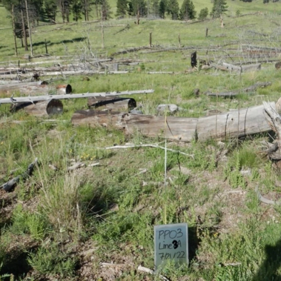
Las Conchas Vegetation Plot, 2011-2022
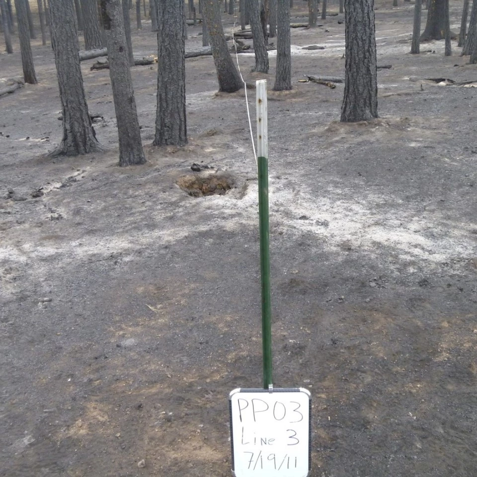
Left image
2011: One month post-fire
Right image
2022: The same site 11 years post-fire