Last updated: April 7, 2025
Article
Podcast 034: Earthwork Stability Research at Poverty Point

Louisiana Office of State Parks
How does your work at ULM relate to Poverty Point?
Derek Linn: Hello, and welcome to the podcast Dr. Greenlee; it’s great to be with you here at Poverty Point today. How long have you been involved in archaeology here, and how does your role at the University of Louisiana at Monroe relate to your work and research here at Poverty Point?
Diana Greenlee: I’ve been at Poverty Point for five years now as the station archaeologist. Even though I’m employed by ULM, I’m actually stationed here at the site; my job has to do with archaeological research and management here at the site.
Can you tell us about Poverty Point?
Derek Linn: Dr. Greenlee, I know Poverty Point is an earthworks landscape recognized as both a Louisiana State Historic Site and a National Monument, and recently you mentioned you’ve been involved with the nomination of this site to the UNESCO World Heritage Sites list. Could you introduce the listener and me to this place and also share a little bit on the significance of Poverty Point?
Diana Greenlee: Poverty Point is a very large archaeological site that dates from about 3700 to 3100 years ago during what we would call the late archaic period. It’s a monumental earthworks site.
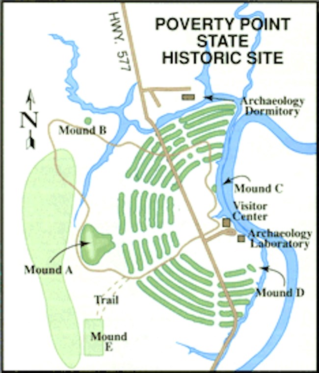
Diana Greenlee: There are four (4) mounds, six (6) earthen concentric ridges, and a large, flat plaza that all date to this time period; it’s a created landscape of mounds and ridges. What is so significant about Poverty Point is that it was constructed by hunter-gatherers. At the time that archaeologists first started working here, they didn’t believe that hunters and gatherers could carry out the work to build a monumental landscape like this.
Diana Greenlee: The existing model was that hunter-gatherers were barely making it from day to day, and that they didn’t have the time or energy to develop complex constructions like mound building. So Poverty Point really changed the way archaeologists and anthropologists looked at hunter-gatherers and what they could do.
Diana Greenlee: One other really interesting thing about Poverty Point is that literally tons of stone was brought here from throughout much of eastern North America: we get steatite from Georgia, chert from Ohio, and novaculite from Arkansas. There’s a large network where a lot of raw material was brought here to make tools and other items.

Louisiana Office of State Parks
Trade Networks
Derek Linn: And those materials may have been traded within this general area here or back in those original locations?
Diana Greenlee: They were redistributed among related sites around here. One of the interesting things is that when we go to those other places we don’t find items that indicate they were derived from Poverty Point. So we don’t know what the exchange mechanism was. It could have been an exchange of things that don’t preserve–like fish or other food items.
Derek Linn: NCPTT recently awarded a grant to ULM to investigate earthworks stability at Poverty Point State Historic Site. I was wondering if you could tell me what prompted your interest in this project and also some of the things you hope to learn from this study.
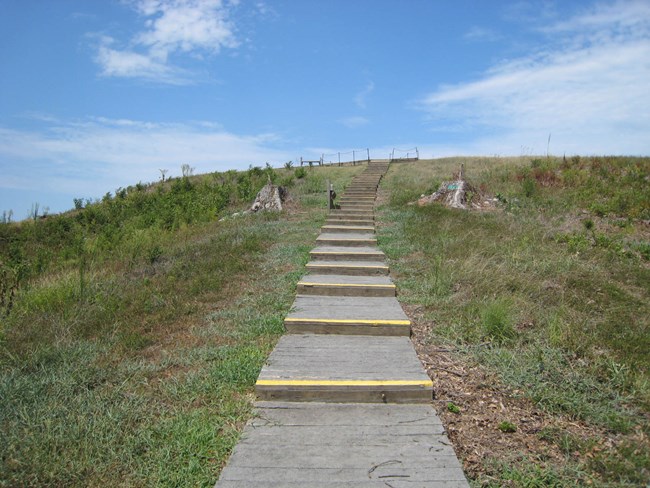
Diana Greenlee: Well the mounds here at Poverty Point were covered with trees, and they were an aging stand of trees; no young growth had been allowed to live and grow. So the trees were all mature: 60 to 130 years old, and they were beginning to die. They were falling over when we had good windstorms. And when they fall over and bring up a root ball coated with dirt, they disturb the archaeological resource. In the case of mounds where there is a steep slope, this can start an erosional sore that is hard to control.
Diana Greenlee: Working with State Parks here, we decided maybe it was time to remove all the trees from the mounds–to have them cut down. When we were doing our research to help us decide if this was the way we should go, we found that the existing literature said mounds can be stable under grass, and they can be stable under trees if you don’t let them get too big.
Diana Greenlee: [The literature continued that] transforming groundcover from trees to grass or vice versa can be a very risky thing, but there wasn’t any real data to show us how risky it is or what could happen. And so as we decided to go ahead and do this project, I decided it was a good opportunity to collect that kind of information. That way somebody else down the line who is trying to make a similar decision can look at our data and see if it’s the right step for them.
Dendromorphology
Derek Linn: I know that dendrogeomorphology is a big part of the project, and I recognized Dr. Stahle’s name; I was wondering if you could tell me about his role in the methodology of this research.
Diana Greenlee: He is playing a pretty important role. One of the things we want to do is contrast past erosion [which we had] under the treed regime with the erosion that happens as we make that transition [to grassland]. [We also want to look at future erosion] once it is under stable grassland. Dr. Stahle is looking at how much erosion happened over the life of the trees.
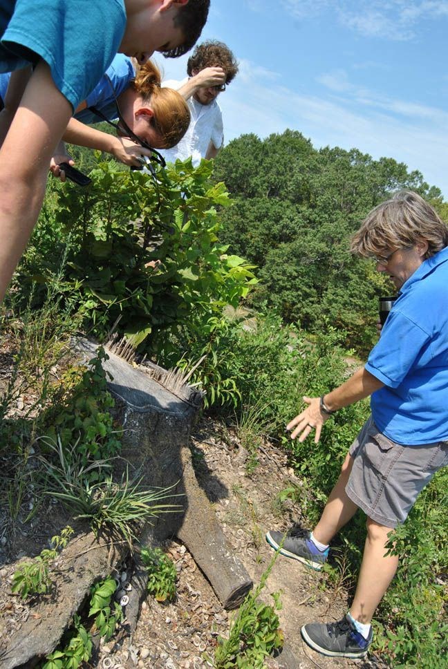
Diana Greenlee: One of the things he’s looking at are the roots that have been exposed due to erosion. He can identify how long ago that happened from the changes in the anatomy of the wood cells of the roots when they’re exposed to oxygen. So we can see during the lives of the trees when the roots became exposed. [We can look to see] whether it was a big episode of erosion or whether it was a slow, gradual process. He’s helping us understand how erosion has been over the last 80 to 100 years.

Louisiana Office of State Parks
Derek Linn: And you said Dr. Stahle has taken some samples thus far, but he still has some more to collect and study.
Diana Greenlee: That’s correct. He made one trip down to collect some samples, and he’ll be back.
Earthworks Management
Derek Linn: Dr. Greenlee, how do you expect this research to build upon or differ from currently available earthworks management recommendations or standards?
Diana Greenlee: Well I think we’re going to build on the current literature, because it is one more situation where we have taken an earthwork and altered the groundcover. In this case it’s going to be different because we’re trying to quantify what the impact of that change will be–and to help us assess whether or not we made the right move, which I think we did.
Derek Linn: And do you think your findings here can be applicable to other earthworks sites as well?
Diana Greenlee: I would hope so. I would hope that we provide a product that will be useful to other people; we sure wish we had this information when we were starting.
Derek Linn: Well I just have one more general question for you. I was wondering what most excites you about the future of Poverty Point and with your role here at the station archaeology program.
Diana Greenlee: Over the next couple years I’m going to be working on our nomination to the World Heritage List, and so I’m pretty excited about that. I sure better be; it’s going to be a lot of work. I sort of have to have tunnel vision as we complete that. I hope Poverty Point becomes a World Heritage Site and that we can continue to learn more about the landscape here.
Derek Linn: I wish you the best with your research, and Dr. Greenlee, thanks so much for taking time to speak with us today here at Poverty Point.
Diana Greenlee: Thank you.
Read other Preservation Technology Podcast articles or learn more about the National Center for Preservation Technology and Training.
