Last updated: October 27, 2023
Contact Us
Article
North Shore Riverwalk Park Exhibit Audio Description

NPS Exhibit
North Shore Riverwalk Park - They Passed This Way Exhibit Audio Description
-
North Shore Riverwalk Park - They Passed This Way Exhibit Audio Description
Interested in the Trail of Tears at North Shore Riverwalk Park? Take a look at this interpretive exhibit and listen to the audio description.
- Date created:
- 10/27/2023
Welcome to North Shore Riverwalk Park.You are standing at a Trail of Tears National Historic Trail exhibit that is 48 inches tall and 36 inches wide. Behind where you stand is the riverwalk and river. A wide concrete path follows the Arkansas River in either direction. In each direction is a bridge across the river. Behind the exhibit is a green lawn that runs between the sidewalk and the levee. To your right is a pathway through the levee, leading to a street.
The exhibit has a black band across the top. Within it, there is text that reads, "North Shore Riverwalk Park, Trail of Tears National Historic Trail, National Park Service, US Army Corps of Engineers." There is a triangular logo for the Trail of Tears National Historic Trail.
Beneath the black band is the exhibit title "They Passed This Way."
The large image at the top is a painting depicting a steamboat traveling slightly right of straight on a river so that you can see the length of the white boat, with smoke billowing out of a smokestack on top towards the front and the paddlewheel at the rear. It is towing a keelboat directly behind it. Facing the viewer in the forefront of the painting on top of the keelboat is a Cherokee Indian man in traditional clothing, standing upright, staring at the viewer. The keelboat depicts people in coversation, one with hands on his face, a woman holding a child, and others.
Below the large image is a quote that reads, "My children became motherless and the remains of Mrs. Ross were left in a strange land." from Cherokee Principal Chief John Ross.
The main text reads, “In 1839, the last of the Cherokee left Tennessee on a steamboat to Indian Territory. Arriving at Little Rock, the Steamboat Victoria landed across the river on the south side of the Arkansas River. It was a sad day. Quatie Ross, wife of Cherokee Principal Chief John Ross, was one of nine who died in this final group of 200 traveling the water route of the Trail of Tears.
Chief Ross purchased the Victoria to complete this last voyage of removal. After his wife’s burial, the steamer continued west to Indian Territory. Most likely, Quatie Ross died from both sadness and illness. All Cherokee suffered from the daily conditions of life on the Trail of Tears and no one was exempt.”
The exhibit has two smaller images and a map. The first image is a historic steamboat illustration at the shoreline with a gangplank. There are people standing on the boat. On the shore stands a couple and two men holding a gurney. The caption reads, "Illustration of Quatie Ross being carried off the Steamboat Victoria."
Underneath the illustration is a quote that reads, "Among those on board the Victoria were John Ross and his family. Mr Ross’ wife, we regret to say, died shortly before reaching Little Rock, and was buried in the cemetery of this city." from The Gazette, February 6, 1839.
Below the quote, the text reads, Later she was moved to Mount Holly where you can visit her grave site and memorial. You can also see her original headstone at the Historic Arkansas Museum.
The second image is a photograph of a gravestone. The caption reads, Quatie Ross's Grave and Memorial at Mount Holly Cemetery. The text below it reads, "Those who journeyed by water faced many challenges and dangers. Aboard flat boats and steamboats, dangers included the quick spread of sickness onboard, exposure to disease along the river lowlands, fires aboard the steamers, unpredictable weather, and changing water levels that affected river navigation."
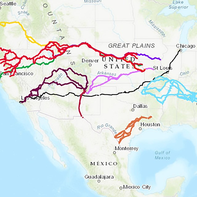
The map is titled "Indian Removal and the Trail of Tears." It shows the five routes of the Trail of Tears crossing the nine states of North Carolina, Georgia, Tennessee, Kentucky, Alabama, Illinois, Missouri, Arkansas, and Oklahoma. The caption reads, You can visit more sites along the Trail of Tears National Historic Trail. There are more than 5,000 miles of routes taken by the Cherokee in 1838-1839. Learn more: nps.gov/trte."
A subtitle reads, "John Drew, Detachment Leader." The following text reads, A detachment is a military unit and the term was used throughout Indian Removal, even when led by the Cherokee themselves. Drew led the final detachment to Indian Territory. Along with the Ross family, other well known Cherokee were on board. Drew’s slaves were carried on the steamboat as well."
Across the bottom are two bands. The first one in black includes the title "Journey Along the Arkansas River - Visit These Sites to Learn More about the Trail of Tears" followed by the URL nps.gov/trte/planyourvisit.
The bottom band includes a horizontal line with places along the Arkansas River and their distance from the mouth of the Arkansas River at the Mississippi River to the Oklahoma border. It is titled "Distance in Miles Across the Arkansas River Portion of the Trail of Tears Water Route."
Mouth of the Arkansas River 0 Arkansas Post National Memorial 14 Pendleton Bend Park 16 Rising Star Park 48 Tar Camp Park 84 Willow Beach Park 102 North Shore Riverwalk Park 112 Toad Suck Ferry Park 152 Cadron Settlement Park 154 Lake Dardanelle State Park 204 Oklahoma Border 303


