Last updated: August 27, 2020
Article
Nohemi Colin, GIS Story Map Development Associate

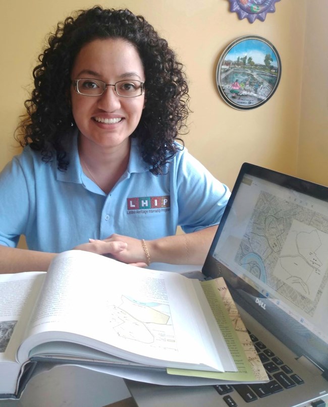
NPS Photo / Nohemi Colin
What is your name and job title?
Hola! My name is Nohemi. I am currently a Latino Heritage Intern with the National Park Service working at the Longfellow House Washington's Headquarters National Historic Site in Massachusetts. As the GIS StoryMap Development Associate, I am creating ArcGIS StoryMaps that will be published on the park’s NPS website. The first story map follows the estate boundaries over the last two centuries in Cambridge, and the second showcases items collected during the Longfellow family’s international travels.
For more information about my internship experience, read my blogs posted on the Hipanic Access Foundation website.
What does your job involve?
So far, I have spent my summer researching the historic property boundaries of the Longfellow House-Washington's Headquarters National Historic Site. The house is mostly known for playing an important role in American history, serving as George Washington's headquarters during the Siege of Boston and home to the famous poet, Henry Wadsworth Longfellow, but there’s so much more to its story! I read the park's Cultural Landscape Report (CLR) and Building Old Cambridge to create the StoryMap narrative, and then began searching well-documented estate maps and photographs from the CLR and deeds from Massachusetts Land Records. I’ve used this information to create outlines of the property boundaries layered over today’s map, to give users a better understanding of how huge the estate once was. Records show the 1.98-acre NPS site was once 140 acres! I looked through hundreds of 1700 and 1800s Cambridge maps in the Norman B. Leventhal Map & Education Center-Digital Collections to find sketches or printed maps. I included them in the story map using the StoryMap Swipe template enabling users to swipe and compare older maps that are layered right on top of today’s map! After I located maps that showed those changes, I cross referenced them with public deeds and the CLR and was then able to map the boundaries on the National Park Service ArcGIS Online. ArcGIS StoryMaps is a web-based application that allows people to publish and share stories in an interactive way that combines both maps and narratives, which is perfect for following the timeline of events and history associated with the house. Every step and feature add to the awesome interactive experience users will get when using StoryMaps.

Map: “Atlas of the city of Cambridge, Massachusetts: from actual surveys and official plans”, 1894, by George W. and Walter S. Bromley, Norman B. Leventhal Map Center Collection.
What is the most rewarding part of your internship?
The most rewarding part of my internship is knowing my research and StoryMaps will help tell part of the house’s history in a new and interactive way for all ages that visit the park and their website. I also enjoy working with the rest of the team because they are passionate about the site’s history. The best part of my week is our weekly meeting where can I update them on my StoryMap and learn about their projects.. Thanks to the Latino Heritage Internship Program, interning with the National Park Service showed me new opportunities and career options within the parks.
What inspired you to choose an internship with the National Park Service?
I chose this internship because it combined two of my favorite things, traveling and visiting historic sites. To share a little info about myself, I am a first-generation college graduate from SIUe where I earned a B.A. in international studies, focused on sustainability and development, with a minor in environmental studies. I have been very fortunate to travel across the country and abroad, with AmeriCorps NCCC and Semester at Sea. While traveling, I loved visiting and learning more about UNESCO World Heritage Sites and national parks. My love for travel and visiting historic sites is what ultimately drew me the Longfellow House-Washington’s Headquarters National Historic Site. This would have been my first time visiting Massachusetts, but working virtually and learning about Cambridge’s history has given me a different perspective of the area.
What would you like to share with other people who may be in your job or in stewardship?
I think this position is important, because we are creating interactive ways for future generations to learn. While this position may only be about StoryMaps, be ready to learn so many new skills. From learning to read and search through 1700s deeds, to georeferencing maps, to altering images using Photoshop, all steps are vital and take time. We joke from time to time when we’ve “gone down the rabbit hole” while researching one statement, but it has led to awesome findings. So just, be ready to learn a new thing every day!

