Last updated: February 27, 2024
Article
Landscape Conservation Connections in the Capital Region

NPS/NatureServe
NCR Landscape Conservation Connections to Create Climate Resilient Corridors
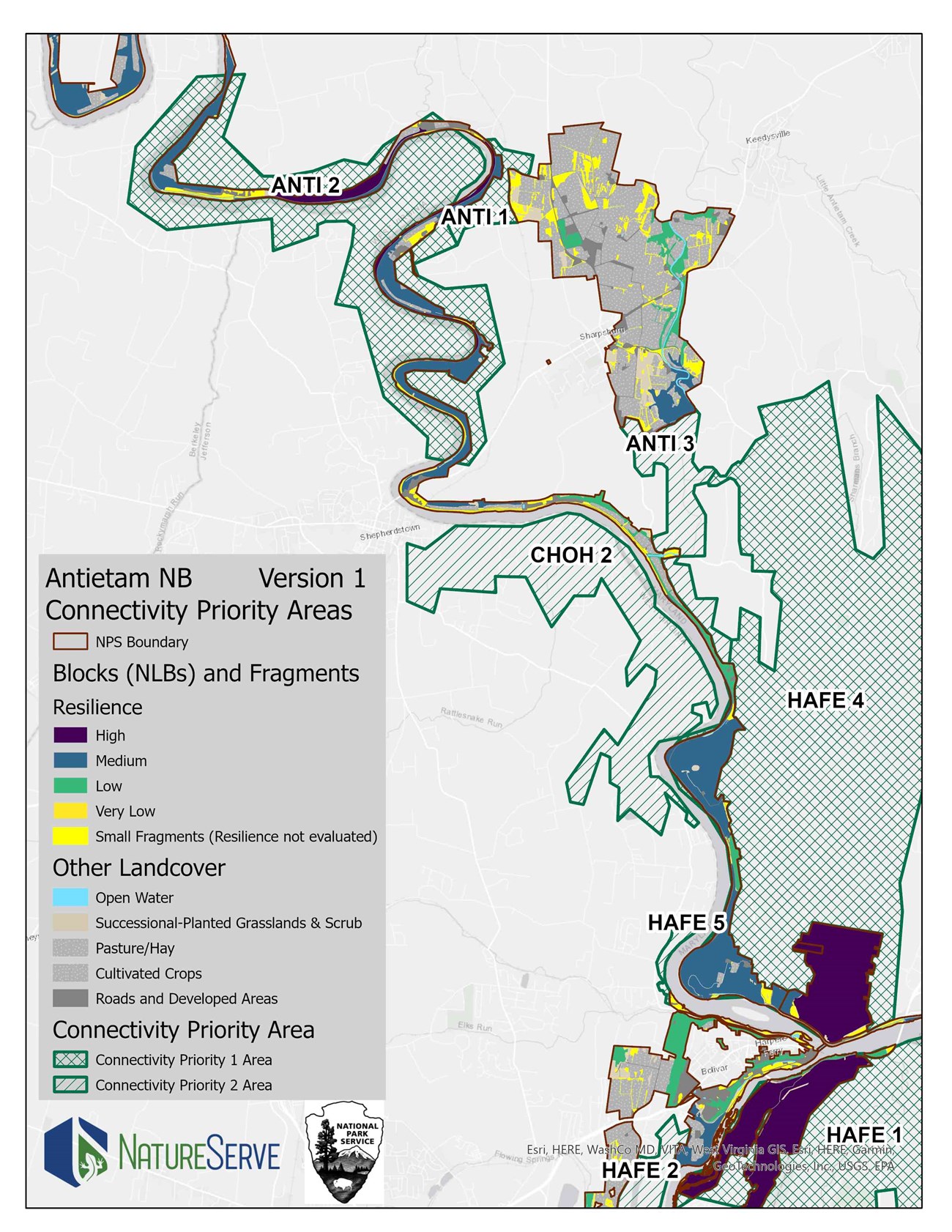
In the National Capital Region (NCR), the National Park Service (NPS) protects functioning ecosystems that operate at scales larger than individual parks. Conservation corridors are important paths across public and nongovernmental lands that improve habitat and allow animals and plants to move in response to climate change and other stressors. To preserve and improve this important ecosystem function, parks need to coordinate and connect with neighbors and other agencies across boundaries.
The NCR Landscape Conservation Connections project aims to identify shared conservation priorities amongst national parks in the National Capital Region and the agencies, non-governmental organizations, and municipalities who manage park-adjacent land in ecologically significant corridors. The project builds on outcomes from the Natural Resource Condition Assessment project known as RAMS, and the ongoing Natural Landscape Block identification project (learn more about each below). Contact us for additional linformation about the NCR Landscape Conservation Connections project.
Resource Assessments for Management Strategies (RAMS)
The Resource Assessments for Management Strategies (RAMS) project is a condition assessment of natural resources across National Capital Region parks based on data from the NCRN Inventory and Monitoring (I&M) network. RAMS helps parks consider management priorities for the most environmentally significant resources at multi-park scales, and understand how park resources fit into landscape level conservation.
The project builds on previous NPS Natural Resource Condition Assessments reports done for all NCR parks and a series of related NCR projects on ecological integrity and natural landscape blocks.
-
Watch a 10-minute overview video on the RAMS project (NPS Only)
-
Park-specific resource briefs summarizing natural resource condition assessments (NPS Only)
Project partner: University of Maryland Center for Environmental Science, Integration and Application Network
Natural Landscape Blocks (NLBs)
The Natural Landscape Block (NLB) project estimates landscape resilience using park condition assessments (from the RAMS project) along with ecological integrity assessments (EIAs; see below) and data from natural vegetation community mapping. Within each park, ecosystem types were combined into Natural Landscape Blocks to help prioritize climate adaptation strategies and actions. Measures of Natural Landscape Block resilience (low, medium, and high) include variations in forest ecological integrity and adaptive capacity as they respond to climate and non-climate stressors and the landscape context.
-
Explore park-specific Natural Landscape Block and Connectivity Maps (NPS Only)
-
Watch an 8-minute overview video of the NLB project (NPS Only)
Project partner: NatureServe
Ecological Integrity Assessments (EIAs)
The Ecological Integrity Assessment (EIA) project is part of a set of general climate change assessments for NCR parks. EIAs factor into a landscape’s resilience to stressors along with measures of adaptive capacity, and climate exposure. Assessments for particular upland forest ecosystems are complete and assessments of small (riparian) and large floodplain wetlands, and seepage and depressional wetlands are currently underway.
We will gather available data and model the response of wetland ecosystems to exposure from stressors that operate at watershed and regional scales (e.g., changing precipitation and temperature patterns, connectivity), as well as at the local park scale (e.g., impermeable surfaces, forest cover, sediment history, stream cutting, water balance, invasive species, deer browse, fragmentation).
-
Explore park-specific resource briefs on climate change vulnerability assessments based on geophysical setting and adaptive capacity (NPS Only)
Project Partner: NatureServe
Terms & Acronyms
EIA – Ecological integrity assessment
NCR – National Capital Region
NLB – Natural Landscape Block
NPS – National Park Service
NRCA – Natural Resource Condition Assessments
RAMS – Resource Assessments for Management Strategies
