Last updated: September 16, 2025
Article
Invasive Exotic Plant Monitoring at Dinosaur National Monument: 2023 and 2024 Field Seasons

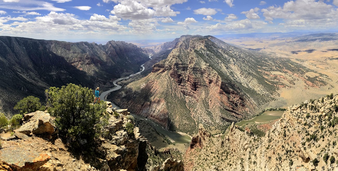
NPS/Amy Washuta
Why Monitoring Matters
Invasive exotic plants (IEPs)—plants that are not native and can quickly spread in new areas—are growing across Dinosaur National Monument (NM). Species like tamarisk and broad-leaf pepperwort can push out native vegetation, harm wildlife habitat, and reduce the quality of visitor experiences. These plants disrupt ecosystems and cause problems such as fewer pollinators or less plant diversity. Monitoring IEPs helps park managers focus control efforts, protect native species, and keep the landscape healthy. This update highlights current trends, high-risk areas, and ongoing challenges.
What We Found
In 2023, crews recorded 4,683 patches of 12 invasive plant species along nearly 35 miles of monitoring routes in the park (Table 1). Tamarisk, broad-leaf pepperwort, yellow sweet-clover, and Russian knapweed were the most widespread species. These plants were often found along riverbanks and in areas that had been disturbed before.
| Species | Common Name | Total Infestations | 1 to Few Plants | Few Plants–40m2 | 40–400 m2 | 400–1000 m2 | > 1000 m2 |
|---|---|---|---|---|---|---|---|
| Arctium minus | burdock | 4 | 1 | 1 | 2 | 0 | 0 |
| Cardaria spp. | whitetop | 9 | 0 | 6 | 3 | 0 | 0 |
| Carduus nutans | musk thistle | 107 | 16 | 33 | 21 | 6 | 31 |
| Centaurea repens | Russian knapweed | 271 | 1 | 61 | 106 | 80 | 23 |
| Cirsium arvense | Canada thistle | 261 | 2 | 48 | 141 | 44 | 26 |
| Cirsium vulgare | bull thistle | 9 | 3 | 5 | 1 | 0 | 0 |
| Elaeagnus angustifolia | Russian olive | 9 | 9 | 0 | 0 | 0 | 0 |
| Euphorbia esula | leafy spurge | 159 | 1 | 13 | 84 | 38 | 2 |
| Hyoscyamus niger | black henbane | 1 | 1 | 0 | 0 | 0 | 0 |
| Lepidium latifolium | broad-leaf pepperwort | 365 | 9 | 74 | 124 | 81 | 77 |
| Melilotus officinalis | yellow sweet clover | 319 | 12 | 126 | 99 | 67 | 15 |
| Tamarix sp. | tamarisk | 3,169 | 200 | 545 | 1,184 | 979 | 261 |
| Priority Species, Total | – | 4,683 | 255 | 912 | 1,765 | 1,295 | 435 |
Trends varied by species and river section. Yellow sweet clover decreased on all three river reaches. Musk thistle was less common overall but increased along the Green River above the Yampa. Leafy spurge remained steady along the Green River but increased along the Yampa River.
Cheatgrass declined in cover and frequency across all river segments since 2019 (Figure 1). The decrease may be linked to high water events that washed away some of the plants.

NPS/Amy Washuta
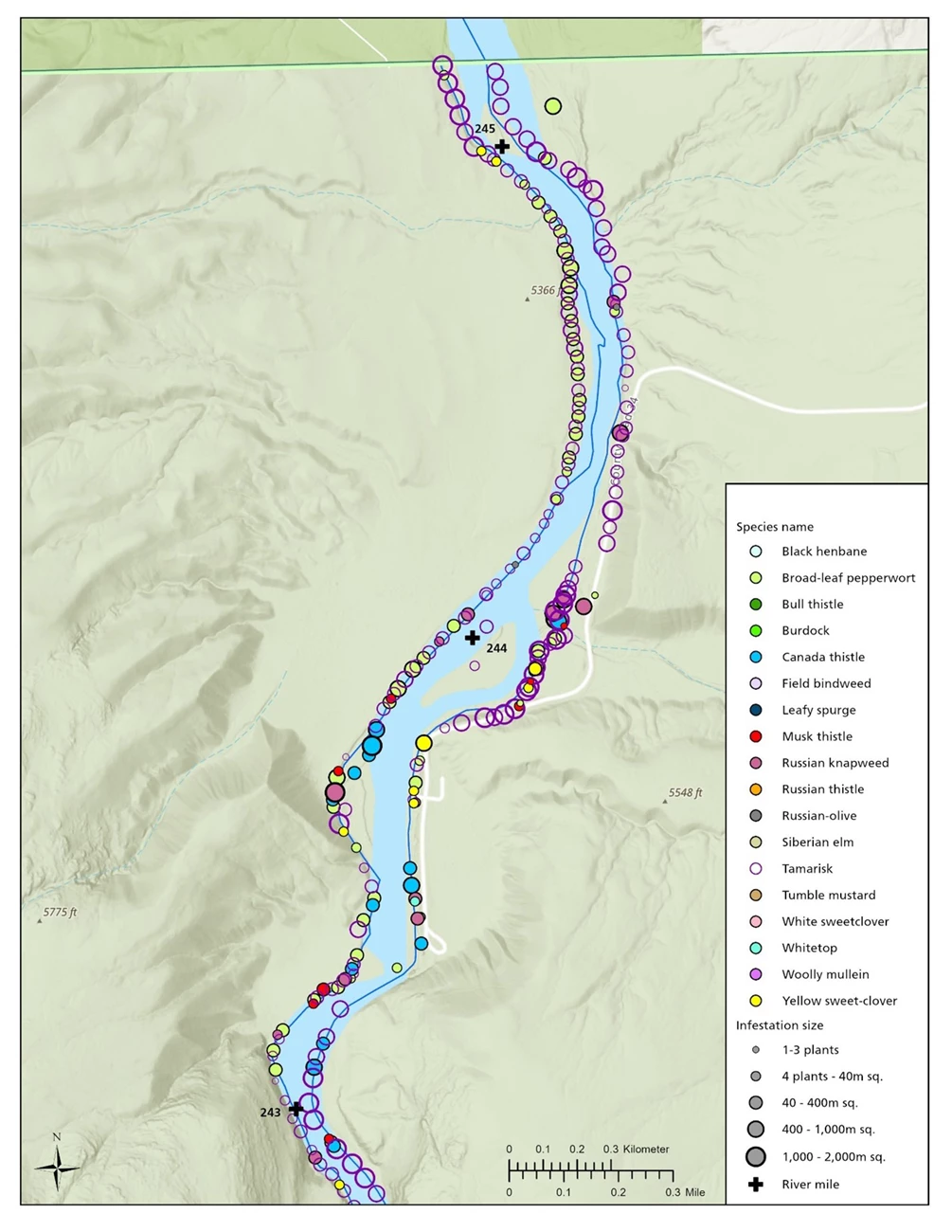
Infestations have gone down near Gates of Lodore and Deerlodge Park since 2014 (Figure 2). However, the upper Green River still has many invasive plants and remains a priority for future monitoring and control.

NPS/Aneth Wight, Eliot Rendleman
How We Collected the Data
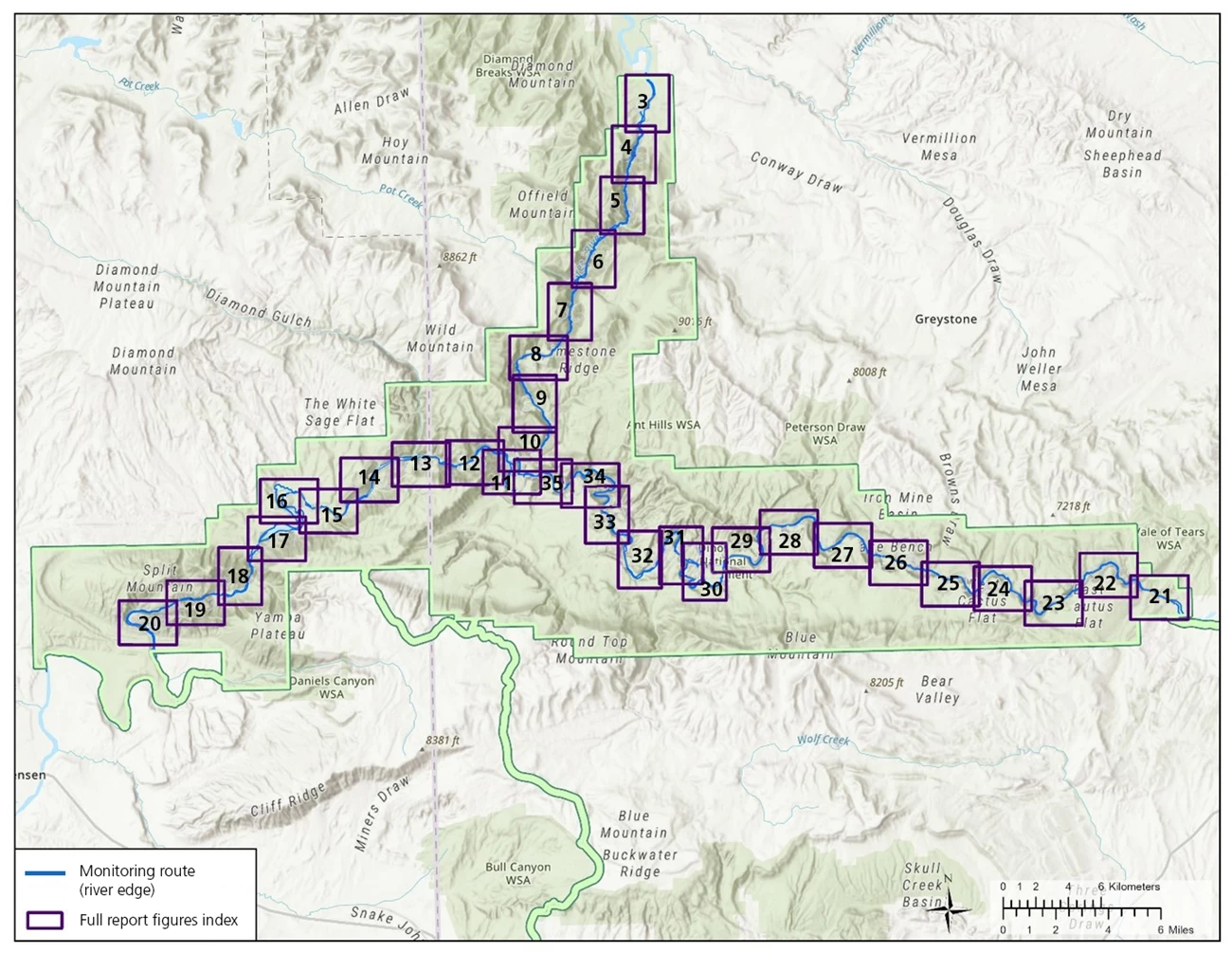
Crews surveyed 35 monitoring routes from June 20–26, 2023, covering about 60 kilometers (Figure 3). They recorded invasive plant locations, species, and patch size. Most routes were near water sources, including the Green and Yampa Rivers. Teams walked along each route and documented all visible infestations within a 10-meter-wide area. Quadrats (small 1-m² frames) were placed at set distances along survey lines to estimate plant cover and soil characteristics.

NPS/Aneth Wight, Eliot Rendleman
Consistent methods were used to estimate how likely it was to detect each plant species in the field. This helps ensure accuracy across different routes and survey teams.
What Comes Next
Infestation patterns were not the same across all rivers. The Green River before it joins the Yampa had the most invasive plants, likely due to controlled water flows from a dam upstream. The section of the Green River below the Yampa had fewer invasive plants, and the Yampa River had the lowest numbers overall. This may be because the Yampa flows more naturally, without a dam controlling it.
Park managers can use these findings to better detect, manage, and prevent the spread of invasive plants at Dinosaur National Monument.
Information in this article was summarized from Invasive exotic plant monitoring at Dinosaur National Monument: 2023 and 2024 field seasons by T. Nash. Content was edited and formatted for the web by E. Rendleman.
