Last updated: October 14, 2022
Article
Martineztown Walking Tour
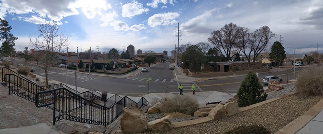
Welcome to Martineztown Park! Follow the stops to learn more about Martineztown and El Camino Real de Tierra Adentro. While you are here, please be aware of your surroundings. You are in a thriving and lively community which includes Longfellow Elementary School. Please be respectful of others while visiting the park. Look out for the steep drop-offs on the High Road Walkway. This walking tour follows accessible sidewalks and ramps. Please use caution when crossing the street to access the acequia. Enjoy this journey through the history of Martineztown!
NPS Photo
Start of Retracement Walk
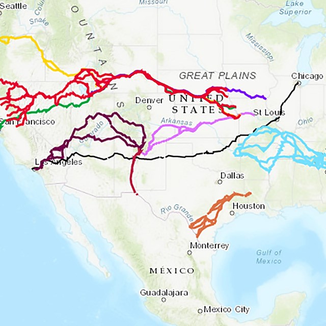
Welcome to El Camino Real de Tierra Adentro and the Historic Martineztown Park. There is a long history along this trail. While it currently connects the U.S. and Mexico, it formerly linked important Spanish cities like Mexico City and Chihuahua to the northern frontier of New Spain. In 1598, El Camino reached its full historic length, from Mexico City to the Pueblos north of Santa Fe. Over a 282-year-period it was used by traders and travelers during periods of peace and conflict. During this period it was used by a diverse array of characters; people headed northward included settlers, priests, and newly appointed officials, while those headed south included retiring officials, friars, traders, enslaved Indians, convicts, and prisoners of war. El Camino shaped the culture of the Rio Grande Valley. Travelers used many resting places, or parajes, on their journey. The journey took roughly six months and stretched approximately 1600 mile, one-way! Martineztown was one of the parajes along the Rio Grande Valley. Travelers would come here to restock, trade goods and catch up on news. As you walk along the trail route through Martineztown Park, look at the plants growing along the path; they represent the changing environments people would have experienced as they traveled along El Camino.
NPS Photo
Orientation Wayside "A Royal Walk"
This wayside should be the first stop on your walk through Historic Martineztown. The sign has a map of the historic route and will orient you to what you will see along the path here. Audio Description and Transcript available.
NPS Photo
Follow the Trail!
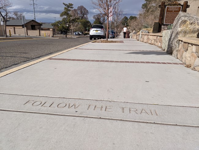
Did you notice the markers below your feet as you've been walking? Mexico, Zacatecas, Doña Ana. You've walked a great distance along El Camino in only a few yards. The 1600 mile one-way trip from Mexico City to Santa Fe would have taken a traveler six months to traverse.
Learn more about the major cities and counties travelers passed through with this fun activity!
Major Stops and Sights Activity
Activity designed by Bernalillo County Open Space as part of the El Camino Real Trade Fair and has been made available for the walking tour with their permission. Special thanks to our partners at Bernalillo County.
NPS Photo
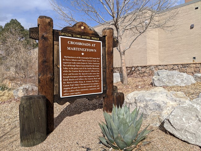
State Historic Marker: "Crossroads at Martineztown"
Read the Official Scenic Historic Marker, available in English and Spanish. El Camino, also known as the 'Royal Road of the Interior Land,' was established by Ancestral Puebloans whose homelands once stretched into what is now northwestern New Mexico and southwestern Colorado. Today, New Mexico is home to 19 different Pueblos, most of them concentrated along the Rio Grande. The residents of these Pueblos are descended from the original users of what would become El Camino. El Camino was also used for nearly three hundred years by American Indians, Mexican, Black, Spanish, and other European cultures. Each of these people brought long their languages, objects and ideas to exchange along the way.
Audio description and transcript in English available.
NPS Photo
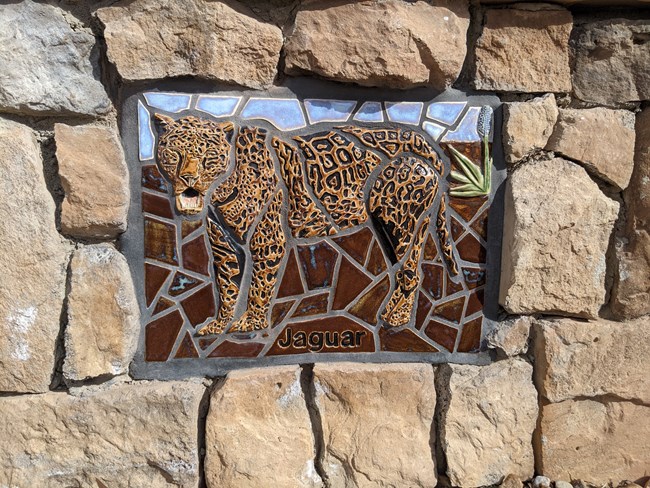
Mosaics
Look for the twelve mosaics on the retaining wall to the east of the path you're walking on. Each piece of art represents a landmark or animal the travelers may have seen on their journey.
The mosaics were created by Cassandra Reid and the Apprenticeships for Leaders in Mosaic Arts, or ALMA. These were designed and installed using traditional handmade mosaic techniques.
Learn more about the stories behind each mosaic piece.
NPS Photo
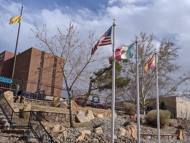
Flags of Three Nations
These three flagpoles are placed here in the park to represent the connection between the three nations-- the United States, Mexico and Spain. Each controlled what is now New Mexico at some point between 1598 and 1880--El Camino's period of greatest use. Each country has had a lasting impact on the culture and community of Martineztown.

NPS Photo
Interpretive Wayside "High Road of El Camino Real"
Read the Wayside "High Road of El Camino Real" and learn about the historic uses of the Royal Road. Do you recognize any of the places on this historic map from 1779?
Audio description and transcript for wayside available.
NPS Photo
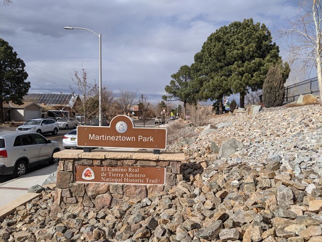
Martineztown Monument Sign
The Martineztown Park development was made possible by cooperation between the City of Albuquerque, Citizens Information Committee of Martineztown, and the National Park Service National Trails Office.
NPS Photo
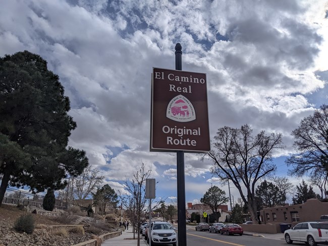
Original Route Sign
These brown-and-white signs with the El Camino Real de Tierra Adentro trail logos can be followed along retracement sections. Follow these signs to walk, bike, or drive the same path as the travelers did over one hundred years ago. No burro, or donkey, required!

NPS Photo
Interpretive Wayside "A Community Spirit"
Read the wayside "A Community Spirit" and look at the aerial and historic photos. The community has a powerful connection to this land. How do you see that connection reflected here at Martineztown Park today?
Audio description and transcript available.
NPS Photo
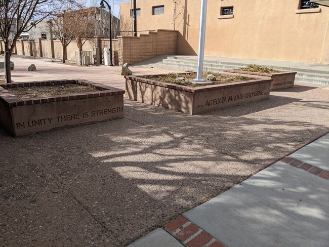
Acequia Madre
Walk across the street to see where the Acequia Madre used to flow. The acequia was constructed in 1832 to bring water from the Rio Grande to this community. Agriculture was one of the key aspects of the economy of Martineztown. Once the railroad became the neighborhood's primary employer, the acequia fell into disuse. As you can see today, it has been filled to connect the streets it used to bisect. Sit for a moment and imagine the water that used to flow from the Rio Grande to this community.
NPS Photo
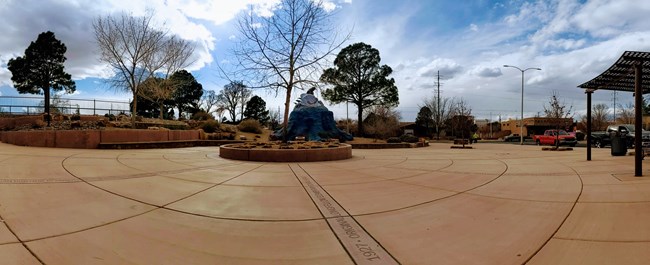
Wagon Wheel Plaza
On the perimeter of the plaza you will notice 15 important dates in the history of El Camino, New Mexico, and Martineztown. Notice how the plaza is a circle, and spokes extend outwards from the center, forming a wagon wheel. On the wheel of time, many events led to this moment. Explore and learn about the milestones in local, national, and international history.
NPS Photo
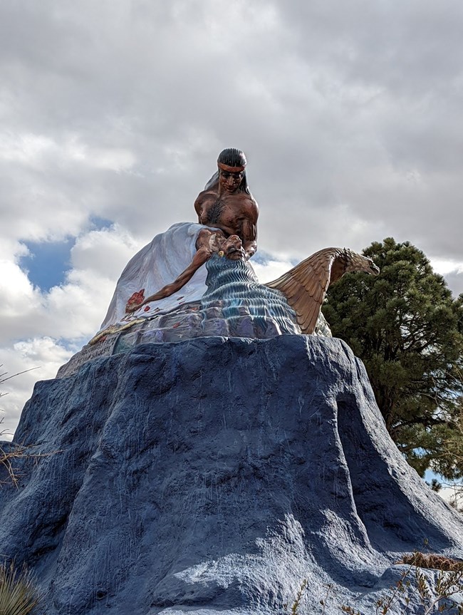
Southwest Pieta
This sculpture by Luis Jiménez Jr. was placed in Martineztown in 1988. Luis Jiménez Jr. was a prolific Chicano sculptor. This piece was inspired by the Christian art form, the Pietà. The sculpture depicts the Aztec myth about star-crossed lovers, the Warrior Popocatepetl and Princess Iztaccihuatl, who both died tragically and were immortalized as two volcanoes outside Mexico City which bear their names.

NPS Photo
Stone Feature Wall
Martineztown has a long and proud history. Generations of its residents witnessed the heyday of El Camino, the rise and fall of the railroad, the coming and going of Route 66 and countless other cultural shifts as Albuquerque grew and changed. In the early 1970s, the Citizens Information Committee of Martineztown organized the neighborhood to protect it from urban renewal condemnation. This strong community spirit has helped Martineztown keep its historic residential character.
Audio description and transcript in English available.
NPS Photo
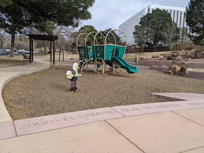
Park Play Area
This play area features a covered wagon and stylized play areas. The hope is that Martineztown will be a welcoming place for future generations -- a place where citizens and visitors can learn, play, and enjoy.
NPS Photo
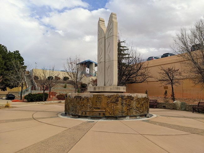
Sisters of Charity Commemorative Plaza and Fountain
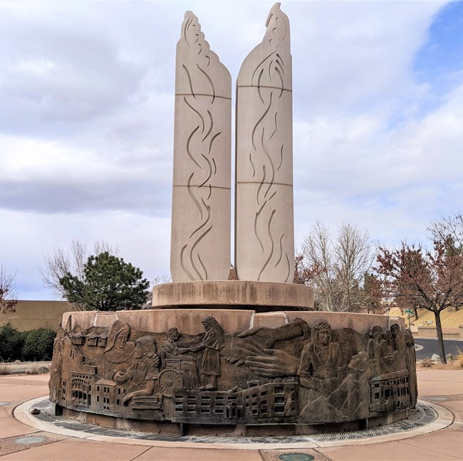
The Sisters of Charity arrived in Albuquerque via train in 1902, after the end of El Camino Real's popular use. These nuns were pillars of the community, treating the sick and caring for the elderly and children in need. The Sisters of Charity established St. Joseph Sanitarium to treat patients suffering from tuberculosis. They also established the first free school in Albuquerque. Overall, they built a legacy of patient care and education in Martineztown. Surrounding this park are modern hospitals and Longfellow Elementary school. The twin stone pillars, sculpted by Albuquerque artist Linda Dabeau, represent angelic wings.
NPS Photo
Bronze Mural
This bronze mural and stone sculpture were added to the park in 2011 and represents the dedication the Sisters of Charity had to this neighborhood. Walk around the Charity Commemorative Plaza, around the "Angelitas de Caridad" statues, to see all the features, read the words etched on the sidewalk, and think about the stories these images tell. Pay close attention to the 3D bronze mural; some community members' likenesses are featured on it. How do the images of compassion and charity displayed in this artwork make you feel?
NPS Photo
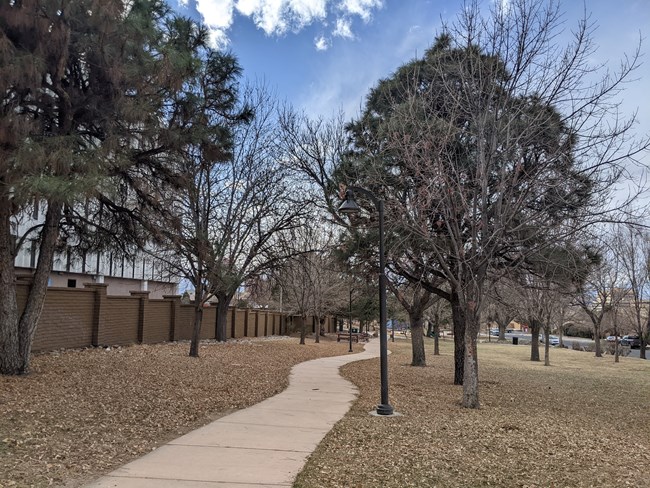
First Impressions on High Road Walkway
Follow the highroad sidewalk back to the beginning of the walk. Along the way, look at the plants in the garden and read the plaques about some things travelers saw on their way to Mexico City on El Camino Real. There are quotes from trail travelers about what they saw. Think about your first impressions if you traveled through a foreign landscape. What would you think if you saw these animals for the first time, without the reference of photos, television, or the internet?
Transcripts of waysides available.
Audio Descriptions coming soon.
NPS Photo
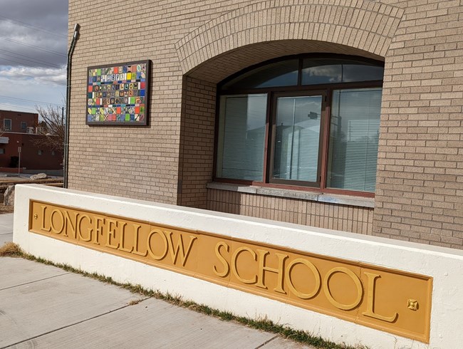
Longfellow Mosaic
The tile art was done by students of Longfellow Elementary school, which was built in 1927. It was condemned in 1979, but--through the hard work and dedication of community members--the school was rebuilt in 1983. The relationship between this school, the Camino Real, and its community is strong.

