Part of a series of articles titled Water Resources Monitoring in the Lamar River near Tower Ranger Station, Wyoming, 2021.
Article
Monitoring Methods for the Lamar River near Tower Ranger Station, Wyoming

NPS
Water Chemistry
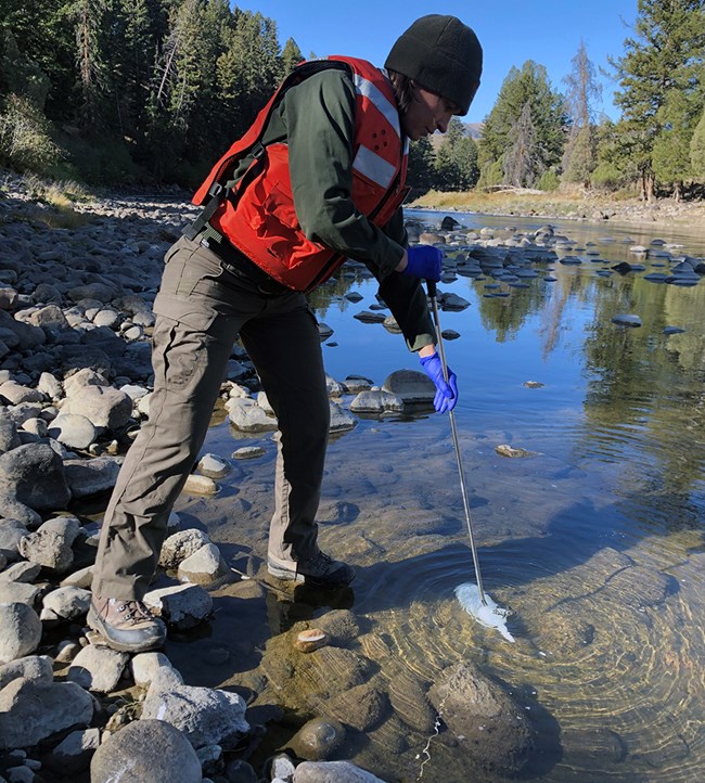
The Greater Yellowstone Inventory and Monitoring Network collects water samples monthly during ice-free periods generally following depth and width-integrated protocols outlined in the U.S. Geological Survey (USGS) National Field Manual for the Collection of Water-Quality Data.
We use a 1-L, hand-held DH-81 sampler affixed to a 1-m wading rod to collect depth and width-integrated water samples. At multiple locations along the river's cross-section, we collect water using vertically integrated sampling techniques. Samples from the 1-L bottle are mixed into an 8-L churn splitter; we use the churn splitter to homogenize and dispense a representative subsample into laboratory-provided bottles. These bottles are then shipped overnight to an EPA-certified commercial lab for processing.

NPS
Core Water Quality Parameters
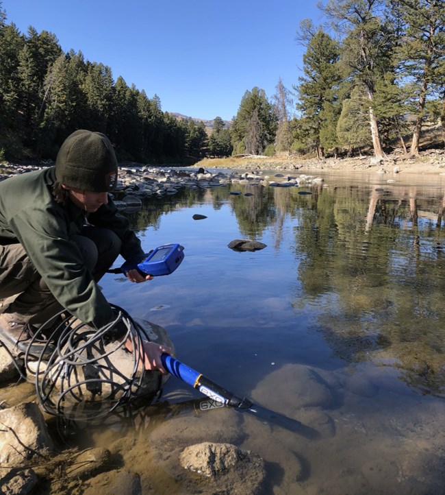
In addition to water samples, water quality parameters (temperature, specific conductance, dissolved oxygen, pH, and turbidity) are collected in situ using a handheld, multi-parameter instrument (e.g., YSI EXO 1 sonde) at four representative locations on the river cross section. Collection of water sample core parameters and rationale for testing nutrients and suspended solids is described in the approved Greater Yellowstone Network Regulatory Water Quality Monitoring Protocol (O'Ney 2006).
River Discharge
Discharge (river flow estimates) and water temperature data from the Lamar River sampling location are available online from the U.S. Geological Survey's National Water Information System and listed under station USGS 06191500. The station is near Tower Ranger Station, WY.
Greater Yellowstone Network Water Resources Protocols
Read the full protocols and standard operating procedures for water quality and discharge here.Source: NPS DataStore Collection 7853. To search for additional information, visit the NPS DataStore.
Last updated: March 10, 2023
