Last updated: August 22, 2023
Article
Lake Area Change in Interior Alaska Parklands

Lake area in Arctic and sub-Arctic Alaska is changing. Declines in lake surface area have been linked to changes in precipitation patterns, permafrost degradation, increased evaporation rates, and terrestrialization. In Denali National Park and Preserve, Wrangell-St. Elias National Park and Preserve, and Yukon-Charley Rivers National Preserve, the Central Alaska Network Shallow Lake Monitoring Program studies lakes and ponds in a wide range of natural settings and analyzes how and why they are changing.
Using satellite-based tools, aquatic ecologists Danielle Knapp and Amy Larsen tested landscape-scale trends in surface water area from 2000-2019 in an array of ecological settings in the Central Alaska Network parks. Over the course of the study period, surface water area in all parks experienced similar overall fluctuations, likely due to oscillations in regional climate. Periods of high surface water area coincided with relatively warm, wet periods. There was a small, but significant, loss of lake surface area across the study area with the greatest surface water losses occurring in Denali National Park and Preserve.

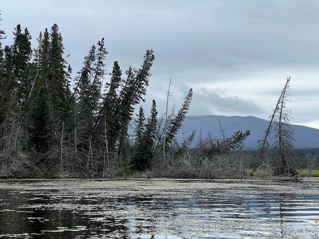
NPS/Jared Hughey
Lake surface area varied depending on landscape characteristics. Lakes most susceptible to surface water area decreases were often situated in glacial and thermokarst landscapes (landscapes with ice-rich permafrost or perpetually frozen soil). In some regions of the parks, where ice-rich permafrost or buried glacial ice is present, lakes expanded. In actively eroding areas such as these, it was more difficult to detect trends in lake surface area because lake expansion compensated for surface area declines. Surface area increased in only one region of the network: a floodplain of the Copper River in Wrangell-St. Elias National Park and Preserve. Despite areas of active lake expansion, we observed declines in lake surface area in 9 of 32 areas throughout the three parks.
Climate models project increases in both temperature and precipitation in Alaska, which will lead to significant permafrost and glacier degradation in Alaska’s national parks. One significant consequence of permafrost degradation is enhanced groundwater connectivity, which could lead to significant lake expansion or drainage depending on subsurface flow paths.


Despite permafrost thaw increasing water on the landscape and increasing surface water in some lakes, 9 of 32 ecological areas experienced declines. Seventy-seven of 344 lakes experienced declines, 19 increased in area, and 248 remained stable. The results of this study suggest that periods of regional warm, wet weather – times when permafrost and glaciers may see the most deterioration – may make Alaska’s interior parkland landscapes wetter as melt and thaw contribute to surface water. If and when these landscape features degrade, landscape-wide drying and surface water loss are likely to be more prevalent.
Shallow lake ecosystems provide critical habitat for wildlife, including many species of migratory birds. Loss of aquatic habitat will impact important breeding populations of the many species that use shallow lakes. The variable, and sometimes conflicting, lake responses to the changing landscape and climate highlight the importance and need for continued long-term monitoring of Alaska’s interior lakes in diverse settings.
Surface water area in a changing climate: Differential responses of Alaska’s subarctic lakes
Abstract
Lake surface area in arctic and sub-arctic Alaska is changing in response to permafrost deterioration, changes in precipitation, and shifts in landscape hydrology. In interior Alaska, the National Park Service’s Central Alaska Network Shallow Lakes program studies lakes and ponds in a wide range of geomorphological settings ranging from alpine lakes to low lying lakes on fluvial plains. The purpose of this study was to determine if and how lake area was changing across this diverse environment. Using the USGS Dynamic Surface Water Extent product, we tested landscape-scale trends in surface water area from 2000–2019 in 32 distinct ecological areas, or ecological subsections, within the three parks. Surface water area declined in 9 subsections, largely in glaciated landscapes with coarse substrates and areas underlain by ice-rich permafrost. Surface water increase was seen in one subsection in the floodplain of the Copper River in Wrangell-St. Elias National Park. No net change was observed in many subsections, but individual lake analysis showed that within several ecological subsections some lakes were increasing in area while others decreased in area, masking changes in lake surface area within the subsection. Over the course of the study period, surface water area in all parks experienced similar fluctuations, likely due to oscillations in regional climate. Periods of high surface water area coincided with relatively warm, wet periods. Climate change models project increases in both temperature and precipitation in Alaska; our results suggest periods of regional wetting may mask longer-term declines in surface water area in some geomorphological settings. Overall, lake surface area declined over the study period; declines were greatest in the Glaciated Lowlands in Denali National Park and Preserve.
Rupp, D. L. and A. S. Larsen. 2022. Surface water area in a changing climate: Differential responses of Alaska's subarctic lakes. PLOS Climate 1(6): e0000036.
