Last updated: September 10, 2025
Article
Jordan Pond Loop


Overview
Length: 8.6 miles
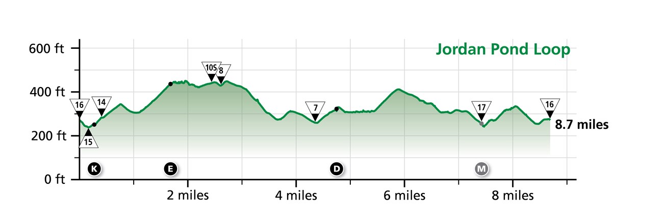
Traveling Intersection Numbers: 16-10-8-7-17-16
The Jordan Pond Loop crosses these carriage road bridges:
-
Jordan Pond Dam Bridge (K)
-
Deer Brook Bridge (E)
-
Bubble Pond Bridge (D)
-
Triad-Day Mountain Bridge (M)
Experience and Expectations
The Jordan Pond Loop follows along the western side of Jordan Pond, connects with Day Mountain on its southeast corner, then comes back up along the west side of Bubble Pond and the south side of Eagle Lake. Many bikers choose to stop at intersection 15 to visit the Jordan Pond House or hike around Jordan Pond.
Intersection 10S marks the high point of the loop, and the grade of the incline is roughly the same on either side. The section around Bubble Pond is almost entirely flat, while the rest of the route has several ups and downs.
On a manual bike, this loop is estimated to take around 1 hour to 1 hour and 15 minutes.
