Last updated: January 19, 2024
Article
Interpretation of Route 66 in Oklahoma
Getting the Word Out – Interpretation of Route 66 in Oklahoma
By: Scott Sundermeyer, Oklahoma Department of Transportation, Cultural Resources Program
Chad Moffett, Mead & Hunt, Inc., Cultural Resources Department

Abstract
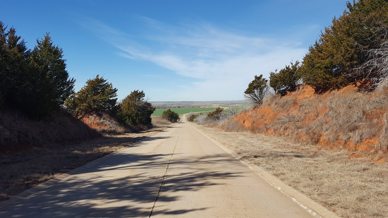
Route 66, commonly known as “America’s Main Street” or “Mother Road,” runs for approximately 400 miles across the state of Oklahoma. Historically, it served as the state’s first major east-west highway. While Route 66 is well known for its tourism and roadside attractions, the essence of the highway is its historic roadbed, bridges, and other integral roadbed features. The mission of the Oklahoma Department of Transportation (ODOT) is to provide safe and efficient transportation, which can sometimes conflict with historic preservation goals. To foster historic preservation when possible and to be a good steward of Route 66, ODOT is committed to the preservation, interpretation, and management of Route 66. This paper focuses on efforts to provide traditional and creative mitigation to tell the story of this road. Such mitigation expands public understanding of the road’s historical significance, even if it is undertaken when historic resources are being destroyed or moved to accommodate transportation improvement projects.
ODOT has created a Route 66 “interactive map” available as a KMZ file that opens as a layer in Google Earth, making it easy to view the many historic roadway resources of the corridor.1 Using Google Earth, this map provides the location and survey data such as date of construction, description, and photographs for segments of roadbed, bridges, and other roadbed features along the various alignments of Route 66. ODOT is developing the “Route 66 Story Map” that provides a web-based view of historic roadbed and road-related resources from a desktop or mobile device.2 The story map is continually being expanded with more information. These efforts build on the Oklahoma Route 66 Roadbed Documentation Project (1926-1970): A Survey of Roadbed and Integral Structures completed in 2002 in cooperation with the State Historic Preservation Office (SHPO) and the Oklahoma Route 66 Association, and ODOT’s “Memorial Highways & Bridges: Historic Route 66” that provides construction history of the road, maps and historic pictures of the corridor.3 ODOT’s Oklahoma Route 66 webpage provides links to other studies by the SHPO.
Ongoing interpretation by ODOT includes outdoor displays to tell the story of the highway and the bridges along this iconic corridor as part of mitigation for project impacts under Section 106 of the National Historic Preservation Act. ODOT is working to install interpretive panels that discuss the history of two bridges: one that has been preserved—the historic 1916 11th Street Bridge over the Arkansas River in Tulsa, and another bridge that was relocated—the Bird Creek K-truss Bridge that spans in a city park in Catoosa near the famous Blue Whale roadside attraction.
ODOT’s goal is to integrate the story maps with the “Oklahoma Historic Route 66 Mobile Tour” of sites along Route 66 completed by SHPO.4

ODOT
Introduction
Route 66, commonly known as “America’s Main Street” or “Mother Road,” stretched from Chicago to Santa Monica, California, passing through Oklahoma. The development of Route 66 as a major transportation corridor during the twentieth century facilitated migration, culture, and tourism in twentieth-century America. Designated as U.S. Highway 66 in 1926, the route was one of the earliest national highways and ran for approximately 400 miles across the state of Oklahoma. Historically, it served as the state’s first major east-west highway. It carried the traveling public across Oklahoma until the mid-twentieth century Interstate Highway System bypassed the corridor. While Route 66 is well known for its tourism and roadside attractions, the essence of the highway is its roadbed, bridges, and other integral roadbed features. The mission of ODOT is to provide safe and efficient transportation, which can sometimes conflict with historic preservation goals. To foster historic preservation when possible and to be a good steward of Route 66, ODOT is committed to the preservation, interpretation, and management of Route 66; however, meeting its mission sometimes results in the loss of resources associated with Route 66. Mitigation expands public understanding of the road’s historical significance even it is undertaken when historic resources are destroyed or moved resulting from transportation improvement These projects expand public understanding of the road’s significance, even though they are undertaken as mitigation when historic resources are destroyed or moved during transportation improvements. This paper focuses on recent efforts by the Oklahoma Department of Transportation (ODOT) to provide traditional and creative ways to interpret the history and tell the story of this road for the next generation.
Route 66 in Oklahoma: Online and Outdoor Interpretation
ODOT has long been committed to the preservation, interpretation, and management of Route 66. ODOT completed the “Memorial Highways & Bridges: Historic Route 66” webpage that provides construction history of the road, maps, and historic pictures of the corridor.[5] Together with the State Historic Preservation Office (SHPO) and the Oklahoma Route 66 Association, ODOT worked to prepare the report, Oklahoma Route 66 Roadbed Documentation Project (1926-1970): A Survey of Roadbed and Integral Structures.[6] The ODOT Cultural Resources Program has also developed the “Oklahoma Route 66” webpage to provide a clearinghouse of links related to work by ODOT and SHPO on Route 66 in Oklahoma, and ODOT continues to tell the history of Route 66 both through creative online formats and traditional outdoor interpretive panels related to specific resources.[7]

ODOT
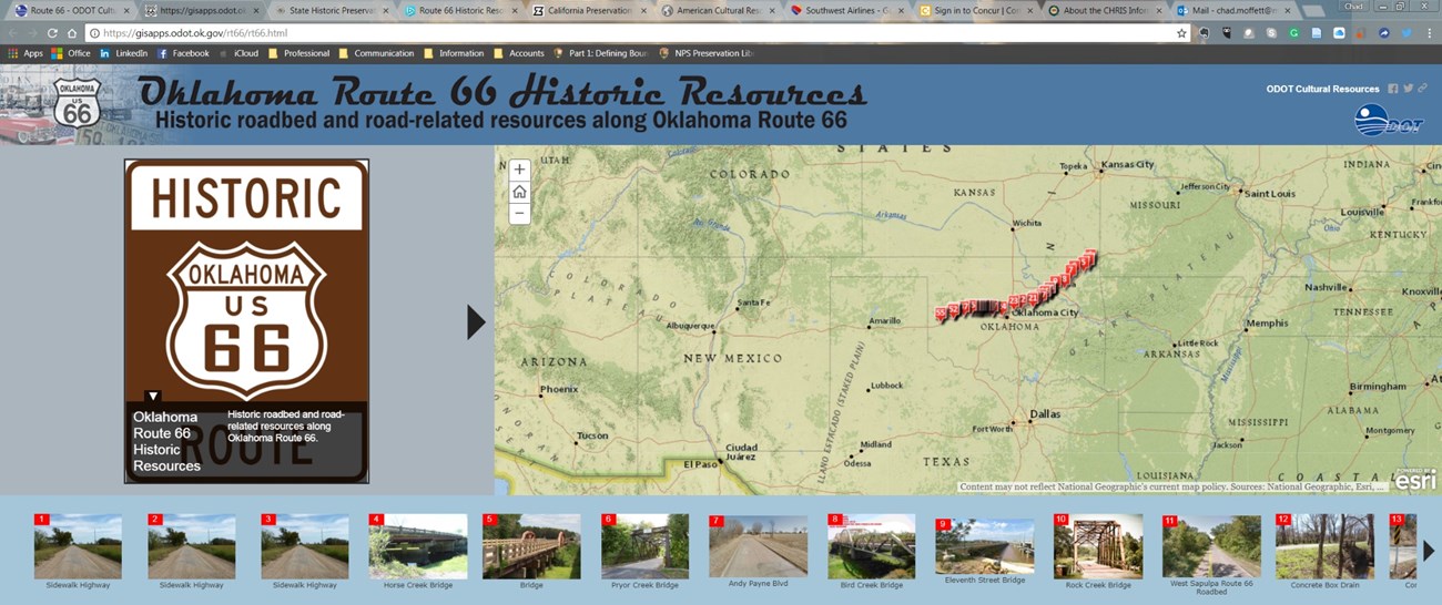
As an update to the Oklahoma Route 66 Roadbed Documentation Project (1926-1970): A Survey of Roadbed and Integral Structures, in 2017 ODOT digitally mapped the alignments and resources noted in the report and located additional bridges along Route 66 alignments. The result is the “Oklahoma Route 66 Historic Resources” map available online.[8] The updated statewide survey makes the associated bridges, segments of roadbed, and other integral roadbed features easy to view. The map provides the location and other data such as the date of construction, a description, and photographs for bridges, integral roadbed features, and segments of roadbed along Route 66. Creating the map entailed digitally mapping the information on segments of roadbed, bridges, and integral roadbed features such as culverts, rest stops, and roadside markers. This work involved compiling supplemental data related to Route 66 and these historic resources for a variety of sources, such as National Register of Historic Places Nominations and other historic resource studies. The interactive mapping allows users to click on icons within the map to provide data associated with each resource.
Online Story Maps
Now ODOT is embarking on integrating the statewide survey information to provide a more engaging online experience. “Oklahoma Route 66 Historic Resources: Historic Roadbed and Road-related Resources Along Oklahoma Route 66” provides a web-based story book view of the bridges, roadbed segments, and integral roadbed features.[9] The story maps are continually being expanded with more survey information and current inventory images as ODOT completes additional field work. ODOT’s goal is to work to integrate this information with the “Oklahoma Historic Route 66 Mobile Tour” of sites along Route 66 completed by SHPO into the story maps.[10]
Outdoor Interpretive Panels
ODOT is completing several cultural resources evaluations and studies for compliance with Section 106 of the National Historic Preservation Act. Projects include outdoor interpretive panels for historic bridges located along Route 66 to assist ODOT in fulfilling its National Environmental Policy Act (NEPA) and Section 106 responsibilities as mitigation for impacts to these resources. For example, ODOT is also developing interpretive displays to tell the story of Route 66 and the bridges along it to tell the story of this iconic corridor. Interpretive panels will be installed to discuss the history of two bridges: the 11th Street Bridge over the Arkansas River in Tulsa, a 1916 concrete arch, and the Bird Creek K-truss Bridge, a relocated span of a bridge in a park in the city of Catoosa near the famous Blue Whale roadside attraction.
Learn More
ODOT’s Cultural Resources Program web page provides additional information on Route 66 in Oklahoma, including a historic context and list of Route 66 repositories with resources from the Oklahoma Historical Society and a mobile tour of sites along Route 66 from the SHPO, as well as technical studies related to Route 66.
Endnotes
1 Interactive Map, “Route 66 Historic Resources,” Oklahoma Department of Transportation, n.d., http://okdot.maps. arcgis.com/apps/webappviewer/index.html?id=0141b[1]c59a324483c924a5633974d396a.
2 Interactive Map, “Oklahoma Route 66 Historic Resources: Historic Roadbed and Road-related Resources Along Oklahoma Route 66,” Oklahoma Department of Transportation, n.d., https://gisapps.odot.ok.gov/rt66/rt66.html.
3 The Oklahoma Route 66 Association, Oklahoma Route 66 Roadbed Documentation Project (1926-1970): A Sur[1]vey of Roadbed and Integral Structures, prepared for the Oklahoma State Historic Preservation Office, http://www. okhistory.org/shpo/thematic/rt66roadbed.pdf; “Oklahoma’s Memorial Highways & Bridges: Historic Route 66,” Oklahoma Department of Transportation, n.d., http://www. okladot.state.ok.us/memorial/route66/.
4 “Oklahoma Historic Route 66 Mobile Tour,” State Historic Preservation Office, Oklahoma Historical Society, n.d., http://www.okhistory.org/shpo/route66mobiletour.htm.
5 “Oklahoma’s Memorial Highways & Bridges: Historic Route 66,” Oklahoma Department of Transportation.
6 The Oklahoma Route 66 Association, Oklahoma Route 66 Roadbed Documentation Project (1926-1970): A Survey of Roadbed and Integral Structures.
7 “Oklahoma Route 66,” ODOT Cultural Resources Program, n.d., http://www.odotculturalresources.info/route-66. html.
8 Interactive Map, “Oklahoma Route 66 Historic Resources: Historic Roadbed and Road-related Resources Along Oklahoma Route 66,” Oklahoma Department of Transportation.
9 Interactive Map, “Oklahoma Route 66 Historic Resources: Historic Roadbed and Road-related Resources Along Oklahoma Route 66,” Oklahoma Department of Transportation.
10 “Oklahoma Historic Route 66 Mobile Tour,” State Historic Preservation Office, Oklahoma Historical Society.
Biographies
Scott Sundermeyer is the Cultural Resources Program Director for the Oklahoma Department of Transportation. Scott received his Bachelor’s and Master’s degrees in anthropology from the University of Oklahoma. He coordinates all Section 106 consultation with the Oklahoma SHPO and manages the review and coordination for project impacts that may impact resources related to Route 66.
Chad Moffett is market lead and project manager for Mead & Hunt, a nationwide professional services firm. He has worked extensively to document Route 66 in California including the development of a historic context and Multiple Property Document, along with an inventory of the various alignments of the Route 66 roadbed along with hundreds of road-related properties along the route. He received a Master’s degree in Cultural Resources Preservation from the University of Wisconsin. Chad works extensively with state departments of transportation on activities to comply with Section 106, Section 4(f) and CEQA. Chad assisted ODOT with interpretation of Route 66 in Oklahoma.
Symposium
You can read other articles from the proceedings of Are We There Yet? Preserving Roadside Architecture and Attractions, April 10-12, 2018, Tulsa, Oklahoma. Or explore other content from the National Center for Preservation Technology and Training (NCPTT).
