Last updated: December 18, 2023
Article
Archeology and the Indigenous Peoples at Grant's Headquarters at City Point (An Informal Learning Activity)
Archeology shows that indigenous peoples were the first inhabitants of and visitors to the area now called Grant’s Headquarters at City Point. Now part of Petersburg National Battlefield, these sites are located on a peninsula on the James River, not far from the mouth of the Appomattox River in the state of Virginia. Today, Grant’s Headquarters at City Point helps the National Park Service tell the story of over 12,000 years of history: from the first people to explore the area, to the establishment of plantations, through the Civil War.
About This Activity
In this informal learning activity, we will explore ways that the archeological artifacts can provide insight about people's lives in the past.
Objectives: 1) Explore how archeology reveals information about indigenous peoples and 2) Study artifacts and complete activities to deepen your understanding.
Audience: This informal learning activity is developed primarily for 4th-grade audiences but can be scaled to lower or higher grade levels. It provides a starting point that you can adapt to suit the needs of your learners.
Skills and Standards: Each section asks learners to draw on skills such as reading comprehension, independent or group work, writing, and using evidence to support conclusions. The activities provide opportunities to meet several Common Core State Standards, Virginia State Standards, and National Council for the Social Studies Curriculum Standards Themes. The content can be adapted to address Virginia State Standards for grades 4, 5, 8, and 11.
For more information, visit the park’s website. Also try the other two activities in this series: Archeology at the Eppes Family Plantation at Grant’s Headquarters at City Point and Archeology and When War Came to the Hare House in the Eastern Front.
Archeology and Indigenous Peoples
Before we begin, learn common terms used in this activity. Archeologists use these terms to describe artifacts and what they mean.BC (before Christ) and AD (Anno Domini) use Christ’s life to measure time. For example, 2021 BC refers to 2,021 years prior to Christ, while AD 2021 refers to 2,021 years after Christ. Many scientists prefer to use BCE (before the common era) and CE (common era) because the terms are more neutral. The important thing is that BC = BCE and AD = CE.
BP stands for “before present.” It refers to dates obtained through radiocarbon dating. In the 1940s and 1950s, radiocarbon dating became a reliable way to date very old sites. Scientists chose the year 1950 for year 0, or 0 BP (before the present).
Additionally, over time, archeologists find enough artifacts of a type with enough archeological context to be able to put an age to them. Archeologists can also use technologies like radiocarbon dating or dendrochronology to identify the age of artifacts.

Around CE 900-1600 (common era), people began settling nearby. They used local clays and tempers to make ceramics for cooking and food storage; hunted the woods for game, fished the rivers, and cultivated crops like beans, corn, squash, and tobacco; and established more permanent villages.
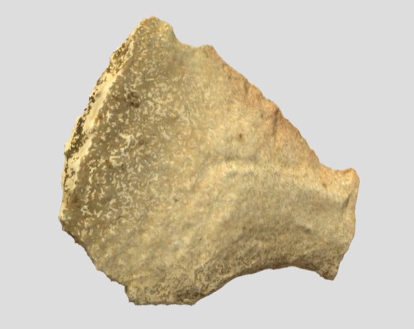
View the scraper in 3d.

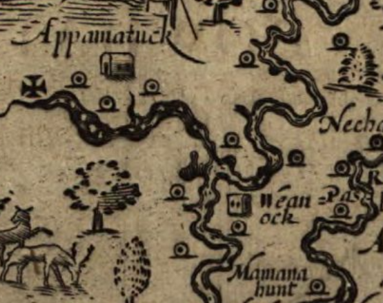
By 1610, at least five Appamatuck villages stood in the vicinity of Grant’s Headquarters at City Point. Captain John Smith (1612) described the settlements:
Their buildings and habitations are for the most part by the rivers or not farre distant from some fresh spring. Their houses are built like our Arbors of small young springs bowed and tyed, and so close covered with mats or the barkes of trees very handsomely, that not withstanding either winde raine or weather, they are as warme as stoves.
The last documented record of an Appamatuck community is from 1705. By 1722, English colonists no longer recorded a distinct group. It is likely any survivors joined other tribes or merged into colonial Virginia society.
Artifact Study
Artifacts and sites are physical evidence about Native Americans at this time. Here are two different types of stone points dating to the Late Woodland period (approximately CE 900-1700) in Virginia, which were found at Grant’s Headquarters at City Point.
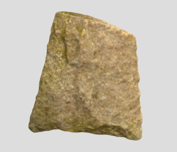
Yadkin Point
A Yadkin type point is a “hafted biface.” It was made by carefully applying pressure to chip away at the stone.This artifact was designed to attach to a haft. A haft is a handle. People lashed a wooden stick to the notch using plant material or sinew.
View the Yadkin point in 3d.

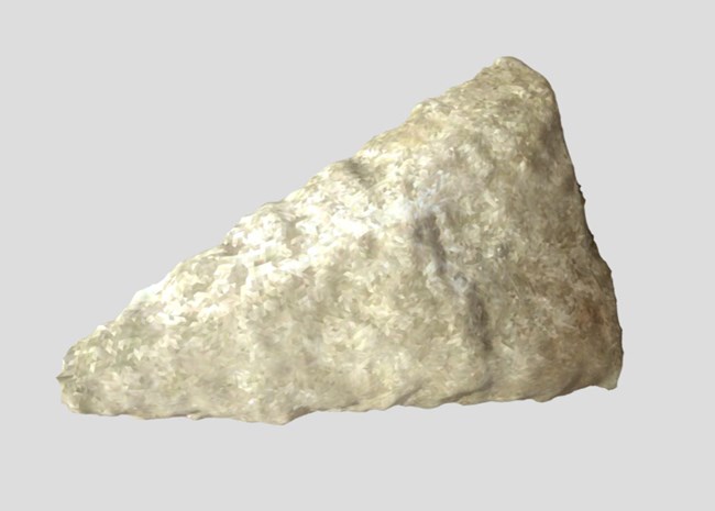
Madison Point
A Madison type point was also made by applying pressure to chip at the stone.View the Madison point in 3d.
Compare the two stone points.
Look Closer
Choose one of the triangular points.How would you describe it? For instance: What kind of triangle is it? Which way is up? Where would a haft have attached? Is it symmetrical or asymmetrical? Which side is the base? Is the base concave or straight? What different purposes might each have been used for?
Help Us
If you find a stone point during a visit to Petersburg National Battlefield, or at any other national park, leave it be! It is illegal to remove archeological artifacts or to disturb archeological sites on federal lands, like national parks.
You can help the National Park Service preserve and protect the history of Petersburg National Battlefield. The Archaeological Resources Protection Act is the federal law that protects archeological sites and artifacts on federal lands, like Petersburg National Battlefield. Learn all about it at Learn the Law: The Archaeological Resources Protection Act.
Wondering what to do if you find an artifact during your visit to Petersburg? Here's What To Do If You Find an Artifact.
