Last updated: April 4, 2023
Article
Ice Age Floods

NPS
Article written by James Schroeder
Approximately fifteen thousand years ago, roaring walls of water hundreds of feet high ripped through the Priest Rapids Valley at 80 miles per hour (128.75 kph), scarring the hills and ridges, gouging out new ravines and coulees, and leaving sediment strewn across the landscape. All human and animal life in the path of the raging waters died instantly. Floods on this massive scale happened not once, but hundreds of times over the course of the last Ice Age, a period of glaciation lasting roughly 2.6 million years. During this time, glaciers across North America underwent cycles of expansion and contraction that lasted tens of thousands of years. The most recent cycle occurred between 80,000 and 15,000 years ago. The Cordilleran glacier spread south from Canada sending giant fingers of ice into Washington, Idaho, and Montana. One finger (the Purcell Trench ice lobe) traveled down the border of Idaho and Montana, creating an ice dam in the Rocky Mountains that prevented the flow of the Clark Fork River. Valleys behind the dam quickly filled with water to form 3,000 square mile (7770 sq km) Lake Missoula in Montana.
Geologists estimate that between 15,000 and 13,000 years ago the ice containing Lake Missoula failed as many as 100 separate times, creating what are known as the Missoula Floods. Rising water either caused the ice dam to float or melted and widened cracks until the dam collapsed. Torrents of water then swept south and west across eastern Washington, traveling hundreds of miles before emptying through the Willamette Valley of Oregon into the Pacific Ocean. Water traveled so fast that each flood only lasted a week. Floodwater scraped away topsoil to form the Channeled Scablands and dramatically reshaped the topography of central and eastern Washington. Other giant floods also occurred during this period. Seventeen thousand years ago, Lake Bonneville (the larger ancestor of the Great Salt Lake) in Utah smashed through its rocky bank, sending water as far north as Washington.vi Glacial Lake Columbia in northern Washington also unleashed water when the glacier containing it retreated at the end of the ice age. Together these floods significantly impacted the environment and landscape of the Priest Rapids Valley.
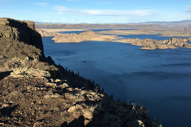
The landmarks these floods left behind are readily distinguishable today. As floodwaters advanced south, they slammed into the Saddle Mountains along the northern border of the Priest Rapids Valley. Too high to breach, the mountains forced water west through Sentinel Gap just south of Beverly and east along what became the Ringold and Koontz Coulees, flowing down towards Hanford. Missoula floodwaters slowed when they reached the narrow Wallula Gap southeast of Kennewick, a two mile (3.21 km) opening in the Horse Heaven Hills through which the Columbia River flows to the sea. Excess floodwater quickly backed up into the Yakama and Priest Rapids Valleys, forming Lake Lewis. When the water slowed it deposited sediment, forming the Priest Rapids Bar near Priest Rapids Dam and Cold Creek Bar where much of the Hanford Site rests today. The Cold Creek Bar rerouted the Columbia River, blocking its original route south and forcing it east past the Hanford Site and White Bluffs. Flood deposits also rerouted the Yakama River, channeling it north through the Horn Rapids. On the Hanford Site, water completely covered Gable Mountain, eroding its slopes into the narrow, elongated shape seen today. Floodwaters also eroded the bluffs east of the Columbia, exposing distinctive white soil that gave name to the early town of White Bluffs.
Could humans have witnessed these massive floods and lived to tell the tale? There is little evidence either way, although some Native American oral histories have reportedly been passed down for 14,000 years, and many stories from the region do refer to historic floods. In addition, Rattlesnake Mountain on the southern edge of the Priest Rapids Valley and one of the few landmarks higher than the floodwater is known to area Tribes as Lalíik, or ‘land above the water.” Anyone lucky enough to survive the flooding would have had a difficult time remaining in the valley however. It takes time for plant and animal life to recover, and cyclical flooding ensured destruction every several decades.
As floodwaters emptied out of the Priest Rapids Valley they left behind rocky debris from grounded icebergs and layers of sandy sediment. Thousands of years later, this sediment defines agricultural life in the region. Many crops grow well here, and the region is particularly well suited to grapes that thrive in the dry, permeable soil. Many American Viticultural Areas (AVAs) denoting quality wine regions are concentrated around the Priest Rapids Valley. Conversely, this loose, water-permeable soil also ensures that all but the best insulated irrigation canals constantly leak. Loose soil also contributes to frequent dust storms, a fact many new Hanford Site employees discovered when they arrived. Perhaps the most pressing concern is the fact that the majority of the Hanford Site’s slowly leaking nuclear waste remains stored in this ice age sediment. The age of these mammoth floods has long past, but their presence remains etched in the valley and the lives of its inhabitants.
- Cassandra Tate, “Ice Age Floods in Washington: A Tour,” HistoryLink.org, March 26, 2008, https://www.historylink.org/File/8449.
- Bruce Bjornstad, On the Trail of the Ice Age Floods: A Geological Field Guide to the Mid-Columbia Basin,(Sandpoint, ID: Keokee Books, 2006), 1, 5, 7.
- Alison Kartevold, Sculpted by Floods: The Northwest’s Ice Age Legacy, (Spokane, WA: KSPBS-TV, 2001), https://www.pbs.org/video/ksps-documentaries-sculpted-by-floods-the-northwests-ice-age-legacy/.
