Last updated: December 20, 2021
Article
Hazardous Fuel Reduction Treatments in the National Capital Area Protects Structures

NPS, Matthew Boss
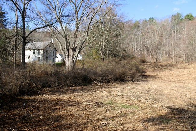
In 2021, wildland fire staff throughout Interior Region (IR) 1 and the National Capital Area continued safeguarding National Park Service (NPS)-owned structures by reducing brush and trees adjacent to them. These efforts adhere to the Wildland Fire Risk Assessment Project, a bureau-wide effort focused on creating and maintaining defensible space around NPS-owned infrastructure. In addition to protecting infrastructure, these projects restored visitor access to buildings and returned the landscapes to a more historical state at New River Gorge National Park and Preserve, Delaware Water Gap National Recreation Area, and Cape Cod National Seashore.
After each fuels treatment project was completed, NPS-owned structures within the treated area were reassessed following the wildfire risk assessment protocol. This reassessment captured the decrease in the surrounding fuel loading, resulting in risk reduction posed by a wildfire.
Furthermore, IR 1 wildland fire staff coordinated efforts across the region to maximize the efforts of contractors as they reassessed over 650 structure risk assessments at eight parks across Virginia. In the past seven years, over 93% of IR 1 and National Capital Area’s structures have been assessed, and since the initial assessment, mechanical treatments and prescribed fire projects have reduced hazardous fuel conditions around the structures. Structure reassessments are vital and assist fire and land managers in identifying which structures and parks should be prioritized for future fuel reduction treatments.
Key to this effort is the utilization of the Wildfire Risk Assessment Geodatabase. This centralized database stores geolocation and structure information including accessibility, environmental characteristics, construction materials, wildfire defensibility and safety considerations. The collected data is processed and disseminated via the National Interagency Fire Center’s ArcGIS Online Organization to a wide variety of decision support systems and the public.
