Last updated: December 8, 2023
Article
GIS training prepares NPS employees for success in wildland fire management.

NPS/Li Brannfors
The frequency, duration, and intensity of wildland fire incidents has significantly increased in the last 20 years. In the same period, Geographic Information Systems (GIS) have rapidly advanced in accuracy, timeliness, and organizational capabilities. Fire planners and initial attack responders rely on accurate data provided by trained GIS professionals to increase operational efficiency and manage risk.
The National Park Service (NPS) Intermountain Region Fire and Aviation Management office has been investing in training field-level and park fire management staff in GIS systems for several years. Webinars have provided users with online training and the ability to interact with subject matter experts to gain knowledge specific to their park and program. While this approach has garnered significant success, in-person training was needed to bolster the GIS capability within park units and in the field.
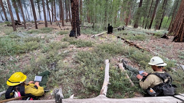
In April 2023 NPS Intermountain Region GIS specialists visited Yellowstone National Park, Grand Canyon National Park, and Bandelier National Monument to provide two-day GIS training sessions in person to 42 trainees. These sessions provided expert-level training in using GIS systems in different scenarios, focusing mainly on fuels planning and incident response. Staff from a variety of positions and disciplines attended the training classes including park GIS specialists, cultural resource specialists, archeologists, fire management officers, fuels specialists, fire ecologists, biologists, wildland fire module leaders, engine crew members, and helitack crew members.
By conducting GIS training to an interdisciplinary, in-person class, the trainers were able to elevate existing park GIS knowledge and provide detailed location-based information that pinpointed the exact needs of the park in which the training was taking place. Park staff were able to have their specific concerns addressed while working side-by-side with those who would be present during initial incident response. The result of these training sessions has not only improved the quantity and quality of GIS data collected and analyzed for initial incident response, it also sets up the park for a smoother and faster transition to an Incident Management Team should one be required for more complex response.
Investing in GIS training for field staff has improved data quality, cost-effectiveness, situational awareness, data-driven decision-making, collaboration, planning, and incident response. These benefits will ultimately improve the efficiency and effectiveness of fuels management projects, including thinning and prescribed burns, critical to resource management and mitigation of severe wildland fire risk. By increasing the GIS capacity of park staff, the NPS is better able to plan for and respond to rapidly changing wildland fire variables.
