Last updated: April 26, 2023
Article
Geographic Information Systems at Joshua Tree National Park
Geographic information systems (GIS) are computer-based systems for gathering and organizing spatial data and related information for display and analysis. GIS and related technologies, such as global positioning systems (GPS), are essential tools for supporting the mandate of the National Park Service to manage park lands for future generations.

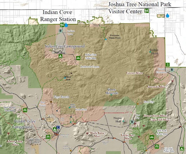
NPS map
The GIS program at Joshua Tree National Park (JTNP) maintains accurate geospatial data for the park, produces high-quality maps, collects and processes a wide variety of data, and supports the effective use of GIS for park management and operations. The park employs one GIS Specialist and one GIS Technician in the Science & Resource Stewardship Division.
GIS Data
GIS data are managed on a dedicated server that park users can access through a mapped file server (the G drive). The most commonly used data sets, such as roads, trails, boundaries, and terrain, are stored in the park’s base geodatabase. Park units including cultural resources, wildlife, physical science, and vegetation also maintain geodatabases specific to their needs. Data are managed in conformance with NPS data standards, with record-level metadata at a minimum.
GIS Maps
Maps generated by the park's GIS program range from digital products (for websites, field instrumentation, etc.) to large-format print maps for all park administrative divisions. Maps are created both for internal use and for use by partner organizations and other agencies and municipalities.
The GIS program has prepared several base maps that have symbology and layouts already completed to NPS general standards. They are commonly used for compliance and for both internal and external projects. They can be exported and imported into other applications as GeoPDFs or image files, depending on the user's needs. An advantage of the GeoPDF format is that custom topographic maps can be viewed on mobile devices with location services.
GIS Analysis
GIS helps answer questions like the following: Is a proposed study site in designated wilderness? Is there a line of sight from a particular location to a park-servicing radio tower? How are species distributions related to terrain and elevation? Where is visitor use affecting the resources of the park?
The park also uses GIS to monitor and develop responses to graffiti and other resource impacts (such as Off-Highway Vehicle incursions), to inform the climbing management program, to track invasive plant distributions and rare plant occurrences, and to support tortoise telemetry monitoring, just to name a few applications.

GIS in Action
GIS supports critical work across many park programs.Cultural Resources
- GIS is used to produce Area of Potential Effects maps for NHPA compliance. Archeologists manage their GIS data in a secure geodatabase and use GPS to document and monitor sites.
Data Management
- The GIS program is ideally positioned to aid in data and database management and protocols for park-wide and program-specific data. This is an ongoing process that incorporates NPS standards across all data.
Facilities Management
- GIS is used to manage building, utility, road, and trail asset data, to define project scope of work, to locate features in the field, and to meet reporting requirements.
- Data are also used in park-wide planning. Analysis tracks the longevity of current assets and guides the placement of new features in the park.
Fee Program
- All reserved campgrounds were GPS mapped in 2017-19 for a new campsite reservation system.
Media and Large Format Requests
- Large-format maps are used for wayside information, visitor centers, and other displays.
Protection
- The GIS program works closely with law enforcement to support search and rescue (SAR), preventative search and rescue (PSAR), land ownership mapping, hazard maps, and logistics for special requests.
Planning and Compliance
- GIS is used to produce maps for public scoping, to develop planning alternatives, and to manage and update boundary, parcel, and inholding data.
Physical Science
- GIS is used to track science programs and aid in meeting annual reporting needs.
- Analysis is used to help define AML (Abandoned Mine Lands) needs and assessments for closure and other safety mitigations.
- Drilled water well and weather station data are also managed in large part using GIS.
Visitor Impacts
- GIS manages visitor impact data, analysis, and mapping requests, including graffiti program management, off-highway vehicle (OHV) data, and disturbances to vegetation and infrastructure.
Vegetation Program
- GIS is used to map Joshua Tree refugia, vegetation plots that are used to monitor climate change, the locations of rare plants, fire hazard vegetation, and invasive species.
Wildlife
- GIS and GPS are used in desert tortoise telemetry, tracking raptor nesting in climbing areas, and studying the movement of bighorn sheep.
- Analyses inform basic science, as well as decision making about closures, conservation measures, and visitor engagement.
Wildland Fire
- GIS plays a critical role in incident support and pre-planning. Maps can be generated on a short timeframe to support responders.
- The GIS program provides annual updates to the Spatial Fire Management Plan (SFMP) for park managers and the interagency fire management team.
