Last updated: December 3, 2021
Article
NPS Improving Pedestrian and Bicycle Access Near Rock Creek and Potomac Parkway Through GAOA Funding

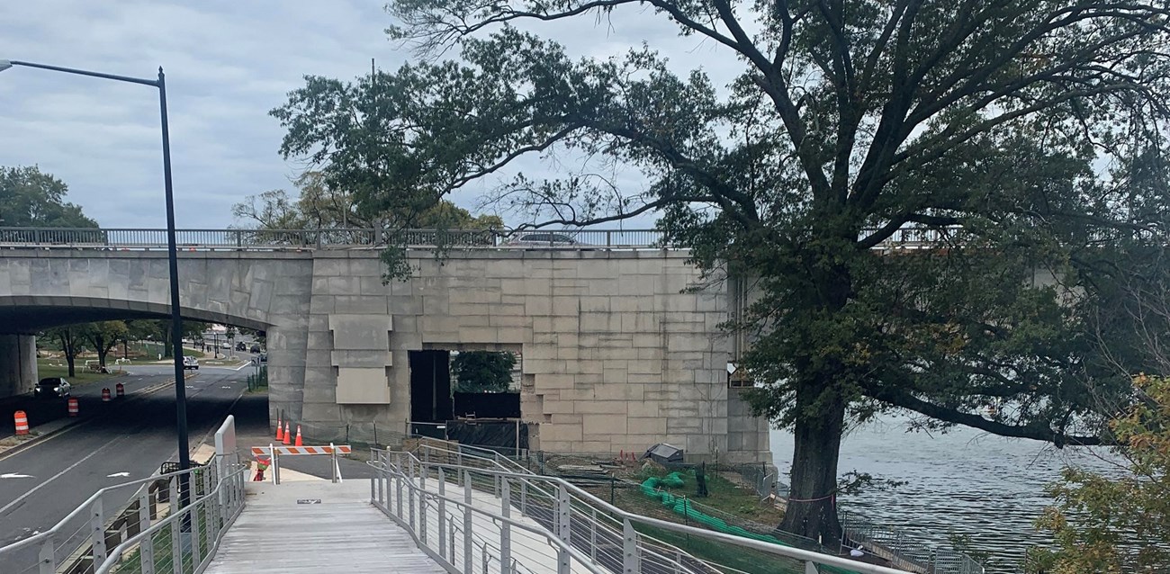
NPS photo.
The National Park Service is making safety and accessibility improvements to the popular multi-use trail along the Rock Creek and Potomac Parkway. Pedestrians and bicyclists will enjoy a wider trail, a new tunnel and expanded green space.
The $8 million project is funded in part through the Great American Outdoors Act (GAOA) will rehabilitate 1.5 miles of the trail near Georgetown and the Kennedy Center from Virginia Ave., NW to the Inlet Bridge along the Potomac River.
Project at a Glance: This $8 million project will improve access for pedestrians and bicyclists by widening the trail, adding a protected tunnel, and enlarging and enhancing green space on 1.5 miles of multi-use trail next to the Rock Creek and Potomac Parkway.
What are the benefits? The upgrades will provide visitors, commuters, and neighbors with an exceptional outdoor experience. Through this project, users will be better connected to richly diverse places of natural and historic significance in the national capital area while providing accessible, safe, and enjoyable experiences for people to walk, run, bike and have fun with friends and family.
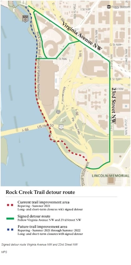
This project will improve accessibility and safety on the multi-use trail between Georgetown and Inlet Bridge along the Potomac River.

NPS Image.
A dashed red line on the map represents “Current trail improvement area; Repaving Summer 2021; Long- and short-term closures with signed detour.” Areas on the map that are dashed in red include a trail that beings near the Lincoln Memorial and proceeds north along the Rock Creek and Potomac Parkway to F Street NW.
A solid green line on the map represents “Signed detour route; Follow Virginia Avenue NW and 23rd Street NW.” Areas on the map that have a green line include 23rd Street from the Lincoln Memorial going north to Virginia Avenue, then following Virgina Avenue northwest to where it ends at the Rock Creek Parkway. Additional streets include a section of New Hampshire Avenue between Virginia Avenue and F Street NW and a section of F Street NW from New Hampshire Avenue to the Rock Creek Parkway. It also includes a section of trail along the Rock Creek Parkway from F Street NW to Virginia Avenue.
A dashed blue line on the map represents “Future trail improvement; Repaving – Summer 2021 through Summer 2022; Long- and short-term closures with signed detour.” Areas on the map that are dashed in blue include a section of trail along the Rock Creek and Potomac Parkway from F Street NW to Virginia Avenue.
